 |
|
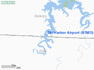
Location & QuickFacts
| FAA Information Effective: | 2008-09-25 |
| Airport Identifier: | 67MO |
| Airport Status: | Operational |
| Longitude/Latitude: | 093-22-11.7120W/37-48-39.1290N
-93.369920/37.810869 (Estimated) |
| Elevation: | 906 ft / 276.15 m (Estimated) |
| Land: | 15 acres |
| From nearest city: | 4 nautical miles SW of Pittsburg, MO |
| Location: | Hickory County, MO |
| Magnetic Variation: | 03E (1995) |
Owner & Manager
| Ownership: | Privately owned |
| Owner: | Ski Harbor Homeowners Assn |
| Address: | Hc 76 Box 3040
Pittsburg, MO 65724 |
| Phone number: | 417-852-7255 |
| Manager: | Frankie Stretesky, Sec/trea |
| Address: | Hc 76 Box 3040
Pittsburg, MO 65724 |
| Phone number: | 417-852-7255 |
Airport Operations and Facilities
| Airport Use: | Private |
| Wind indicator: | Yes |
| Segmented Circle: | No |
| Control Tower: | No |
| Sectional chart: | Kansas City |
| Region: | ACE - Central |
| Boundary ARTCC: | ZKC - Kansas City |
| Tie-in FSS: | COU - Columbia |
| FSS on Airport: | No |
| FSS Toll Free: | 1-800-WX-BRIEF |
Runway Information
Runway 18/36
| Dimension: | 2640 x 100 ft / 804.7 x 30.5 m |
| Surface: | TURF, |
| |
Runway 18 |
Runway 36 |
| Traffic Pattern: | Left | Left |
| Obstruction: | 50 ft trees, 50.0 ft from runway | 50 ft pline, 0.0 ft from runway |
|
Radio Navigation Aids
| ID |
Type |
Name |
Ch |
Freq |
Var |
Dist |
| ILJ | NDB | Willard | | 254.00 | 03E | 30.9 nm |
| GLY | NDB | Golden Valley | | 388.00 | 04E | 36.1 nm |
| IEB | NDB | Lebanon | | 414.00 | 03E | 36.8 nm |
| AIZ | NDB | Kaiser | | 377.00 | 05E | 42.4 nm |
| EAD | NDB | Nevada | | 209.00 | 06E | 44.4 nm |
| LLU | NDB | Spring River | | 356.00 | 05E | 48.8 nm |
| SHY | VOR/DME | Sunshine | 021X | 108.40 | 05E | 38.9 nm |
| SGF | VORTAC | Springfield | 116X | 116.90 | 04E | 27.4 nm |
Remarks
- PRVDD CLEAR APCH TO EACH RY FOR A 20:1 GLIDE SLOPE & A CLEAR TRANSITIONAL SFC FOR 7:1 SLOPE.
Images and information placed above are from
http://www.airport-data.com/airport/67MO/
We thank them for the data!
| General Info
|
| Country |
United States
|
| State |
MISSOURI
|
| FAA ID |
67MO
|
| Latitude |
37-48-39.129N
|
| Longitude |
093-22-11.712W
|
| Elevation |
906 feet
|
| Near City |
PITTSBURG
|
We don't guarantee the information is fresh and accurate. The data may
be wrong or outdated.
For more up-to-date information please refer to other sources.
|
|


