 |
|
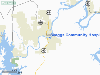
Skaggs Community Hospital Heliport |
Location & QuickFacts
| FAA Information Effective: | 2008-09-25 |
| Airport Identifier: | 5MO0 |
| Airport Status: | Operational |
| Longitude/Latitude: | 093-13-04.6520W/36-38-02.2230N
-93.217959/36.633951 (Estimated) |
| Elevation: | 783 ft / 238.66 m (Estimated) |
| Land: | 0 acres |
| From nearest city: | 0 nautical miles N of Branson, MO |
| Location: | Taney County, MO |
| Magnetic Variation: | 04E (1990) |
Owner & Manager
| Ownership: | Privately owned |
| Owner: | Skaggs Community Hospital |
| Address: | Po Box 650
Branson, MO 65616 |
| Phone number: | 417-335-7000 |
| Manager: | Mike Epley |
| Address: | Po Box 650
Branson, MO 65616 |
| Phone number: | 417-335-7370 |
Airport Operations and Facilities
| Airport Use: | Private
MEDICAL USE. |
| Wind indicator: | Yes |
| Segmented Circle: | No |
| Control Tower: | No |
| Lighting Schedule: | PHONE REQ
FOR PERIMETER LIGHTS CALL 417-335-7388. |
| Sectional chart: | Kansas City |
| Region: | ACE - Central |
| Boundary ARTCC: | ZME - Memphis |
| Tie-in FSS: | COU - Columbia |
| FSS Toll Free: | 1-800-WX-BRIEF |
Runway Information
Helipad H1
| Dimension: | 50 x 50 ft / 15.2 x 15.2 m |
| Surface: | CONC, |
| |
Runway H1 |
Runway |
| Traffic Pattern: | Left | Left |
|
Radio Navigation Aids
| ID |
Type |
Name |
Ch |
Freq |
Var |
Dist |
| PLK | NDB | Point Lookout/dcmsnd | | 204.00 | 03E | 0.7 nm |
| AOV | NDB | Bilmart | | 341.00 | 02E | 32.9 nm |
| ILJ | NDB | Willard | | 254.00 | 03E | 41.4 nm |
| HRO | VOR/DME | Harrison | 072X | 112.50 | 04E | 19.0 nm |
| FLP | VOR/DME | Flippin | 075X | 112.80 | 03E | 41.9 nm |
| DGD | VORTAC | Dogwood | 031X | 109.40 | 06E | 28.6 nm |
| SGF | VORTAC | Springfield | 116X | 116.90 | 04E | 43.8 nm |
| RZC | VORTAC | Razorback | 111X | 116.40 | 04E | 49.5 nm |
Remarks
- OWNER DESIRES HELIPAD NOT BE CHARTED.
- PRVDD A MINIMUM 8:1 APCH/DEP SLOPE IS MAINTAINED AND A 2:1 TRANSITIONAL SURFACE IS MAINTAINED; OPERATIONS OF SINGLE-ENGINE, TWO-BLADED ROTORCRAFT ARE OBJECTIONABLE.
Images and information placed above are from
http://www.airport-data.com/airport/5MO0/
We thank them for the data!
| General Info
|
| Country |
United States
|
| State |
MISSOURI
|
| FAA ID |
5MO0
|
| Latitude |
36-38-02.223N
|
| Longitude |
093-13-04.652W
|
| Elevation |
783 feet
|
| Near City |
BRANSON
|
We don't guarantee the information is fresh and accurate. The data may
be wrong or outdated.
For more up-to-date information please refer to other sources.
|
|


