 |
|
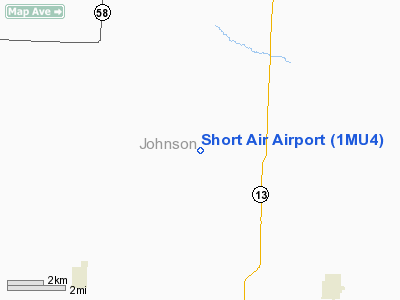
Location & QuickFacts
| FAA Information Effective: | 2008-09-25 |
| Airport Identifier: | 1MU4 |
| Airport Status: | Operational |
| Longitude/Latitude: | 093-46-43.7770W/38-39-06.0490N
-93.778827/38.651680 (Estimated) |
| Elevation: | 840 ft / 256.03 m (Estimated) |
| Land: | 0 acres |
| From nearest city: | 6 nautical miles S of Warrensburg, MO |
| Location: | Johnson County, MO |
| Magnetic Variation: | 04E (1995) |
Owner & Manager
| Ownership: | Privately owned |
| Owner: | Wallace S Brown |
| Address: | 226 Sw 21
Warrensburg, MO 64093 |
| Phone number: | 816-747-5217 |
| Manager: | David J Short |
| Address: | 660 Sw 21
Warrensburg, MO 64093 |
| Phone number: | 816-747-3659 |
Airport Operations and Facilities
| Airport Use: | Private |
| Wind indicator: | Yes |
| Segmented Circle: | No |
| Control Tower: | No |
| Sectional chart: | Kansas City |
| Region: | ACE - Central |
| Boundary ARTCC: | ZKC - Kansas City |
| Tie-in FSS: | COU - Columbia |
| FSS on Airport: | No |
| FSS Toll Free: | 1-800-WX-BRIEF |
Runway Information
Runway 15/33
| Dimension: | 2600 x 75 ft / 792.5 x 22.9 m |
| Surface: | TURF, |
| |
Runway 15 |
Runway 33 |
| Traffic Pattern: | Left | Left |
|
Radio Navigation Aids
| ID |
Type |
Name |
Ch |
Freq |
Var |
Dist |
| HCK | NDB | Hawks | | 296.00 | 04E | 9.8 nm |
| GLY | NDB | Golden Valley | | 388.00 | 04E | 18.2 nm |
| DMO | NDB | Sedalia | | 281.00 | 03E | 28.4 nm |
| LXT | NDB | Lesumit | | 263.00 | 04E | 33.4 nm |
| PUR | NDB | Marshall | | 371.00 | 03E | 36.0 nm |
| GKB | NDB | Norge | | 517.00 | 05E | 47.9 nm |
| GQ | NDB | Norge | | 517.00 | 05E | 47.9 nm |
| GPH | NDB | Mosby | | 284.00 | 03E | 48.5 nm |
| SZL | TACAN | Whiteman | 035X | | 04E | 11.8 nm |
| OJC | VOR/DME | Johnson County | 077X | 113.00 | 06E | 46.3 nm |
| RIS | VOR/DME | Riverside | 051X | 111.40 | 05E | 47.5 nm |
| ANX | VORTAC | Napoleon | 087X | 114.00 | 07E | 31.3 nm |
| BUM | VORTAC | Butler | 106X | 115.90 | 07E | 40.4 nm |
| MKC | VOT | Kansas City Downtown | | 108.60 | | 47.7 nm |
Remarks
- PRVDD A CLEAR APCH TO EACH RY FOR A 20:1 GLIDE SLOPE & A CLEAR TRANSITIONAL SFC FOR A 7:1 SLOPE.
Images and information placed above are from
http://www.airport-data.com/airport/1MU4/
We thank them for the data!
| General Info
|
| Country |
United States
|
| State |
MISSOURI
|
| FAA ID |
1MU4
|
| Latitude |
38-39-06.049N
|
| Longitude |
093-46-43.777W
|
| Elevation |
840 feet
|
| Near City |
WARRENSBURG
|
We don't guarantee the information is fresh and accurate. The data may
be wrong or outdated.
For more up-to-date information please refer to other sources.
|
|


