 |
|
| Shelby County Airport |
| IATA: none – ICAO: none – FAA LID: 6K2 |
| Summary |
| Airport type |
Public |
| Operator |
City of Shelbyville |
| Location |
Shelbyville, Missouri |
| Elevation AMSL |
766 ft / 233.5 m |
| Coordinates |
39°49′00.14″N 92°03′00.62″W / 39.8167056°N 92.0501722°W / 39.8167056; -92.0501722Coordinates: 39°49′00.14″N 92°03′00.62″W / 39.8167056°N 92.0501722°W / 39.8167056; -92.0501722 |
| Runways |
| Direction |
Length |
Surface |
| ft |
m |
| 17/35 |
2,300 |
701 |
Turf |
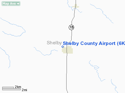
Shelby County Airport (FAA LID: 6K2) is a public airport located 1 mile (2 km) northwest of Shelbyville, in Shelby County, Missouri, USA.
Facilities
Shelby County Airport covers 28 acres (110,000 m) and has one runway:
- Runway 17/35: 2,300 x 46 ft. (701 x 14 m), Surface: Turf
The above content comes from Wikipedia and is published under free licenses – click here to read more.
Location & QuickFacts
| FAA Information Effective: | 2008-09-25 |
| Airport Identifier: | 6K2 |
| Airport Status: | Operational |
| Longitude/Latitude: | 092-03-00.7800W/39-48-45.2400N
-92.050217/39.812567 (Estimated) |
| Elevation: | 766 ft / 233.48 m (Estimated) |
| Land: | 28 acres |
| From nearest city: | 1 nautical miles NW of Shelbyville, MO |
| Location: | Shelby County, MO |
| Magnetic Variation: | 03E (1985) |
Owner & Manager
| Ownership: | Publicly owned |
| Owner: | City Of Shelbyville |
| Address: | 106 S Washington Box 90
Shelbyville, MO 63469 |
| Phone number: | 573-633-2520 |
| Manager: | Kathy Jones
CTC PERSON; CITY CLERK. |
| Address: | 106 S Washington Box 90
Shelbyville, MO 63469 |
| Phone number: | 573-633-2520 |
Airport Operations and Facilities
| Airport Use: | Open to public |
| Wind indicator: | Yes |
| Segmented Circle: | No |
| Control Tower: | No |
| Landing fee charge: | No |
| Sectional chart: | Kansas City |
| Region: | ACE - Central |
| Boundary ARTCC: | ZKC - Kansas City |
| Tie-in FSS: | COU - Columbia |
| FSS on Airport: | No |
| FSS Toll Free: | 1-800-WX-BRIEF |
| NOTAMs Facility: | COU (NOTAM-d service avaliable) |
Airport Communications
Airport Services
| Airframe Repair: | NONE |
| Power Plant Repair: | NONE |
| Bottled Oxygen: | NONE |
| Bulk Oxygen: | NONE |
Runway Information
Runway 17/35
| Dimension: | 2300 x 46 ft / 701.0 x 14.0 m |
| Surface: | TURF, Good Condition |
| |
Runway 17 |
Runway 35 |
| Longitude: | 092-03-01.9900W | 092-02-59.5700W |
| Latitude: | 39-48-56.5700N | 39-48-33.9200N |
| Traffic Pattern: | Left | Left |
| Obstruction: | 4 ft fence, 80.0 ft from runway, 20:1 slope to clear | 54 ft tree, 1038.0 ft from runway, 127 ft right of centerline, 19:1 slope to clear |
|
Radio Navigation Aids
| ID |
Type |
Name |
Ch |
Freq |
Var |
Dist |
| HAE | NDB | Hannibal | | 411.00 | 03E | 28.3 nm |
| UI | NDB | Quincy | | 293.00 | 02E | 37.0 nm |
| EOK | NDB | Keokuk | | 366.00 | 02E | 48.4 nm |
| BZK | NDB | Brookfield | | 383.00 | 03E | 49.0 nm |
| MCM | VOR/DME | Macon | 076X | 112.90 | 06E | 22.1 nm |
| IRK | VORTAC | Kirksville | 093X | 114.60 | 06E | 31.6 nm |
| UIN | VORTAC | Quincy | 083X | 113.60 | 05E | 35.7 nm |
| HLV | VORTAC | Hallsville | 089X | 114.20 | 06E | 42.2 nm |
Remarks
- RADIO CONTROLLED MODEL AIRPLANES ON AND INVOF ARPT AND HEAVY CONCENTRATION OF LARGE WATER FOWL ON & INVOF ARPT.
- NTSD RWY SAFETY AREA BEYOND EACH RWY END; RY 17 HAS FENCE 80 FT FM THLD; RY 35 HAS LARGE DROP OFF AND LAKE.
- PROVIDED THE APPROACH TO EACH RWY IS MAINTAINED FOR A MINIMUM 20:1 GLIDE SLOPE AND THE TRANSITIONAL SURFACE BE MAINTAINED FOR A 7:1 SLOPE.
Images and information placed above are from
http://www.airport-data.com/airport/6K2/
We thank them for the data!
| General Info
|
| Country |
United States
|
| State |
MISSOURI
|
| FAA ID |
6K2
|
| Latitude |
39-49-00.140N
|
| Longitude |
092-03-00.625W
|
| Elevation |
766 feet
|
| Near City |
SHELBYVILLE
|
We don't guarantee the information is fresh and accurate. The data may
be wrong or outdated.
For more up-to-date information please refer to other sources.
|
|


