 |
|
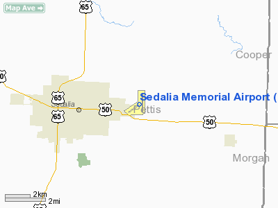
| Sedalia Memorial Airport |
| IATA: DMO – ICAO: KDMO |
| Summary |
| Airport type |
Public |
| Serves |
Sedalia, Missouri |
| Location |
City of Sedalia |
| Elevation AMSL |
909 ft / 277.1 m |
| Coordinates |
38°42′26″N 93°10′33″W / 38.70722°N 93.17583°W / 38.70722; -93.17583Coordinates: 38°42′26″N 93°10′33″W / 38.70722°N 93.17583°W / 38.70722; -93.17583 |
Sedalia Memorial Airport is a public airport that is located 4.4 miles east of Sedalia, in Pettis County, Missouri, United States.
Trivia
- The biggest plane ever to land at the Sedalia Memorial Airport was Bill Cosby's plane he was in Sedalia to perform at the Missouri State Fair.
- The second biggest plane ever to land at the Sedalia Memorial Airport was Hank Williams, Jr's plane he was in Sedalia to perform at the Missouri State Fair.
The above content comes from Wikipedia and is published under free licenses – click here to read more.
Location & QuickFacts
| FAA Information Effective: | 2008-09-25 |
| Airport Identifier: | DMO |
| Airport Status: | Operational |
| Longitude/Latitude: | 093-10-33.2660W/38-42-26.6620N
-93.175907/38.707406 (Estimated) |
| Elevation: | 909 ft / 277.06 m (Surveyed) |
| Land: | 507 acres |
| From nearest city: | 2 nautical miles E of Sedalia, MO |
| Location: | Pettis County, MO |
| Magnetic Variation: | 03E (2000) |
Owner & Manager
| Ownership: | Publicly owned |
| Owner: | City Of Sedalia |
| Address: | Box 1707 2nd & Osage St
Sedalia, MO 65302 |
| Phone number: | 660-827-3000 |
| Manager: | Chris Cox |
| Address: | 1900 E Booneville
Sedalia, MO 65301 |
| Phone number: | 660-826-4128 |
Airport Operations and Facilities
| Airport Use: | Open to public |
| Wind indicator: | Yes |
| Segmented Circle: | Yes |
| Control Tower: | No |
| Lighting Schedule: | DUSK-DAWN
ACTVT MIRL RY 18/36 & REIL RYS 18 & 36 - CTAF. PAPI RYS 18 & 36 ON 24 HRS. |
| Beacon Color: | Clear-Green (lighted land airport) |
| Landing fee charge: | No |
| Sectional chart: | Kansas City |
| Region: | ACE - Central |
| Boundary ARTCC: | ZKC - Kansas City |
| Tie-in FSS: | COU - Columbia |
| FSS on Airport: | No |
| FSS Toll Free: | 1-800-WX-BRIEF |
| NOTAMs Facility: | DMO (NOTAM-d service avaliable) |
| Federal Agreements: | NGY |
Airport Communications
| CTAF: | 122.800 |
| Unicom: | 122.800 |
Airport Services
| Fuel available: | 100LLA |
| Airframe Repair: | MAJOR |
| Power Plant Repair: | MINOR |
| Bottled Oxygen: | NONE |
| Bulk Oxygen: | NONE |
Runway Information
Runway 05/23
| Dimension: | 3520 x 50 ft / 1072.9 x 15.2 m |
| Surface: | ASPH, Good Condition |
| Weight Limit: | Single wheel: 9000 lbs.
Dual wheel: 11300 lbs. |
| |
Runway 05 |
Runway 23 |
| Longitude: | 093-11-09.5870W | 093-10-33.4568W |
| Latitude: | 38-42-06.0094N | 38-42-26.2333N |
| Elevation: | 909.00 ft | 884.00 ft |
| Alignment: | 54 | 127 |
| Traffic Pattern: | Left | Right |
| Markings: | Basic, Good Condition | Basic, Good Condition |
| Obstruction: | 67 ft tree, 1620.0 ft from runway, 30 ft left of centerline, 21:1 slope to clear | 61 ft tree, 2375.0 ft from runway, 220 ft left of centerline, 36:1 slope to clear |
|
Runway 18/36
| Dimension: | 5500 x 100 ft / 1676.4 x 30.5 m |
| Surface: | CONC, Fair Condition |
| Surface Treatment: | Wire Comb or Wire Tine
APRXLY 40% OF RY WIRE COMBED. |
| Weight Limit: | Single wheel: 30000 lbs.
Dual wheel: 48000 lbs. |
| Edge Lights: | Medium |
| |
Runway 18 |
Runway 36 |
| Longitude: | 093-10-20.5610W | 093-10-22.6050W |
| Latitude: | 38-43-00.5780N | 38-42-06.2365N |
| Elevation: | 882.00 ft | 902.00 ft |
| Alignment: | 127 | 2 |
| Traffic Pattern: | Left | Right |
| Markings: | Non-precision instrument, Good Condition | Non-precision instrument, Good Condition |
| Crossing Height: | 37.00 ft | 30.00 ft |
| VASI: | 2-light PAPI on left side | 2-light PAPI on left side |
| Visual Glide Angle: | 3.00° | 3.00° |
| Runway End Identifier: | Yes
REIL OTS INDEFLY. | Yes
REIL OTS INDEFLY. |
| Obstruction: | , 50:1 slope to clear | 55 ft tree, 1725.0 ft from runway, 395 ft right of centerline, 27:1 slope to clear |
|
Radio Navigation Aids
| ID |
Type |
Name |
Ch |
Freq |
Var |
Dist |
| DMO | NDB | Sedalia | | 281.00 | 03E | 0.2 nm |
| HCK | NDB | Hawks | | 296.00 | 04E | 19.2 nm |
| PUR | NDB | Marshall | | 371.00 | 03E | 20.1 nm |
| VER | NDB | Viertel | | 347.00 | 02E | 27.2 nm |
| GLY | NDB | Golden Valley | | 388.00 | 04E | 31.8 nm |
| ONH | NDB | Noah | | 515.00 | 03E | 43.9 nm |
| AIZ | NDB | Kaiser | | 377.00 | 05E | 47.0 nm |
| SZL | TACAN | Whiteman | 035X | | 04E | 17.6 nm |
| COU | VOR/DME | Columbia | 039X | 110.20 | 03E | 45.3 nm |
| SHY | VOR/DME | Sunshine | 021X | 108.40 | 05E | 48.3 nm |
| JEF | VOT | Jefferson City | | 112.00 | | 48.8 nm |
Remarks
- WILDLIFE ON RYS EARLY MORNING & DUSK.
Images and information placed above are from
http://www.airport-data.com/airport/DMO/
We thank them for the data!
| General Info
|
| Country |
United States
|
| State |
MISSOURI
|
| FAA ID |
DMO
|
| Latitude |
38-42-24.800N
|
| Longitude |
093-10-34.000W
|
| Elevation |
909 feet
|
| Near City |
SEDALIA
|
We don't guarantee the information is fresh and accurate. The data may
be wrong or outdated.
For more up-to-date information please refer to other sources.
|
|


