|
|
|
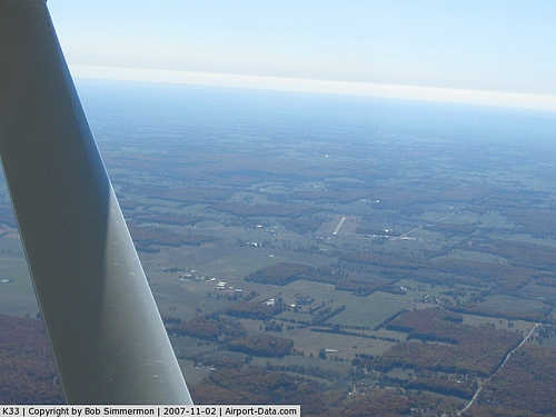 |
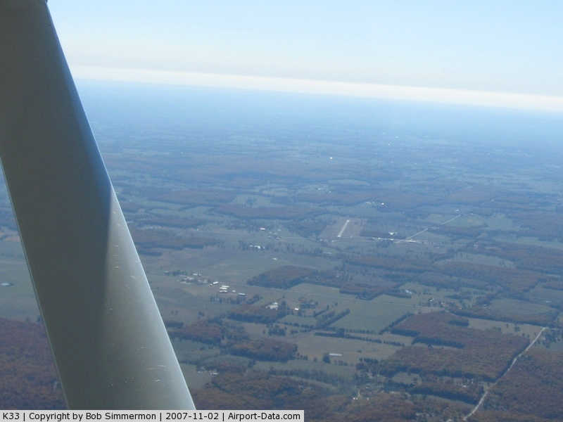
(Click on the photo to enlarge) |
|
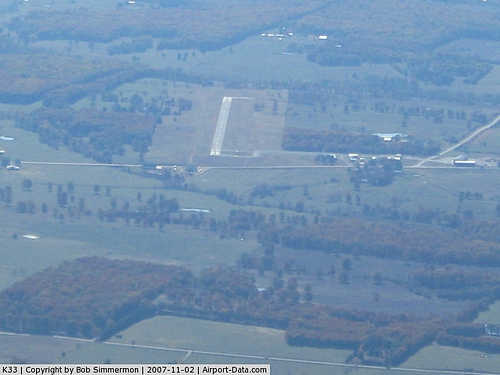 |
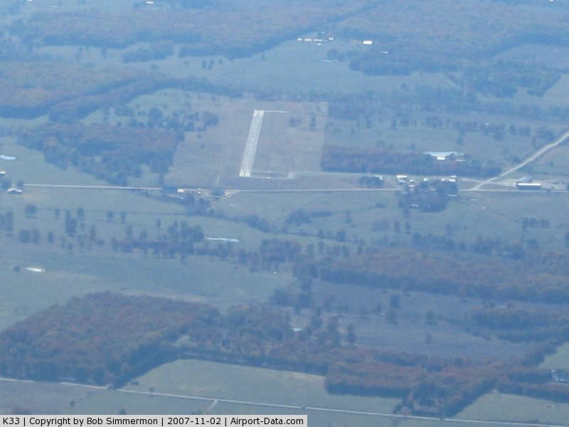
(Click on the photo to enlarge) |
|
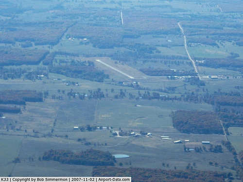 |
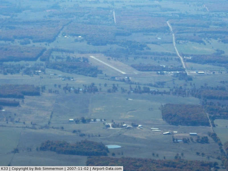
(Click on the photo to enlarge) |
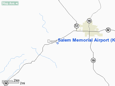
Location & QuickFacts
| FAA Information Effective: | 2008-09-25 |
| Airport Identifier: | K33 |
| Airport Status: | Operational |
| Longitude/Latitude: | 091-36-15.9900W/37-36-54.8400N
-91.604442/37.615233 (Estimated) |
| Elevation: | 1241 ft / 378.26 m (Estimated) |
| Land: | 86 acres |
| From nearest city: | 4 nautical miles SW of Salem, MO |
| Location: | Dent County, MO |
| Magnetic Variation: | 02E (2000) |
Owner & Manager
| Ownership: | Publicly owned |
| Owner: | City Of Salem |
| Address: | 400 North Iron Street
Salem, MO 65560 |
| Phone number: | 573-729-4811 |
| Manager: | Greg Capps
AIRPORT BOARD CHAIRMAN. |
| Address: | 400 North Iron Street
Salem, MO 65560 |
| Phone number: | 573-247-1161 |
Airport Operations and Facilities
| Airport Use: | Open to public |
| Wind indicator: | Yes |
| Segmented Circle: | Yes |
| Control Tower: | No |
| Lighting Schedule: | DUSK-DAWN
ACTVT MIRL RY 17/35 - CTAF; TO INCR INTST & ACTVT REIL RYS 17 & 35 - CTAF |
| Beacon Color: | Clear-Green (lighted land airport) |
| Landing fee charge: | No |
| Sectional chart: | Kansas City |
| Region: | ACE - Central |
| Traffic Pattern Alt: | 800 ft |
| Boundary ARTCC: | ZKC - Kansas City |
| Tie-in FSS: | STL - Saint Louis |
| FSS on Airport: | No |
| FSS Toll Free: | 1-800-WX-BRIEF |
| NOTAMs Facility: | STL (NOTAM-d service avaliable) |
| Federal Agreements: | NGY |
Airport Communications
Airport Services
| Fuel available: | 100LL
SELF SVC FUEL AVBL 24 HRS. |
| Airframe Repair: | NONE |
| Power Plant Repair: | NONE |
Runway Information
Runway 17/35
| Dimension: | 2998 x 60 ft / 913.8 x 18.3 m |
| Surface: | ASPH, Good Condition |
| Weight Limit: | Single wheel: 12500 lbs. |
| Edge Lights: | Medium |
| |
Runway 17 |
Runway 35 |
| Longitude: | 091-36-20.0150W | 091-36-11.9600W |
| Latitude: | 37-37-09.3120N | 37-36-40.3650N |
| Elevation: | 1220.00 ft | 1241.00 ft |
| Alignment: | 127 | 127 |
| Traffic Pattern: | Left | Left |
| Markings: | Non-precision instrument, Good Condition | Non-precision instrument, Good Condition |
| Runway End Identifier: | Yes | Yes |
| Obstruction: | 28 ft trees, 770.0 ft from runway, 120 ft left of centerline, 20:1 slope to clear | 34 ft trees, 912.0 ft from runway, 290 ft left of centerline, 20:1 slope to clear |
|
Radio Navigation Aids
| ID |
Type |
Name |
Ch |
Freq |
Var |
Dist |
| BHN | NDB | Buckhorn | | 391.00 | 03E | 24.3 nm |
| UBX | NDB | Cuba | | 380.00 | 01E | 28.3 nm |
| MNF | NDB | Mountain View | | 365.00 | 03E | 37.7 nm |
| UUV | NDB | Sullivan | | 356.00 | 02E | 42.7 nm |
| UNO | NDB | Pomona | | 335.00 | 02E | 46.5 nm |
| TBN | VOR | Forney | | 110.00 | 03E | 26.6 nm |
| VIH | VOR/DME | Vichy | 124X | 117.70 | 06E | 32.8 nm |
| HUW | VOR/DME | Hutton | 053X | 111.60 | 02E | 46.9 nm |
| MAP | VORTAC | Maples | 081X | 113.40 | 06E | 8.9 nm |
Remarks
- HELICOPTER OPERATIONS ON & INVOF ARPT.
- POOR PVMT CONDITIONS EXITS BETWEEN RY, APRON, AND TIEDOWN AREA; LOOSE AGGREGRATE, LARGE CRACKS & WEEDS IN CRACKS.
- ESTABD PRIOR TO OCT.1959.
Images and information placed above are from
http://www.airport-data.com/airport/K33/
We thank them for the data!
| General Info
|
| Country |
United States
|
| State |
MISSOURI
|
| FAA ID |
K33
|
| Latitude |
37-36-54.840N
|
| Longitude |
091-36-15.990W
|
| Elevation |
1241 feet
|
| Near City |
SALEM
|
We don't guarantee the information is fresh and accurate. The data may
be wrong or outdated.
For more up-to-date information please refer to other sources.
|
|