 |
|
Location & QuickFacts
| FAA Information Effective: | 2008-09-25 |
| Airport Identifier: | 2MO9 |
| Airport Status: | Operational |
| Longitude/Latitude: | 094-27-00.8270W/38-57-00.0240N
-94.450230/38.950007 (Estimated) |
| Elevation: | 929 ft / 283.16 m (Estimated) |
| Land: | 0 acres |
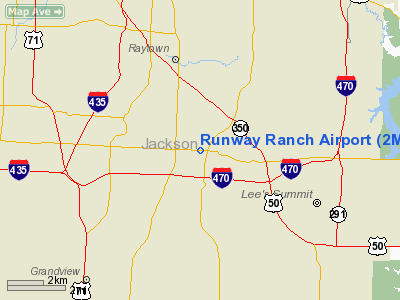
| From nearest city: | 10 nautical miles SE of Kansas City, MO |
| Location: | Jackson County, MO |
| Magnetic Variation: | 05E (1985) |
Owner & Manager
| Ownership: | Privately owned |
| Owner: | Gloria J. Mc Reynolds |
| Address: | P.o. Box 446
Camdenton, MO 65020 |
| Phone number: | 314-346-7772 |
| Manager: | Jerry Lempe |
| Address: | 9778 Woodson
Kansas City, MO 64134 |
| Phone number: | 816-761-9203 |
Airport Operations and Facilities
| Airport Use: | Private |
| Wind indicator: | No |
| Segmented Circle: | No |
| Control Tower: | No |
| Landing fee charge: | No |
| Sectional chart: | Kansas City |
| Region: | ACE - Central |
| Boundary ARTCC: | ZKC - Kansas City |
| Tie-in FSS: | COU - Columbia |
| FSS on Airport: | No |
| FSS Toll Free: | 1-800-WX-BRIEF |
Airport Services
| Airframe Repair: | NONE |
| Power Plant Repair: | NONE |
Runway Information
Runway N/S
| Dimension: | 1320 x 100 ft / 402.3 x 30.5 m |
| Surface: | TURF, |
| |
Runway N |
Runway S |
| Traffic Pattern: | Left | Left |
|
Radio Navigation Aids
| ID |
Type |
Name |
Ch |
Freq |
Var |
Dist |
| LXT | NDB | Lesumit | | 263.00 | 04E | 3.7 nm |
| GKB | NDB | Norge | | 517.00 | 05E | 11.7 nm |
| GQ | NDB | Norge | | 517.00 | 05E | 11.7 nm |
| DO | NDB | Dotte | | 359.00 | 05E | 21.5 nm |
| GPH | NDB | Mosby | | 284.00 | 03E | 24.7 nm |
| HCK | NDB | Hawks | | 296.00 | 04E | 45.4 nm |
| EZZ | NDB | Cameron | | 394.00 | 03E | 47.6 nm |
| SZL | TACAN | Whiteman | 035X | | 04E | 44.0 nm |
| RIS | VOR/DME | Riverside | 051X | 111.40 | 05E | 12.3 nm |
| OJC | VOR/DME | Johnson County | 077X | 113.00 | 06E | 14.9 nm |
| BQS | VOR/DME | Braymer | 049X | 111.20 | 03E | 48.9 nm |
| ANX | VORTAC | Napoleon | 087X | 114.00 | 07E | 17.4 nm |
| MCI | VORTAC | Kansas City | 079Y | 113.25 | 05E | 24.2 nm |
| BUM | VORTAC | Butler | 106X | 115.90 | 07E | 40.8 nm |
| MKC | VOT | Kansas City Downtown | | 108.60 | | 12.5 nm |
Images and information placed above are from
http://www.airport-data.com/airport/2MO9/
We thank them for the data!
| General Info
|
| Country |
United States
|
| State |
MISSOURI
|
| FAA ID |
2MO9
|
| Latitude |
38-57-00.024N
|
| Longitude |
094-27-00.827W
|
| Elevation |
929 feet
|
| Near City |
KANSAS CITY
|
We don't guarantee the information is fresh and accurate. The data may
be wrong or outdated.
For more up-to-date information please refer to other sources.
|
|


