 |
|
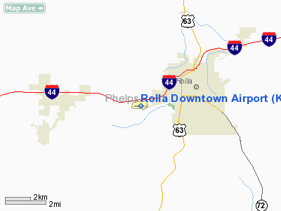
Location & QuickFacts
| FAA Information Effective: | 2008-09-25 |
| Airport Identifier: | K07 |
| Airport Status: | Operational |
| Longitude/Latitude: | 091-48-48.7710W/37-56-08.3480N
-91.813547/37.935652 (Estimated) |
| Elevation: | 987 ft / 300.84 m (Surveyed) |
| Land: | 33 acres |
| From nearest city: | 3 nautical miles SW of Rolla, MO |
| Location: | Phelps County, MO |
| Magnetic Variation: | 05E (1975) |
Owner & Manager
| Ownership: | Privately owned |
| Owner: | Maxine Dickman |
| Address: | 13720 County Road 7040
Rolla, MO 65401 |
| Phone number: | 573-341-2994 |
| Manager: | Maxine Dickman |
| Address: | 13720 County Road 7040
Rolla, MO 65401 |
| Phone number: | 573-341-2994 |
Airport Operations and Facilities
| Airport Use: | Open to public |
| Wind indicator: | Yes |
| Segmented Circle: | No |
| Control Tower: | No |
| Lighting Schedule: | RDO-CTL
ACTVT LIRL RY 09/27 - CTAF. |
| Landing fee charge: | No |
| Sectional chart: | Kansas City |
| Region: | ACE - Central |
| Boundary ARTCC: | ZKC - Kansas City |
| Tie-in FSS: | COU - Columbia |
| FSS on Airport: | No |
| FSS Toll Free: | 1-800-WX-BRIEF |
| NOTAMs Facility: | COU (NOTAM-d service avaliable) |
Airport Communications
| CTAF: | 122.800 |
| Unicom: | 122.800
UNICOM UNMONITORED. |
Airport Services
| Bottled Oxygen: | NONE |
| Bulk Oxygen: | NONE |
Runway Information
Runway 09/27
| Dimension: | 3028 x 38 ft / 922.9 x 11.6 m |
| Surface: | ASPH, Fair Condition |
| Edge Lights: | Non-standard lighting system
NSTD LIRL; TWO GREEN THLD LGTS RY 09; TWO GREEN THLD LGTS 10-15 FT W OF DSPLCD THLD BAR RY 27; NO DSPLCD THLD LGTS; RY EDGE LGTS 35-40 FT FM RY EDGE; FIRST 445 FT OF RY 27 UNLGTD. |
| |
Runway 09 |
Runway 27 |
| Longitude: | 091-49-07.6070W | 091-48-29.8720W |
| Latitude: | 37-56-09.2280N | 37-56-07.5300N |
| Elevation: | 956.00 ft | 964.00 ft |
| Alignment: | 93 | 127 |
| Traffic Pattern: | Left | Left |
| Markings: | Nonstandard, Poor Condition
MARKINGS FADED. | Nonstandard, Poor Condition
MARKINGS FADED. |
| Displaced threshold: | 0.00 ft | 445.00 ft
DSPLCD THLD ELEV 7 FT HIGHER THAN RY END ELEV; DALGT OPNS ONLY. |
| Obstruction: | 35 ft trees, 675.0 ft from runway, 160 ft left of centerline, 13:1 slope to clear
RY 09 +1-8 FT GND, TREES, BRUSH 0-200 FT FM RY END, 0-65 FT R. | 54 ft tree, 480.0 ft from runway, 20 ft right of centerline, 5:1 slope to clear
RY 27 15:1TO DSPLCD THLD; +15 FT TREE, 340 FT FM DSPLCD THLD, 50 FT R, 9:1 BASED ON DSPLCD THLD.
RY 27 1-20 FT TREES; FENCES; BRUSHES & HIGH GND 0-200 FT FM RY END L & R. |
|
Radio Navigation Aids
| ID |
Type |
Name |
Ch |
Freq |
Var |
Dist |
| BHN | NDB | Buckhorn | | 391.00 | 03E | 19.9 nm |
| UBX | NDB | Cuba | | 380.00 | 01E | 19.9 nm |
| UUV | NDB | Sullivan | | 356.00 | 02E | 35.6 nm |
| AIZ | NDB | Kaiser | | 377.00 | 05E | 36.3 nm |
| JE | NDB | Algoa | | 397.00 | 03E | 38.8 nm |
| IEB | NDB | Lebanon | | 414.00 | 03E | 45.7 nm |
| ONH | NDB | Noah | | 515.00 | 03E | 46.8 nm |
| TBN | VOR | Forney | | 110.00 | 03E | 19.3 nm |
| VIH | VOR/DME | Vichy | 124X | 117.70 | 06E | 14.1 nm |
| SHY | VOR/DME | Sunshine | 021X | 108.40 | 05E | 37.9 nm |
| MAP | VORTAC | Maples | 081X | 113.40 | 06E | 20.8 nm |
| JEF | VOT | Jefferson City | | 112.00 | | 42.3 nm |
Remarks
- WILDLIFE ON & INVOF ARPT.
- ULTRALIGHT ACFT ON & INVOF ARPT.
- RY 09/27 LINE OF SIGHT OBSTRUCTED BY GRADE CHANGE IN RY.
- TALL BRUSH LOCATED 70-125 FT SOUTH OF RY, FM RY 09 THLD TO ACCESS TWY.
Images and information placed above are from
http://www.airport-data.com/airport/K07/
We thank them for the data!
| General Info
|
| Country |
United States
|
| State |
MISSOURI
|
| FAA ID |
K07
|
| Latitude |
37-56-08.348N
|
| Longitude |
091-48-48.771W
|
| Elevation |
987 feet
|
| Near City |
ROLLA
|
We don't guarantee the information is fresh and accurate. The data may
be wrong or outdated.
For more up-to-date information please refer to other sources.
|
|


