 |
|
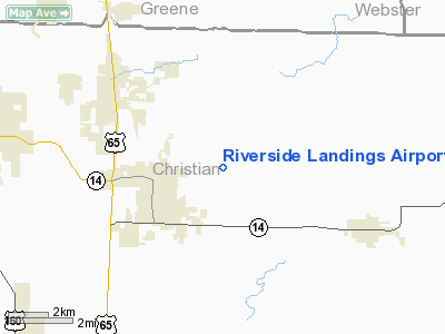
Riverside Landings Airport |
Location & QuickFacts
| FAA Information Effective: | 2008-09-25 |
| Airport Identifier: | 6MO7 |
| Airport Status: | Operational |
| Longitude/Latitude: | 093-10-00.6540W/37-01-45.1900N
-93.166848/37.029219 (Estimated) |
| Elevation: | 1280 ft / 390.14 m (Estimated) |
| Land: | 0 acres |
| From nearest city: | 2 nautical miles NE of Ozark, MO |
| Location: | Christian County, MO |
| Magnetic Variation: | 04E (1985) |
Owner & Manager
| Ownership: | Privately owned |
| Owner: | Pete Dreher |
| Address: | Rt 1 Box 104
Lampe, AZ 65681 |
| Phone number: | 417-779-5282 |
| Manager: | Pete Dreher |
| Address: | Rt 1 Box 104
Lampe, MO 65681 |
| Phone number: | 417-779-5282 |
Airport Operations and Facilities
| Airport Use: | Private |
| Wind indicator: | Yes |
| Segmented Circle: | No |
| Control Tower: | No |
| Landing fee charge: | No |
| Sectional chart: | Kansas City |
| Region: | ACE - Central |
| Boundary ARTCC: | ZKC - Kansas City |
| Tie-in FSS: | COU - Columbia |
| FSS on Airport: | No |
| FSS Toll Free: | 1-800-WX-BRIEF |
Airport Services
| Airframe Repair: | NONE |
| Power Plant Repair: | NONE |
Runway Information
Runway N/S
| Dimension: | 2700 x 50 ft / 823.0 x 15.2 m |
| Surface: | TURF, |
| |
Runway N |
Runway S |
| Traffic Pattern: | Left | Left |
|
Radio Navigation Aids
| ID |
Type |
Name |
Ch |
Freq |
Var |
Dist |
| ILJ | NDB | Willard | | 254.00 | 03E | 20.9 nm |
| AOV | NDB | Bilmart | | 341.00 | 02E | 23.8 nm |
| PLK | NDB | Point Lookout/dcmsnd | | 204.00 | 03E | 24.3 nm |
| IEB | NDB | Lebanon | | 414.00 | 03E | 40.7 nm |
| HRO | VOR/DME | Harrison | 072X | 112.50 | 04E | 42.8 nm |
| DGD | VORTAC | Dogwood | 031X | 109.40 | 06E | 13.9 nm |
| SGF | VORTAC | Springfield | 116X | 116.90 | 04E | 21.2 nm |
Images and information placed above are from
http://www.airport-data.com/airport/6MO7/
We thank them for the data!
| General Info
|
| Country |
United States
|
| State |
MISSOURI
|
| FAA ID |
6MO7
|
| Latitude |
37-01-45.190N
|
| Longitude |
093-10-00.654W
|
| Elevation |
1280 feet
|
| Near City |
OZARK
|
We don't guarantee the information is fresh and accurate. The data may
be wrong or outdated.
For more up-to-date information please refer to other sources.
|
|


