 |
|
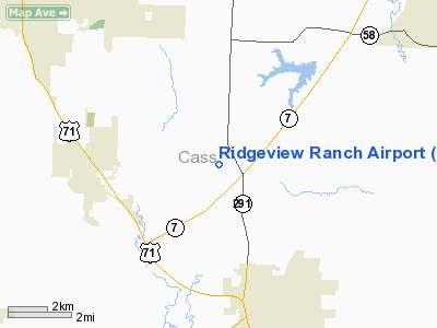
Location & QuickFacts
| FAA Information Effective: | 2008-09-25 |
| Airport Identifier: | MO37 |
| Airport Status: | Operational |
| Longitude/Latitude: | 094-22-54.8200W/38-43-23.0400N
-94.381894/38.723067 (Estimated) |
| Elevation: | 1000 ft / 304.80 m (Estimated) |
| Land: | 140 acres |
| From nearest city: | 3 nautical miles NW of Harrisonville, MO |
| Location: | Harrison County, MO |
| Magnetic Variation: | 04E (1995) |
Owner & Manager
| Ownership: | Privately owned |
| Owner: | T.l. Mcginnis |
| Address: | 21720 South St. Rte 291
Harrisonville, MO 64701 |
| Phone number: | 816-380-2074 |
| Manager: | T.l. Mcginnis |
| Address: | 21720 South St. Rte 291
Harrisonville, MO 64701 |
| Phone number: | 816-380-2074 |
Airport Operations and Facilities
| Airport Use: | Private |
| Wind indicator: | Yes |
| Segmented Circle: | No |
| Control Tower: | No |
| Region: | ACE - Central |
| Boundary ARTCC: | ZKC - Kansas City |
| Tie-in FSS: | COU - Columbia |
| FSS Toll Free: | 1-800-WX-BRIEF |
Runway Information
Runway 09/27
| Dimension: | 2300 x 60 ft / 701.0 x 18.3 m |
| Surface: | TURF, |
| |
Runway 09 |
Runway 27 |
| Traffic Pattern: | Right | Left |
|
Runway 18/36
| Dimension: | 2300 x 60 ft / 701.0 x 18.3 m |
| Surface: | TURF, |
| |
Runway 18 |
Runway 36 |
| Traffic Pattern: | Right | Left |
|
Radio Navigation Aids
| ID |
Type |
Name |
Ch |
Freq |
Var |
Dist |
| LXT | NDB | Lesumit | | 263.00 | 04E | 14.3 nm |
| GQ | NDB | Norge | | 517.00 | 05E | 24.0 nm |
| GKB | NDB | Norge | | 517.00 | 05E | 24.0 nm |
| DO | NDB | Dotte | | 359.00 | 05E | 34.5 nm |
| GPH | NDB | Mosby | | 284.00 | 03E | 37.6 nm |
| HCK | NDB | Hawks | | 296.00 | 04E | 38.4 nm |
| GLY | NDB | Golden Valley | | 388.00 | 04E | 39.4 nm |
| SZL | TACAN | Whiteman | 035X | | 04E | 39.0 nm |
| OJC | VOR/DME | Johnson County | 077X | 113.00 | 06E | 18.1 nm |
| RIS | VOR/DME | Riverside | 051X | 111.40 | 05E | 25.9 nm |
| ANX | VORTAC | Napoleon | 087X | 114.00 | 07E | 25.3 nm |
| BUM | VORTAC | Butler | 106X | 115.90 | 07E | 27.6 nm |
| MCI | VORTAC | Kansas City | 079Y | 113.25 | 05E | 37.6 nm |
| MKC | VOT | Kansas City Downtown | | 108.60 | | 26.1 nm |
Remarks
- OWNER DESIRES ARPT NOT BE CHARTED.
- PRVDD A CLEAR APCH TO EA RY FOR A 20:1 GLIDE SLOPE; A CLEAR TRANSITIONAL SFC FOR A 7:1 SLOPE; AND MAINTAIN RGT TFC TO RYS 09 & 18 & LEFT TFC TO RYS 27 & 36.
Images and information placed above are from
http://www.airport-data.com/airport/MO37/
We thank them for the data!
| General Info
|
| Country |
United States
|
| State |
MISSOURI
|
| FAA ID |
MO37
|
| Latitude |
38-43-23.040N
|
| Longitude |
094-22-54.820W
|
| Elevation |
1000 feet
|
| Near City |
HARRISONVILLE
|
We don't guarantee the information is fresh and accurate. The data may
be wrong or outdated.
For more up-to-date information please refer to other sources.
|
|


