 |
|
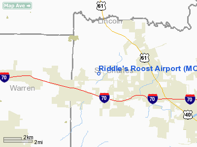
Location & QuickFacts
| FAA Information Effective: | 2008-09-25 |
| Airport Identifier: | MO36 |
| Airport Status: | Operational |
| Longitude/Latitude: | 090-55-30.4920W/38-49-55.1800N
-90.925137/38.831994 (Estimated) |
| Elevation: | 650 ft / 198.12 m (Estimated) |
| Land: | 21 acres |
| From nearest city: | 3 nautical miles NE of Foristell, MO |
| Location: | St Charles County, MO |
| Magnetic Variation: | 01E (1995) |
Owner & Manager
| Ownership: | Privately owned |
| Owner: | John L. Riddle |
| Address: | 338 Duenke Rd
Foristell, MO 63348 |
| Manager: | John L. Riddle |
| Address: | 338 Duenke Rd
Foristell, MO 63348 |
Airport Operations and Facilities
| Airport Use: | Private |
| Segmented Circle: | No |
| Control Tower: | No |
| Region: | ACE - Central |
| Boundary ARTCC: | ZKC - Kansas City |
| Tie-in FSS: | STL - Saint Louis |
| FSS Toll Free: | 1-800-WX-BRIEF |
Runway Information
Runway 09/27
| Dimension: | 2600 x 50 ft / 792.5 x 15.2 m |
| Surface: | TURF, |
| |
Runway 09 |
Runway 27 |
| Traffic Pattern: | Left | Left |
|
Radio Navigation Aids
| ID |
Type |
Name |
Ch |
Freq |
Var |
Dist |
| LM | NDB | Oblio | | 338.00 | 00E | 21.2 nm |
| UUV | NDB | Sullivan | | 356.00 | 02E | 37.6 nm |
| CVM | NDB | Civic Memorial | | 263.00 | 02E | 40.8 nm |
| FES | NDB | Festus | | 269.00 | 01E | 45.8 nm |
| PPQ | NDB | Pittsfield | | 344.00 | 02E | 49.0 nm |
| CSX | VOR/DME | Cardinal | 111Y | 116.45 | 00E | 26.9 nm |
| FTZ | VORTAC | Foristell | 045X | 110.80 | 05E | 8.5 nm |
| STL | VORTAC | St Louis | 121X | 117.40 | 01E | 20.8 nm |
| TOY | VORTAC | Troy | 107X | 116.00 | 04E | 47.5 nm |
| SUS | VOT | Spirit Of St Louis | | 112.20 | | 16.4 nm |
| STL | VOT | St Louis Lambert | | 111.00 | | 26.8 nm |
Remarks
- PRVDD APCH TO EA RY MAINTAINED FOR A 20:1 GLIDE SLOPE & TRANSITIONAL SFC MAINTAINTED AT A 7:1 SLOPE.
Images and information placed above are from
http://www.airport-data.com/airport/MO36/
We thank them for the data!
| General Info
|
| Country |
United States
|
| State |
MISSOURI
|
| FAA ID |
MO36
|
| Latitude |
38-49-55.180N
|
| Longitude |
090-55-30.492W
|
| Elevation |
650 feet
|
| Near City |
FORISTELL
|
We don't guarantee the information is fresh and accurate. The data may
be wrong or outdated.
For more up-to-date information please refer to other sources.
|
|


