 |
|
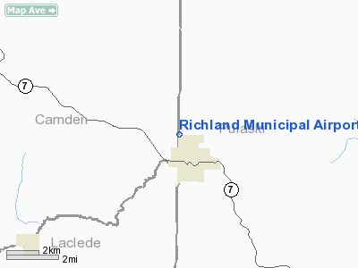
Richland Municipal Airport |
| Richland Municipal Airport |
| IATA: none – ICAO: none – FAA LID: MO1 |
| Summary |
| Airport type |
Public |
| Owner |
City of Richland |
| Serves |
Richland, Missouri |
| Elevation AMSL |
1,110 ft / 338 m |
| Coordinates |
37°52′30″N 092°24′29″W / 37.875°N 92.40806°W / 37.875; -92.40806 |
| Runways |
| Direction |
Length |
Surface |
| ft |
m |
| 14/32 |
3,000 |
914 |
Asphalt |
| Statistics (2007) |
| Aircraft operations |
520 |
| Source: Federal Aviation Administration |
Richland Municipal Airport (FAA LID: MO1) is a city-owned, public-use airport located one mile (2 km) north of the central business district of Richland, a city in Pulaski County, Missouri, United States.
Facilities and aircraft
Richland Municipal Airport covers an area of 140 acres (57 ha) and has one runway designated 14/32 with a 3,000 x 60 ft (914 x 18 m) asphalt surface. For the 12-month period ending June 13, 2007, the airport had 520 aircraft operations, an average of 43 per month: 90% general aviation and 10% military.
The above content comes from Wikipedia and is published under free licenses – click here to read more.
Location & QuickFacts
| FAA Information Effective: | 2008-09-25 |
| Airport Identifier: | MO1 |
| Airport Status: | Operational |
| Longitude/Latitude: | 092-24-29.0000W/37-52-29.6000N
-92.408056/37.874889 (Estimated) |
| Elevation: | 1110 ft / 338.33 m (Surveyed) |
| Land: | 140 acres |
| From nearest city: | 1 nautical miles N of Richland, MO |
| Location: | Pulaski County, MO |
| Magnetic Variation: | 04E (1985) |
Owner & Manager
| Ownership: | Publicly owned |
| Owner: | City Of Richland |
| Address: | 204 E Washington Box 798
Richland, MO 65556 |
| Phone number: | 573-765-4421 |
| Manager: | Anita Ivey
CITY ADMINISTRATOR |
| Address: | 204 E Washington Box 798
Richland, MO 65556 |
| Phone number: | 573-765-4421 |
Airport Operations and Facilities
| Airport Use: | Open to public |
| Wind indicator: | Yes |
| Segmented Circle: | Yes |
| Control Tower: | No |
| Lighting Schedule: | DUSK-DAWN
ACTVT LIRL RY 14/32 - CTAF. |
| Landing fee charge: | No |
| Sectional chart: | Kansas City |
| Region: | ACE - Central |
| Boundary ARTCC: | ZKC - Kansas City |
| Tie-in FSS: | COU - Columbia |
| FSS on Airport: | No |
| FSS Toll Free: | 1-800-WX-BRIEF |
| NOTAMs Facility: | COU (NOTAM-d service avaliable) |
Airport Communications
Airport Services
| Airframe Repair: | NONE |
| Power Plant Repair: | NONE |
| Bottled Oxygen: | NONE |
| Bulk Oxygen: | NONE |
Runway Information
Runway 14/32
| Dimension: | 3000 x 60 ft / 914.4 x 18.3 m |
| Surface: | ASPH, Good Condition |
| Weight Limit: | Single wheel: 6000 lbs. |
| Edge Lights: | Low |
| |
Runway 14 |
Runway 32 |
| Longitude: | 092-24-41.1700W | 092-24-16.7600W |
| Latitude: | 37-52-40.8800N | 37-52-18.4000N |
| Traffic Pattern: | Left | Left |
| Markings: | Basic, Good Condition | Basic, Good Condition |
| Displaced threshold: | 170.00 ft | 130.00 ft |
| Obstruction: | 38 ft trees, 265.0 ft from runway, 123 ft right of centerline, 1:1 slope to clear
RWY 14 +38 FT TREE, 265 FT, 123 FT R, 6:1 BASED ON DSPLCD THLD.
RWY 14 +1-15 FT BRUSH & TREES 0-200 FT FM RY END L & R. | 12 ft trees, 200.0 ft from runway
RWY 32 +12 FT TREES, 200 FT, 50 FT L/R, 10:1 BASED ON DSPLCD THLD.
RWY 32 +1-6 FT GND, BRUSH & EQUIPMENT ; 0-90 FT FM RY END; 0-125 FT L; +1-20 FT BRUSH & TREES; 180-200 FT FM RY END, L & R. |
|
Radio Navigation Aids
| ID |
Type |
Name |
Ch |
Freq |
Var |
Dist |
| AIZ | NDB | Kaiser | | 377.00 | 05E | 15.0 nm |
| BHN | NDB | Buckhorn | | 391.00 | 03E | 18.0 nm |
| IEB | NDB | Lebanon | | 414.00 | 03E | 21.8 nm |
| JE | NDB | Algoa | | 397.00 | 03E | 43.5 nm |
| ONH | NDB | Noah | | 515.00 | 03E | 46.5 nm |
| UBX | NDB | Cuba | | 380.00 | 01E | 47.9 nm |
| TBN | VOR | Forney | | 110.00 | 03E | 15.1 nm |
| SHY | VOR/DME | Sunshine | 021X | 108.40 | 05E | 13.6 nm |
| VIH | VOR/DME | Vichy | 124X | 117.70 | 06E | 37.2 nm |
| MAP | VORTAC | Maples | 081X | 113.40 | 06E | 34.0 nm |
| JEF | VOT | Jefferson City | | 112.00 | | 44.6 nm |
Remarks
- GOLFERS CROSSING RY APPROXIMATELY 800 FT NORTHWEST OF RY 32 THR.
- WILDLIFE ON & INVOF ARPT.
Images and information placed above are from
http://www.airport-data.com/airport/MO1/
We thank them for the data!
| General Info
|
| Country |
United States
|
| State |
MISSOURI
|
| FAA ID |
MO1
|
| Latitude |
37-52-30.140N
|
| Longitude |
092-24-30.624W
|
| Elevation |
1110 feet
|
| Near City |
RICHLAND
|
We don't guarantee the information is fresh and accurate. The data may
be wrong or outdated.
For more up-to-date information please refer to other sources.
|
|


