 |
|
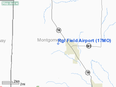
Location & QuickFacts
| FAA Information Effective: | 2008-09-25 |
| Airport Identifier: | 17MO |
| Airport Status: | Operational |
| Longitude/Latitude: | 091-32-05.5860W/38-59-06.1450N
-91.534885/38.985040 (Estimated) |
| Elevation: | 825 ft / 251.46 m (Estimated) |
| Land: | 107 acres |
| From nearest city: | 1 nautical miles W of Montgomery City, MO |
| Location: | Montgomery County, MO |
| Magnetic Variation: | 03E (1985) |
Owner & Manager
| Ownership: | Privately owned |
| Owner: | Charles Roden
ENTERPRISE INC. |
| Address: | P O Box 102
Montgomery City, MO 63361 |
| Phone number: | 314-564-3992 |
| Manager: | Charles Roden |
| Address: | P O Box 102
Montgomery City, MO 63361 |
| Phone number: | 573-564-3992 |
Airport Operations and Facilities
| Airport Use: | Private |
| Wind indicator: | Yes |
| Segmented Circle: | No |
| Control Tower: | No |
| Sectional chart: | Kansas City |
| Region: | ACE - Central |
| Boundary ARTCC: | ZKC - Kansas City |
| Tie-in FSS: | STL - Saint Louis |
| FSS on Airport: | No |
| FSS Toll Free: | 1-800-WX-BRIEF |
Runway Information
Runway 08/26
| Dimension: | 3000 x 75 ft / 914.4 x 22.9 m |
| Surface: | TURF, |
| |
Runway 08 |
Runway 26 |
| Traffic Pattern: | Left | Left |
|
Radio Navigation Aids
| ID |
Type |
Name |
Ch |
Freq |
Var |
Dist |
| FTT | NDB | Guthrie | | 317.00 | 03E | 23.6 nm |
| JE | NDB | Algoa | | 397.00 | 03E | 36.4 nm |
| ONH | NDB | Noah | | 515.00 | 03E | 39.3 nm |
| HAE | NDB | Hannibal | | 411.00 | 03E | 44.8 nm |
| UUV | NDB | Sullivan | | 356.00 | 02E | 48.3 nm |
| COU | VOR/DME | Columbia | 039X | 110.20 | 03E | 33.6 nm |
| HLV | VORTAC | Hallsville | 089X | 114.20 | 06E | 28.8 nm |
| FTZ | VORTAC | Foristell | 045X | 110.80 | 05E | 31.6 nm |
| STL | VORTAC | St Louis | 121X | 117.40 | 01E | 49.8 nm |
| JEF | VOT | Jefferson City | | 112.00 | | 37.3 nm |
| SUS | VOT | Spirit Of St Louis | | 112.20 | | 45.7 nm |
Remarks
- PRVDD APCH TO EA RY MAINTAINED FOR A 20:1 GLIDE SLOPE AND TRANSITIONAL SFC FOR A 7:1 SLOPE.
Images and information placed above are from
http://www.airport-data.com/airport/17MO/
We thank them for the data!
| General Info
|
| Country |
United States
|
| State |
MISSOURI
|
| FAA ID |
17MO
|
| Latitude |
38-59-06.145N
|
| Longitude |
091-32-05.586W
|
| Elevation |
825 feet
|
| Near City |
MONTGOMERY CITY
|
We don't guarantee the information is fresh and accurate. The data may
be wrong or outdated.
For more up-to-date information please refer to other sources.
|
|


