 |
|
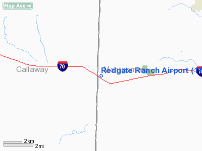
Location & QuickFacts
| FAA Information Effective: | 2008-09-25 |
| Airport Identifier: | 11MO |
| Airport Status: | Operational |
| Longitude/Latitude: | 091-38-06.6040W/38-54-06.1470N
-91.635168/38.901708 (Estimated) |
| Elevation: | 820 ft / 249.94 m (Estimated) |
| Land: | 0 acres |
| From nearest city: | 3 nautical miles E of Williamsburg, MO |
| Location: | Montgomery County, MO |
| Magnetic Variation: | 03E (1985) |
Owner & Manager
| Ownership: | Privately owned |
| Owner: | Turken |
| Address: | Rt 1
Kingdom City, MO 65262 |
| Phone number: | 573-564-3512 |
| Address: |
|
Airport Operations and Facilities
| Airport Use: | Private |
| Wind indicator: | Yes |
| Segmented Circle: | No |
| Control Tower: | No |
| Landing fee charge: | No |
| Sectional chart: | Kansas City |
| Region: | ACE - Central |
| Boundary ARTCC: | ZKC - Kansas City |
| Tie-in FSS: | COU - Columbia |
| FSS on Airport: | No |
| FSS Toll Free: | 1-800-WX-BRIEF |
Airport Services
| Airframe Repair: | NONE |
| Power Plant Repair: | NONE |
Runway Information
Runway 18/36
| Dimension: | 2100 x 70 ft / 640.1 x 21.3 m |
| Surface: | TURF, |
| |
Runway 18 |
Runway 36 |
| Traffic Pattern: | Left | Left |
|
Radio Navigation Aids
| ID |
Type |
Name |
Ch |
Freq |
Var |
Dist |
| FTT | NDB | Guthrie | | 317.00 | 03E | 17.6 nm |
| JE | NDB | Algoa | | 397.00 | 03E | 29.5 nm |
| ONH | NDB | Noah | | 515.00 | 03E | 32.7 nm |
| UUV | NDB | Sullivan | | 356.00 | 02E | 45.8 nm |
| VER | NDB | Viertel | | 347.00 | 02E | 49.1 nm |
| COU | VOR/DME | Columbia | 039X | 110.20 | 03E | 27.8 nm |
| VIH | VOR/DME | Vichy | 124X | 117.70 | 06E | 45.1 nm |
| HLV | VORTAC | Hallsville | 089X | 114.20 | 06E | 26.3 nm |
| FTZ | VORTAC | Foristell | 045X | 110.80 | 05E | 33.5 nm |
| JEF | VOT | Jefferson City | | 112.00 | | 30.5 nm |
| SUS | VOT | Spirit Of St Louis | | 112.20 | | 48.3 nm |
Images and information placed above are from
http://www.airport-data.com/airport/11MO/
We thank them for the data!
| General Info
|
| Country |
United States
|
| State |
MISSOURI
|
| FAA ID |
11MO
|
| Latitude |
38-54-06.147N
|
| Longitude |
091-38-06.604W
|
| Elevation |
820 feet
|
| Near City |
WILLIAMSBURG
|
We don't guarantee the information is fresh and accurate. The data may
be wrong or outdated.
For more up-to-date information please refer to other sources.
|
|


