 |
|
| Rankin Airport |
| IATA: none – ICAO: none – FAA LID: 78Y |
| Summary |
| Airport type |
Public |
| Owner |
Joe Rankin |
| Location |
Maryville, Missouri |
| Elevation AMSL |
976 ft / 297 m |
| Coordinates |
40°19′54″N 094°50′05″W / 40.33167°N 94.83472°W / 40.33167; -94.83472 |
| Runways |
| Direction |
Length |
Surface |
| ft |
m |
| 17/35 |
3,050 |
930 |
Concrete/Gravel |
| Statistics (2007) |
| Aircraft operations |
3,100 |
| Based aircraft |
9 |
| Source: Federal Aviation Administration |
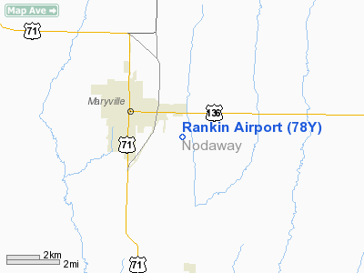
Rankin Airport (FAA LID: 78Y) is a privately-owned, public-use airport located three miles (5 km) southeast of the central business district of Maryville, a city in Nodaway County, Missouri, United States.
Facilities and aircraft
Rankin Airport covers an area of 25 acres (10 ha) and has one runway designated 17/35 with a 3,050 x 25 ft (930 x 8 m) concrete/gravel surface. For the 12-month period ending September 17, 2007, the airport had 3,100 general aviation aircraft operations, an average of 8 per day. At that time there were 9 aircraft based at this airport: 89% single-engine and 11% ultralight.
The above content comes from Wikipedia and is published under free licenses – click here to read more.
Location & QuickFacts
| FAA Information Effective: | 2008-09-25 |
| Airport Identifier: | 78Y |
| Airport Status: | Operational |
| Longitude/Latitude: | 094-50-04.9000W/40-19-54.1000N
-94.834694/40.331694 (Estimated) |
| Elevation: | 976 ft / 297.48 m (Surveyed) |
| Land: | 25 acres |
| From nearest city: | 3 nautical miles SE of Maryville, MO |
| Location: | Nodaway County, MO |
| Magnetic Variation: | 05E (1985) |
Owner & Manager
| Ownership: | Privately owned |
| Owner: | Joe Rankin |
| Address: | 26842 Jet Rd
Maryville, MO 64468 |
| Phone number: | 660-582-3791 |
| Manager: | Joe Rankin |
| Address: | 26842 Jet Rd.
Maryville, MO 64468 |
| Phone number: | 660-582-3791 |
Airport Operations and Facilities
| Airport Use: | Open to public |
| Wind indicator: | Yes |
| Segmented Circle: | No |
| Control Tower: | No |
| Lighting Schedule: | PHONE REQ
FOR LIRL RY 17/35 CALL 660-582-3791. |
| Landing fee charge: | No |
| Sectional chart: | Omaha |
| Region: | ACE - Central |
| Traffic Pattern Alt: | 800 ft |
| Boundary ARTCC: | ZMP - Minneapolis |
| Tie-in FSS: | COU - Columbia |
| FSS on Airport: | No |
| FSS Toll Free: | 1-800-WX-BRIEF |
| NOTAMs Facility: | (NOTAM-d service avaliable) |
Airport Communications
| CTAF: | 122.800 |
| Unicom: | 122.800 |
Airport Services
| Fuel available: | 100LL |
| Airframe Repair: | MAJOR |
| Power Plant Repair: | MAJOR |
Runway Information
Runway 17/35
| Dimension: | 3050 x 25 ft / 929.6 x 7.6 m
RWY 17/35 FIRST 630 FT OF RY 17 GRVL/TURF 60 FT WIDE; NEXT 1,300 FT CONC/TURF; CONC 14 FT WIDE; 18 FT TURF ON EACH SIDE; LAST 1,120 FT GRVL/TURF/ASPH CHIPS 15-25 FT WIDE; 12.5-17.5 FT TURF ON EACH SIDE.
RWY 17/35 WIDTH VARIANCE 25-60 FT. |
| Surface: | CONC-GRVL, Fair Condition
CONC-GRVL-TURF; ASPH CHIPS. |
| Edge Lights: | Non-standard lighting system
RWY 17/35 NSTD LIRL; RY LGTS ON PART OF EAST & WEST SIDE AT VARIOUS DISTANCES; NO THR OR DSPLCD THR LGTS. |
| |
Runway 17 |
Runway 35 |
| Longitude: | 094-50-05.1700W | 094-50-04.5700W |
| Latitude: | 40-20-09.1700N | 40-19-39.0300N |
| Traffic Pattern: | Left | Left |
| Displaced threshold: | 735.00 ft | 0.00 ft |
| Obstruction: | 62 ft pline, 135.0 ft from runway, 2:1 slope to clear
APCH RATIO 15:1 TO DSPLCD THLD; +1-31 FT FENCE; TREES, GND & BLDGS AT DSPLCD THLD 45-125 FT R; 0:1 BASED ON DSPLCD THLD. | 15 ft road, 0.0 ft from runway |
|
Radio Navigation Aids
| ID |
Type |
Name |
Ch |
Freq |
Var |
Dist |
| EVU | NDB | Emville | | 317.00 | 05E | 3.8 nm |
| ICL | NDB | Clarinda | | 353.00 | 04E | 25.3 nm |
| AZN | NDB | Amazon | | 233.00 | 06E | 27.1 nm |
| SDA | NDB | Shenandoah | | 411.00 | 05E | 36.4 nm |
| FNB | NDB | Brenner | | 404.00 | 05E | 37.8 nm |
| CRZ | NDB | Corning | | 278.00 | 04E | 40.1 nm |
| UNE | NDB | Union County | | 379.00 | 04E | 43.7 nm |
| EZZ | NDB | Cameron | | 394.00 | 03E | 44.5 nm |
| AYB | NDB | Auburn | | 430.00 | 05E | 44.9 nm |
| RDK | NDB | Red Oak | | 230.00 | 04E | 45.3 nm |
| AFK | NDB | Nebraska City | | 347.00 | 05E | 49.7 nm |
| RBA | VOR/DME | Robinson | 019X | 108.20 | 04E | 39.6 nm |
| STJ | VORTAC | St Joseph | 102X | 115.50 | 08E | 22.7 nm |
| LMN | VORTAC | Lamoni | 114X | 116.70 | 07E | 42.7 nm |
Images and information placed above are from
http://www.airport-data.com/airport/78Y/
We thank them for the data!
| General Info
|
| Country |
United States
|
| State |
MISSOURI
|
| FAA ID |
78Y
|
| Latitude |
40-19-59.965N
|
| Longitude |
094-50-00.890W
|
| Elevation |
976 feet
|
| Near City |
MARYVILLE
|
We don't guarantee the information is fresh and accurate. The data may
be wrong or outdated.
For more up-to-date information please refer to other sources.
|
|


