 |
|
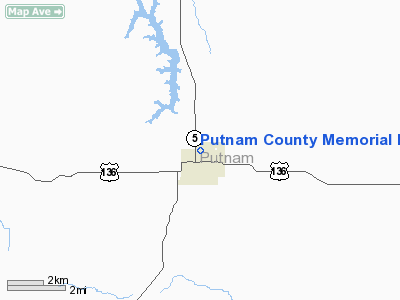
Putnam County Memorial Hospital Heliport |
Location & QuickFacts
| FAA Information Effective: | 2008-09-25 |
| Airport Identifier: | 1MU3 |
| Airport Status: | Operational |
| Longitude/Latitude: | 093-00-21.2410W/40-28-57.5570N
-93.005900/40.482655 (Estimated) |
| Elevation: | 1060 ft / 323.09 m (Estimated) |
| Land: | 0 acres |
| From nearest city: | 0 nautical miles S of Unionville, MO |
| Location: | Putnam County, MO |
| Magnetic Variation: | 03E (1995) |
Owner & Manager
| Ownership: | Privately owned |
| Owner: | Putnam County Memorial Hosp |
| Address: | 1926 Oak
Unionville, MO 63565 |
| Phone number: | 816-947-2411 |
| Manager: | Gary W Kluber, Administrator |
| Address: | 1926 Oak
Unionville, MO 63565 |
| Phone number: | 816-947-2411 |
Airport Operations and Facilities
| Airport Use: | Private
MEDICAL. |
| Segmented Circle: | No |
| Control Tower: | No |
| Lighting Schedule: | PHONE REQ
FOR PERIMETER LGTS CALL (816) 947-2411. |
| Sectional chart: | Kansas City |
| Region: | ACE - Central |
| Boundary ARTCC: | ZKC - Kansas City |
| Tie-in FSS: | COU - Columbia |
| FSS on Airport: | No |
| FSS Toll Free: | 1-800-WX-BRIEF |
Runway Information
Helipad H1
| Dimension: | 50 x 50 ft / 15.2 x 15.2 m |
| Surface: | CONC, |
| |
Runway H1 |
Runway |
| Traffic Pattern: | Left | Left |
|
Radio Navigation Aids
| ID |
Type |
Name |
Ch |
Freq |
Var |
Dist |
| TVK | NDB | Centerville | | 290.00 | 04E | 13.2 nm |
| BEX | NDB | Bloomfield | | 269.00 | 02E | 30.6 nm |
| CNC | NDB | Chariton | | 335.00 | 05E | 36.0 nm |
| TRX | NDB | Trenton | | 400.00 | 03E | 36.2 nm |
| BZK | NDB | Brookfield | | 383.00 | 03E | 43.4 nm |
| CHT | NDB | Chillicothe | | 375.00 | 03E | 48.0 nm |
| OXV | NDB | Knoxville | | 284.00 | 03E | 49.1 nm |
| OTM | VOR/DME | Ottumwa | 053X | 111.60 | 06E | 45.1 nm |
| IRK | VORTAC | Kirksville | 093X | 114.60 | 06E | 28.2 nm |
| LMN | VORTAC | Lamoni | 114X | 116.70 | 07E | 44.5 nm |
Remarks
- PRVDD CLEAR APCH/DEP PATHS TO LANDING AREA FOR A 8:1 GLIDE SLOPE; CLEAR TRANSITIONAL SFC FOR A 2:1 SLOPE; FIRE EQUIP SHOULD BE AVBL & OBSTNS NOT NOTED ON 7480-1 ARE REMOVED OR BURIED.
Images and information placed above are from
http://www.airport-data.com/airport/1MU3/
We thank them for the data!
| General Info
|
| Country |
United States
|
| State |
MISSOURI
|
| FAA ID |
1MU3
|
| Latitude |
40-28-57.557N
|
| Longitude |
093-00-21.241W
|
| Elevation |
1060 feet
|
| Near City |
UNIONVILLE
|
We don't guarantee the information is fresh and accurate. The data may
be wrong or outdated.
For more up-to-date information please refer to other sources.
|
|


