 |
|
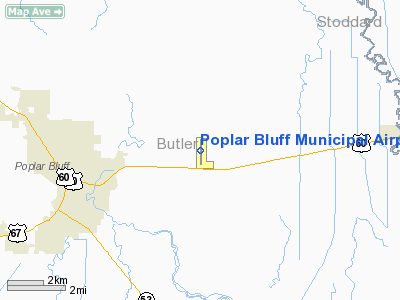
Poplar Bluff Municipal Airport |
Location & QuickFacts
| FAA Information Effective: | 2008-09-25 |
| Airport Identifier: | POF |
| Airport Status: | Operational |
| Longitude/Latitude: | 090-19-29.5000W/36-46-26.2000N
-90.324861/36.773944 (Estimated) |
| Elevation: | 331 ft / 100.89 m (Surveyed) |
| Land: | 240 acres |
| From nearest city: | 3 nautical miles E of Poplar Bluff, MO |
| Location: | Butler County, MO |
| Magnetic Variation: | 00W (2005) |
Owner & Manager
| Ownership: | Publicly owned |
| Owner: | City Of Poplar Bluff |
| Address: | 101 Oak St
Poplar Bluff, MO 63901 |
| Phone number: | 573-686-8620 |
| Manager: | Mike Smith |
| Address: | 101 Oak St
Poplar Bluff, MO 63901 |
| Phone number: | 573-686-8669 |
Airport Operations and Facilities
| Airport Use: | Open to public |
| Wind indicator: | Yes |
| Segmented Circle: | Yes |
| Control Tower: | No |
| Lighting Schedule: | DUSK-DAWN
ACTVT MIRL RWY 18/36, VASI RY 36 & PAPI RY 18 - CTAF. |
| Beacon Color: | Clear-Green (lighted land airport) |
| Landing fee charge: | No |
| Sectional chart: | St Louis |
| Region: | ACE - Central |
| Boundary ARTCC: | ZME - Memphis |
| Tie-in FSS: | STL - Saint Louis |
| FSS on Airport: | No |
| FSS Toll Free: | 1-800-WX-BRIEF |
| NOTAMs Facility: | POF (NOTAM-d service avaliable) |
| Federal Agreements: | NGY |
Airport Communications
| CTAF: | 123.000 |
| Unicom: | 123.000 |
Airport Services
| Fuel available: | 100LLA |
| Airframe Repair: | MINOR |
| Power Plant Repair: | MINOR |
| Bottled Oxygen: | NONE |
| Bulk Oxygen: | NONE |
Runway Information
Runway 18/36
| Dimension: | 5008 x 100 ft / 1526.4 x 30.5 m |
| Surface: | ASPH-CONC, Good Condition
RY 18/36 ASPHALT SURFACE IN FAIR CONDITION.
FIRST 1000 FT OF RY 18 IS CONC; REMAINDER IS ASPH. |
| Weight Limit: | Single wheel: 16000 lbs. |
| Edge Lights: | Non-standard lighting system
DSPLCD THLD LGTS SET AT 300 FT FM RY END. |
| |
Runway 18 |
Runway 36 |
| Longitude: | 090-19-28.7288W | 090-19-30.2282W |
| Latitude: | 36-46-50.9158N | 36-46-01.4136N |
| Elevation: | 331.00 ft | 328.00 ft |
| Alignment: | 127 | 1 |
| ILS Type: | | SDF
|
| Traffic Pattern: | Left | Left |
| Markings: | Non-precision instrument, Poor Condition
RY 18 MARKINGS FADED. | Nonstandard, Poor Condition
RY 36 MARKINGS FADED. |
| Crossing Height: | 30.00 ft | 40.00 ft |
| Displaced threshold: | 0.00 ft | 300.00 ft |
| VASI: | 4-light PAPI on left side | 4-box on left side |
| Visual Glide Angle: | 3.00° | 3.00° |
| Runway End Identifier: | Yes | Yes |
| Obstruction: | 40 ft trees, 1196.0 ft from runway, 268 ft right of centerline, 24:1 slope to clear | 50 ft trees, 1200.0 ft from runway, 171 ft right of centerline, 20:1 slope to clear
RY 36 APCH SLOPE 29:1 TO DSPLCD THLD. |
|
Radio Navigation Aids
| ID |
Type |
Name |
Ch |
Freq |
Var |
Dist |
| FD | NDB | Earli | | 278.00 | 03E | 6.3 nm |
| DXE | NDB | Dexter | | 423.00 | 00E | 18.5 nm |
| TKX | NDB | Kennett | | 358.00 | 00E | 35.6 nm |
| PGR | NDB | Paragould | | 383.00 | 01E | 43.7 nm |
| TNZ | NDB | Lawrence County | | 227.00 | 01E | 44.8 nm |
| CHQ | NDB | Charleston | | 208.00 | 01E | 46.8 nm |
| CGI | VOR/DME | Cape Girardeau | 076X | 112.90 | 01E | 45.3 nm |
| MAW | VORTAC | Malden | 049X | 111.20 | 03E | 23.9 nm |
Remarks
- CROP DUSTING ACFT ON & INVOF ARPT FM MARCH TO AUGUST.
- NTSD RY SAFETY AREA TERRAIN GRADES BYND RY 18 END; ROLLING GND.
- TWY FROM APRON TO RY 36 END DOES NOT PROVIDE SUFFICIENT VISUAL REFERENCE OF RY 36 APPROACH AREA WHILE TAXIING TO RY 36 END FROM APRON.
Images and information placed above are from
http://www.airport-data.com/airport/POF/
We thank them for the data!
| General Info
|
| Country |
United States
|
| State |
MISSOURI
|
| FAA ID |
POF
|
| Latitude |
36-46-26.200N
|
| Longitude |
090-19-29.450W
|
| Elevation |
331 feet
|
| Near City |
POPLAR BLUFF
|
We don't guarantee the information is fresh and accurate. The data may
be wrong or outdated.
For more up-to-date information please refer to other sources.
|
|


