 |
|
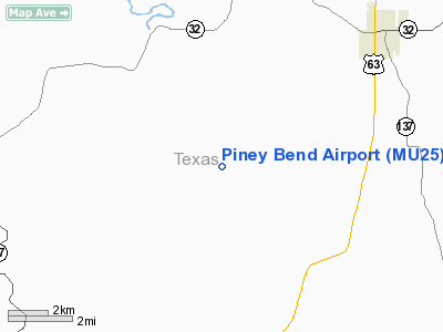
Location & QuickFacts
| FAA Information Effective: | 2008-09-25 |
| Airport Identifier: | MU25 |
| Airport Status: | Operational |
| Longitude/Latitude: | 091-56-57.5600W/37-26-16.1630N
-91.949322/37.437823 (Estimated) |
| Elevation: | 950 ft / 289.56 m (Estimated) |
| Land: | 0 acres |
| From nearest city: | 5 nautical miles N of Houston, MO |
| Location: | Texas County, MO |
| Magnetic Variation: | 03E (1985) |
Owner & Manager
| Ownership: | Privately owned |
| Owner: | Timothy Holekamp |
| Address: | 500 Keene St
Columbia, MO 65201 |
| Phone number: | 314-449-3846 |
| Manager: | Timothy Holekamp |
| Address: | 500 Keene St
Columbia, MO 65201 |
| Phone number: | 314-449-3846 |
Airport Operations and Facilities
| Airport Use: | Private |
| Wind indicator: | No |
| Segmented Circle: | No |
| Control Tower: | No |
| Landing fee charge: | No |
| Sectional chart: | Kansas City |
| Region: | ACE - Central |
| Boundary ARTCC: | ZKC - Kansas City |
| Tie-in FSS: | COU - Columbia |
| FSS on Airport: | No |
| FSS Toll Free: | 1-800-WX-BRIEF |
Runway Information
Runway 15/33
| Dimension: | 2300 x 60 ft / 701.0 x 18.3 m |
| Surface: | TURF, |
| |
Runway 15 |
Runway 33 |
| Traffic Pattern: | Left | Left |
| Obstruction: | 200 ft hill, 1500.0 ft from runway | 4 ft fence, 20.0 ft from runway |
|
Radio Navigation Aids
| ID |
Type |
Name |
Ch |
Freq |
Var |
Dist |
| BHN | NDB | Buckhorn | | 391.00 | 03E | 17.3 nm |
| MNF | NDB | Mountain View | | 365.00 | 03E | 29.0 nm |
| UNO | NDB | Pomona | | 335.00 | 02E | 33.7 nm |
| IEB | NDB | Lebanon | | 414.00 | 03E | 34.7 nm |
| AOV | NDB | Bilmart | | 341.00 | 02E | 44.8 nm |
| UBX | NDB | Cuba | | 380.00 | 01E | 45.1 nm |
| AIZ | NDB | Kaiser | | 377.00 | 05E | 48.9 nm |
| TBN | VOR | Forney | | 110.00 | 03E | 20.4 nm |
| HUW | VOR/DME | Hutton | 053X | 111.60 | 02E | 34.1 nm |
| VIH | VOR/DME | Vichy | 124X | 117.70 | 06E | 44.6 nm |
| SHY | VOR/DME | Sunshine | 021X | 108.40 | 05E | 47.7 nm |
| MAP | VORTAC | Maples | 081X | 113.40 | 06E | 12.0 nm |
Remarks
- PROVIDED THAT THE APPROACH TO EACH RWY IS MAINTAINED FOR A MINIMUM 20:1 GLIDE SLOPE AND THAT THE TRANSITIONAL SURFACE BE MAINTAINED FOR A 7:1 SLOPE.
Images and information placed above are from
http://www.airport-data.com/airport/MU25/
We thank them for the data!
| General Info
|
| Country |
United States
|
| State |
MISSOURI
|
| FAA ID |
MU25
|
| Latitude |
37-26-16.163N
|
| Longitude |
091-56-57.560W
|
| Elevation |
950 feet
|
| Near City |
HOUSTON
|
We don't guarantee the information is fresh and accurate. The data may
be wrong or outdated.
For more up-to-date information please refer to other sources.
|
|


