 |
|
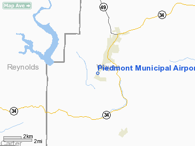
Piedmont Municipal Airport |
Location & QuickFacts
| FAA Information Effective: | 2008-09-25 |
| Airport Identifier: | PYN |
| Airport Status: | Operational |
| Longitude/Latitude: | 090-42-48.7000W/37-07-34.1000N
-90.713528/37.126139 (Estimated) |
| Elevation: | 467 ft / 142.34 m (Estimated) |
| Land: | 72 acres |
| From nearest city: | 2 nautical miles SW of Piedmont, MO |
| Location: | Wayne County, MO |
| Magnetic Variation: | 02E (1985) |
Owner & Manager
| Ownership: | Publicly owned |
| Owner: | City Of Piedmont |
| Address: | 115 W Green St Box 25
Piedmont, MO 63957 |
| Phone number: | 573-223-7660 |
| Manager: | Bill Mcmurry |
| Address: | 115 W Green St Box 25
Piedmont, MO 63957 |
| Phone number: | 573-223-4528 |
Airport Operations and Facilities
| Airport Use: | Open to public |
| Wind indicator: | Yes |
| Segmented Circle: | Yes |
| Control Tower: | No |
| Lighting Schedule: | DUSK-DAWN
ROTG BCN OTS INDEFLY. |
| Beacon Color: | Clear-Green (lighted land airport)
BCN ON EAST HILL 2600' FROM TWY. |
| Landing fee charge: | No |
| Sectional chart: | Kansas City |
| Region: | ACE - Central |
| Boundary ARTCC: | ZME - Memphis |
| Responsible ARTCC: | ZKC - Kansas City |
| Tie-in FSS: | STL - Saint Louis |
| FSS on Airport: | No |
| FSS Toll Free: | 1-800-WX-BRIEF |
| NOTAMs Facility: | STL (NOTAM-d service avaliable) |
| Federal Agreements: | NGY |
Airport Communications
| CTAF: | 122.800 |
| Unicom: | 122.800
NOT MONITORED. |
Airport Services
| Fuel available: | 100LL
FOR FUEL CALL (573) 223-4300. |
| Bottled Oxygen: | NONE |
| Bulk Oxygen: | NONE |
Runway Information
Runway 03/21
| Dimension: | 3300 x 60 ft / 1005.8 x 18.3 m |
| Surface: | ASPH, Good Condition |
| Weight Limit: | Single wheel: 12500 lbs. |
| Edge Lights: | Medium
MIRL RY 03/21 OTS INDEFLY. |
| |
Runway 03 |
Runway 21 |
| Longitude: | 090-42-59.5800W | 090-42-37.8400W |
| Latitude: | 37-07-20.3000N | 37-07-47.8900N |
| Traffic Pattern: | Right | Left |
| Markings: | Basic, Good Condition | Basic, Good Condition |
| Crossing Height: | 0.00 ft | 39.00 ft |
| VASI: | | 2-light PAPI on left side |
| Visual Glide Angle: | 0.00° | 4.00° |
| Runway End Identifier: | Yes | |
| Obstruction: | 98 ft trees, 1420.0 ft from runway, 170 ft left of centerline, 12:1 slope to clear | 38 ft trees, 808.0 ft from runway, 60 ft left of centerline, 16:1 slope to clear |
|
Radio Navigation Aids
| ID |
Type |
Name |
Ch |
Freq |
Var |
Dist |
| FD | NDB | Earli | | 278.00 | 03E | 33.1 nm |
| PRI | NDB | Perrine | | 367.00 | 02E | 40.7 nm |
| DXE | NDB | Dexter | | 423.00 | 00E | 42.3 nm |
| MNF | NDB | Mountain View | | 365.00 | 03E | 48.6 nm |
| FAM | VORTAC | Farmington | 104X | 115.70 | 01E | 40.1 nm |
Remarks
- LAST 35 FT OF TURNAROUND AT SE TWY NOT USBL; PILOTS OF LOW WING ACFT USE CARE.
- BIRDS & WILDLIFE ON & INVOF ARPT.
Images and information placed above are from
http://www.airport-data.com/airport/PYN/
We thank them for the data!
| General Info
|
| Country |
United States
|
| State |
MISSOURI
|
| FAA ID |
PYN
|
| Latitude |
37-07-36.181N
|
| Longitude |
090-42-46.431W
|
| Elevation |
467 feet
|
| Near City |
PIEDMONT
|
We don't guarantee the information is fresh and accurate. The data may
be wrong or outdated.
For more up-to-date information please refer to other sources.
|
|


