 |
|
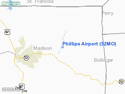
Location & QuickFacts
| FAA Information Effective: | 2008-09-25 |
| Airport Identifier: | 32MO |
| Airport Status: | Operational |
| Longitude/Latitude: | 090-13-33.4210W/37-34-36.1920N
-90.225950/37.576720 (Estimated) |
| Elevation: | 860 ft / 262.13 m (Estimated) |
| Land: | 0 acres |
| From nearest city: | 4 nautical miles E of Fredericktown, MO |
| Location: | Madison County, MO |
| Magnetic Variation: | 02E (1990) |
Owner & Manager
| Ownership: | Privately owned |
| Owner: | Odell Phillips |
| Address: | P.o. Box 550
Fredericktown, MO 63645 |
| Phone number: | 314-783-3560 |
| Manager: | Odell Phillips |
| Address: | P.o. Box 550
Fredericktown, MO 63645 |
| Phone number: | 573-783-3460 |
Airport Operations and Facilities
| Airport Use: | Private |
| Segmented Circle: | No |
| Control Tower: | No |
| Sectional chart: | St Louis |
| Region: | ACE - Central |
| Boundary ARTCC: | ZKC - Kansas City |
| Tie-in FSS: | STL - Saint Louis |
| FSS on Airport: | No |
| FSS Toll Free: | 1-800-WX-BRIEF |
Runway Information
Runway 02/20
| Dimension: | 2000 x 50 ft / 609.6 x 15.2 m |
| Surface: | TURF, |
| |
Runway 02 |
Runway 20 |
| Traffic Pattern: | Left | Left |
|
Radio Navigation Aids
| ID |
Type |
Name |
Ch |
Freq |
Var |
Dist |
| PRI | NDB | Perrine | | 367.00 | 02E | 14.9 nm |
| FES | NDB | Festus | | 269.00 | 01E | 38.0 nm |
| SAR | NDB | Sparta | | 239.00 | 01E | 42.3 nm |
| PJY | NDB | Pinckneyville | | 215.00 | 00E | 47.5 nm |
| DXE | NDB | Dexter | | 423.00 | 00E | 49.3 nm |
| CGI | VOR/DME | Cape Girardeau | 076X | 112.90 | 01E | 37.6 nm |
| FAM | VORTAC | Farmington | 104X | 115.70 | 01E | 5.8 nm |
Remarks
- PRVDD APCH TO EACH RY IS 20:1 GLIDE SLOPE; TRANSITIONAL IS 7:1 SLOPE; CONTACT SHOULD BE MADE WITH BOB SFREDDO CONCERNING THE PROPOSED RELOCATION OF ROUTE 72 - 314-751-2551.
Images and information placed above are from
http://www.airport-data.com/airport/32MO/
We thank them for the data!
| General Info
|
| Country |
United States
|
| State |
MISSOURI
|
| FAA ID |
32MO
|
| Latitude |
37-34-36.192N
|
| Longitude |
090-13-33.421W
|
| Elevation |
860 feet
|
| Near City |
FREDERICKTOWN
|
We don't guarantee the information is fresh and accurate. The data may
be wrong or outdated.
For more up-to-date information please refer to other sources.
|
|


