 |
|
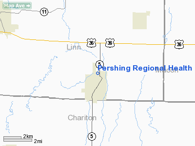
Pershing Regional Health Center - Marceline Heliport |
Location & QuickFacts
| FAA Information Effective: | 2008-09-25 |
| Airport Identifier: | 75MU |
| Airport Status: | Operational |
| Longitude/Latitude: | 092-56-39.7090W/39-43-45.0930N
-92.944364/39.729192 (Estimated) |
| Elevation: | 860 ft / 262.13 m (Estimated) |
| Land: | 0 acres |
| From nearest city: | 1 nautical miles NE of Marceline, MO |
| Location: | Linn County, MO |
| Magnetic Variation: | 04E (1985) |
Owner & Manager
| Ownership: | Privately owned |
| Owner: | Pershing Regl Health Center |
| Address: | 225 W. Hayden
Marceline, MO 64658 |
| Phone number: | 816-376-3521 |
| Manager: | Ed Murphy |
| Address: | 225 W Hayden
Marceline, MO 64658 |
| Phone number: | 816-376-2222 |
Airport Operations and Facilities
| Airport Use: | Private
MEDICAL. |
| Segmented Circle: | No |
| Control Tower: | No |
| Sectional chart: | Kansas City |
| Region: | ACE - Central |
| Boundary ARTCC: | ZKC - Kansas City |
| Tie-in FSS: | COU - Columbia |
| FSS Toll Free: | 1-800-WX-BRIEF |
Runway Information
Helipad H1
| Dimension: | 20 x 20 ft / 6.1 x 6.1 m |
| Surface: | CONC, |
| |
Runway H1 |
Runway |
| Traffic Pattern: | Left | Left |
|
Radio Navigation Aids
| ID |
Type |
Name |
Ch |
Freq |
Var |
Dist |
| BZK | NDB | Brookfield | | 383.00 | 03E | 7.9 nm |
| CHT | NDB | Chillicothe | | 375.00 | 03E | 25.6 nm |
| TRX | NDB | Trenton | | 400.00 | 03E | 36.6 nm |
| PUR | NDB | Marshall | | 371.00 | 03E | 42.9 nm |
| VER | NDB | Viertel | | 347.00 | 02E | 48.4 nm |
| MCM | VOR/DME | Macon | 076X | 112.90 | 06E | 21.9 nm |
| BQS | VOR/DME | Braymer | 049X | 111.20 | 03E | 43.5 nm |
| IRK | VORTAC | Kirksville | 093X | 114.60 | 06E | 29.3 nm |
Remarks
- PROVIDED APCH/DEP PATHS ARE MAINTAINED FOR A MINIMUM 8:1 GLIDE SLOPE & TRANSITIONAL SFCS FOR A 2:1 SLOPE; INGRESS /EGRESS IS TO/FM EAST.
Images and information placed above are from
http://www.airport-data.com/airport/75MU/
We thank them for the data!
| General Info
|
| Country |
United States
|
| State |
MISSOURI
|
| FAA ID |
75MU
|
| Latitude |
39-43-45.093N
|
| Longitude |
092-56-39.709W
|
| Elevation |
860 feet
|
| Near City |
MARCELINE
|
We don't guarantee the information is fresh and accurate. The data may
be wrong or outdated.
For more up-to-date information please refer to other sources.
|
|


