|
|
Perryville Municipal Airport |
| Perryville Municipal Airport |
 |
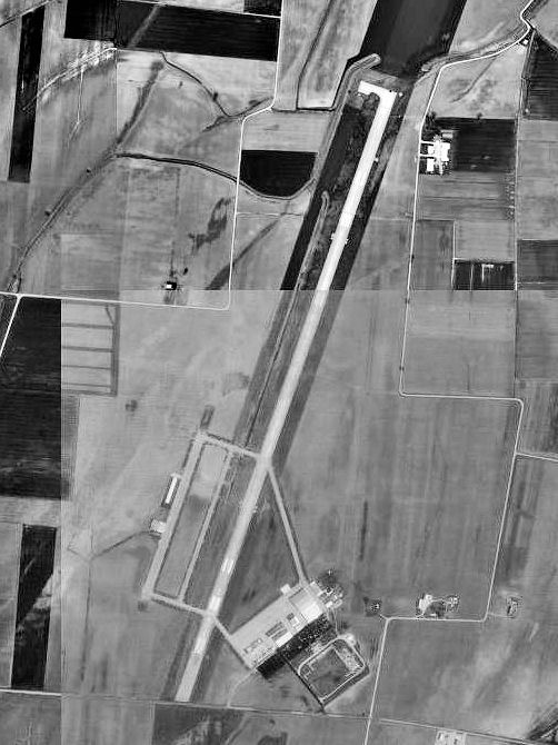
| 1996 USGS photo |
| IATA: none – ICAO: none – FAA LID: K02 |
| Summary |
| Airport type |
Public |
| Owner |
City of Perryville |
| Serves |
Perryville, Missouri |
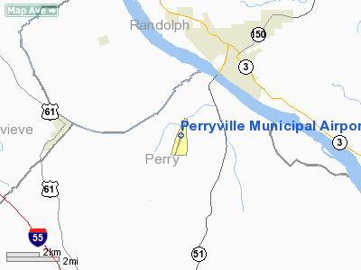
| Location |
Perry County, Missouri, near Chester, Illinois |
| Elevation AMSL |
372 ft / 113 m |
| Coordinates |
37°52′07″N 089°51′44″W / 37.86861°N 89.86222°W / 37.86861; -89.86222 |
| Runways |
| Direction |
Length |
Surface |
| ft |
m |
| 2/20 |
7,003 |
2,135 |
Concrete |
| Statistics (2008) |
| Aircraft operations |
5,900 |
| Based aircraft |
9 |
| Source: Federal Aviation Administration |
Perryville Municipal Airport (FAA LID: K02) (also known as McBride Airport) is a city-owned public-use airport located nine nautical miles (17 km) north of the central business district of Perryville, a city in Perry County, Missouri, United States. Facilities and aircraft
Perryville Municipal Airport covers an area of 351 acres (142 ha) at an elevation of 372 feet (113 m) above mean sea level. It has one runway designated 2/20 with a concrete surface measuring 7,003 by 100 feet (2,135 x 30 m).
For the 12-month period ending August 13, 2008, the airport had 5,900 aircraft operations, an average of 16 per day: 86% general aviation, 8% military and 5% air taxi. At that time there were nine aircraft based at this airport: eight single-engine and one helicopter.
History
The airport was built in 1942 by the United States Army Air Forces as a primary (stage 1) pilot training airfield assigned to AAF Flying Training Command, Southeast Training Center (later Eastern Flying Training Command). It was named Chester Army Airfield and consisted of two parallel 2000' runways aligned NNE/SSW (02/20).
Flight training was provided by Anderson Air Activities to the aviation cadets assigned to the airfield and Fairchild PT-19s were the primary trainer used. Pilot training at the airfield apparently ended on 30 May 1944, with the drawdown of AAFTC's pilot training program. The airfield was turned over to civil control at the end of the war though the War Assets Administration (WAA).
The above content comes from Wikipedia and is published under free licenses – click here to read more.
|
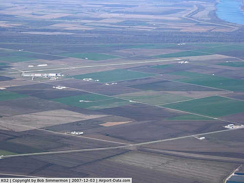 |
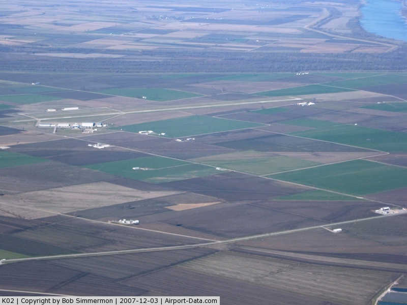
(Click on the photo to enlarge) |
Location & QuickFacts
| FAA Information Effective: | 2008-09-25 |
| Airport Identifier: | K02 |
| Airport Status: | Operational |
| Longitude/Latitude: | 089-51-43.7000W/37-52-07.2000N
-89.862139/37.868667 (Estimated) |
| Elevation: | 371 ft / 113.08 m (Surveyed) |
| Land: | 351 acres |
| From nearest city: | 9 nautical miles N of Perryville, MO |
| Location: | Perry County, MO |
| Magnetic Variation: | 00E (2000) |
Owner & Manager
| Ownership: | Publicly owned |
| Owner: | City Of Perryville |
| Address: | 120 N Jackson
Perryville, MO 63775 |
| Phone number: | 573-547-2594 |
| Manager: | Bill Lewis |
| Address: | 120 North Jackson
Perryville, MO 63775 |
| Phone number: | 573-547-2594 |
Airport Operations and Facilities
| Airport Use: | Open to public |
| Wind indicator: | Yes |
| Segmented Circle: | Yes |
| Control Tower: | No |
| Lighting Schedule: | DUSK-DAWN
ACTVT MIRL RY 02/20, PAPI RY 20, REIL RYS 02 & 20 - CTAF. |
| Beacon Color: | Clear-Green (lighted land airport) |
| Landing fee charge: | No |
| Sectional chart: | St Louis |
| Region: | ACE - Central |
| Boundary ARTCC: | ZKC - Kansas City |
| Tie-in FSS: | STL - Saint Louis |
| FSS on Airport: | No |
| FSS Toll Free: | 1-800-WX-BRIEF |
| NOTAMs Facility: | STL (NOTAM-d service avaliable) |
| Federal Agreements: | NGRY |
Airport Communications
| CTAF: | 122.800 |
| Unicom: | 122.800 |
Airport Services
| Fuel available: | 100LLA
24 HRS CARD READER. |
| Airframe Repair: | MINOR |
| Power Plant Repair: | MINOR |
| Bottled Oxygen: | NONE |
| Bulk Oxygen: | NONE |
Runway Information
Runway 02/20
| Dimension: | 7000 x 100 ft / 2133.6 x 30.5 m |
| Surface: | CONC, Good Condition |
| Weight Limit: | Single wheel: 28000 lbs.
Dual wheel: 48000 lbs. |
| Edge Lights: | Medium |
| |
Runway 02 |
Runway 20 |
| Longitude: | 089-51-56.6540W | 089-51-30.7580W |
| Latitude: | 37-51-34.1580N | 37-52-40.2450N |
| Elevation: | 368.00 ft | 371.00 ft |
| Alignment: | 17 | 127 |
| Traffic Pattern: | Left | Left |
| Markings: | Nonstandard, Fair Condition
MARKINGS FADED | Non-precision instrument, Fair Condition
MARKINGS FADED |
| Displaced threshold: | 520.00 ft | 0.00 ft |
| VASI: | | 2-light PAPI on left side |
| Runway End Identifier: | Yes
REIL LOCATED AT RY THLD; NOT AT DSPLCD THLD. | Yes |
| Obstruction: | 15 ft road, 565.0 ft from runway, 24:1 slope to clear
50:1 TO DSPLCD THLD.
+1-2 FT GND; 0-100 FT FM RY END 115-250 R. | 10 ft crops, 200.0 ft from runway |
|
Radio Navigation Aids
| ID |
Type |
Name |
Ch |
Freq |
Var |
Dist |
| SAR | NDB | Sparta | | 239.00 | 01E | 18.3 nm |
| PJY | NDB | Pinckneyville | | 215.00 | 00E | 24.5 nm |
| PRI | NDB | Perrine | | 367.00 | 02E | 27.6 nm |
| FES | NDB | Festus | | 269.00 | 01E | 31.7 nm |
| BL | NDB | Belleville | | 362.00 | 02E | 36.2 nm |
| SKE | TACAN | Scott | 059X | | 02E | 40.7 nm |
| CGI | VOR/DME | Cape Girardeau | 076X | 112.90 | 01E | 40.9 nm |
| MWA | VOR/DME | Marion | 041X | 110.40 | 04E | 41.0 nm |
| FAM | VORTAC | Farmington | 104X | 115.70 | 01E | 21.2 nm |
| ENL | VORTAC | Centralia | 097X | 115.00 | 04E | 46.9 nm |
Remarks
- HIGH PERFORMANCE MILITARY JET ACFT PRODUCTION TEST FLYING DURING DALGT HRS; CABLES MAY BE ACROSS RY AT THESE TIMES. CABLES ARE LCTD APRXLY 1,800 FT SOUTH OF RY 20 THLD & 1,800 FT NORTH OF RY 02 THLD. CHECK NOTAMS & ASK UNICOM OPR FOR CURRENT RY SITUATION.
- TRANSIENT ACFT USE FACILITES ON W SIDE OF RY.
- NTSD RY SAFETY AREA BYD RY 20 END; INCORRECT TERRAIN GRADES AND CROPS.
- PRVD EACH APCH IS MAINT FOR MIN 20:1 GLIDE SLOPE & TRSNL SFC MAINT FOR 7:1 SLOPE.
Images and information placed above are from
http://www.airport-data.com/airport/K02/
We thank them for the data!
| General Info
|
| Country |
United States
|
| State |
MISSOURI
|
| FAA ID |
K02
|
| Latitude |
37-52-07.200N
|
| Longitude |
089-51-43.700W
|
| Elevation |
371 feet
|
| Near City |
PERRYVILLE
|
We don't guarantee the information is fresh and accurate. The data may
be wrong or outdated.
For more up-to-date information please refer to other sources.
|
|