 |
|
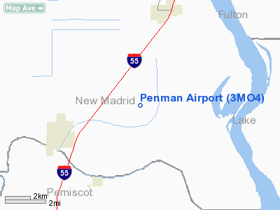
Location & QuickFacts
| FAA Information Effective: | 2008-09-25 |
| Airport Identifier: | 3MO4 |
| Airport Status: | Operational |
| Longitude/Latitude: | 089-37-41.2850W/36-27-02.2270N
-89.628135/36.450619 (Estimated) |
| Elevation: | 287 ft / 87.48 m (Surveyed) |
| Land: | 7 acres |
| From nearest city: | 3 nautical miles NE of Portageville, MO |
| Location: | New Madrid County, MO |
| Magnetic Variation: | 02E (1985) |
Owner & Manager
| Ownership: | Privately owned |
| Owner: | Charles A. Penman |
| Address: | 469 County Hwy 425
Portageville, MO 63873-9172 |
| Phone number: | 573-379-5110 |
| Manager: | Charles A. Penman |
| Address: | 469 County Hwy 425
Portageville, MO 63873-9172 |
| Phone number: | 573-379-5110 |
Airport Operations and Facilities
| Airport Use: | Private |
| Wind indicator: | Yes |
| Segmented Circle: | No |
| Control Tower: | No |
| Landing fee charge: | No |
| Sectional chart: | St Louis |
| Region: | ACE - Central |
| Boundary ARTCC: | ZME - Memphis |
| Tie-in FSS: | STL - Saint Louis |
| FSS on Airport: | No |
| FSS Toll Free: | 1-800-WX-BRIEF |
Airport Services
| Airframe Repair: | NONE |
| Power Plant Repair: | NONE |
| Bottled Oxygen: | NONE |
| Bulk Oxygen: | NONE |
Runway Information
Runway N/S
| Dimension: | 2600 x 100 ft / 792.5 x 30.5 m |
| Surface: | TURF, |
| |
Runway N |
Runway S |
| Traffic Pattern: | Left | Left |
|
Radio Navigation Aids
| ID |
Type |
Name |
Ch |
Freq |
Var |
Dist |
| TKX | NDB | Kennett | | 358.00 | 00E | 24.0 nm |
| DXE | NDB | Dexter | | 423.00 | 00E | 25.3 nm |
| CHQ | NDB | Charleston | | 208.00 | 01E | 27.1 nm |
| DNT | NDB | Nally Dunston | | 343.00 | 01W | 29.4 nm |
| UC | NDB | Obion | | 212.00 | 00E | 32.0 nm |
| IUI | NDB | Hicks | | 350.00 | 01E | 32.4 nm |
| FD | NDB | Earli | | 278.00 | 03E | 36.3 nm |
| CIR | NDB | Cairo | | 397.00 | 00E | 41.6 nm |
| MXA | NDB | Manila | | 282.00 | 01E | 42.3 nm |
| PGR | NDB | Paragould | | 383.00 | 01E | 48.7 nm |
| TGC | NDB | Gibson | | 378.00 | 01E | 48.8 nm |
| BPW | NDB | Osceola | | 239.00 | 02E | 49.2 nm |
| GOJ | VOR | Gosnell | | 111.80 | 01E | 33.6 nm |
| CGI | VOR/DME | Cape Girardeau | 076X | 112.90 | 01E | 46.8 nm |
| MAW | VORTAC | Malden | 049X | 111.20 | 03E | 15.1 nm |
| DYR | VORTAC | Dyersburg | 115X | 116.80 | 03E | 30.0 nm |
Remarks
- PRVDD APCH TO EACH RWY IS MAINTD FOR A MIN 20:1 GLIDE SLOPE AND TRANSITIONAL SFC BE MAINTD FOR A 7:1 SLOPE.
Images and information placed above are from
http://www.airport-data.com/airport/3MO4/
We thank them for the data!
| General Info
|
| Country |
United States
|
| State |
MISSOURI
|
| FAA ID |
3MO4
|
| Latitude |
36-27-02.227N
|
| Longitude |
089-37-41.285W
|
| Elevation |
287 feet
|
| Near City |
PORTAGEVILLE
|
We don't guarantee the information is fresh and accurate. The data may
be wrong or outdated.
For more up-to-date information please refer to other sources.
|
|


