|
|
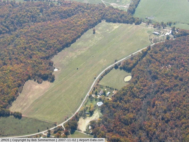
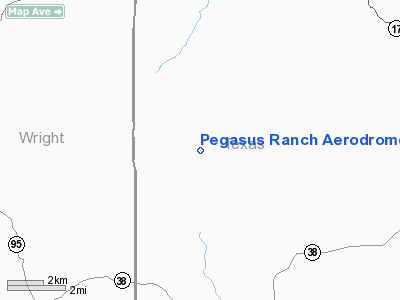
Pegasus Ranch Aerodrome Airport |
|
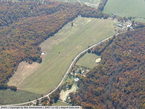 |
(Click on the photo to enlarge) |
Location & QuickFacts
| FAA Information Effective: | 2008-09-25 |
| Airport Identifier: | 2MO5 |
| Airport Status: | Operational |
| Longitude/Latitude: | 092-12-38.5800W/37-22-55.1690N
-92.210717/37.381991 (Estimated) |
| Elevation: | 1430 ft / 435.86 m (Estimated) |
| Land: | 0 acres |
| From nearest city: | 12 nautical miles NW of Houston, MO |
| Location: | Texas County, MO |
| Magnetic Variation: | 03E (1985) |
Owner & Manager
| Ownership: | Privately owned |
| Owner: | Kent Clotfelter |
| Address: | Star Rt 1 Box 185
Rr Huggins, MO 65484 |
| Phone number: | 417-926-3013 |
| Address: |
|
Airport Operations and Facilities
| Airport Use: | Private |
| Wind indicator: | Yes |
| Segmented Circle: | No |
| Control Tower: | No |
| Lighting Schedule: | PHONE REQ
FOR MIRL RY 01/19 CALL 417-926-3013. |
| Landing fee charge: | No |
| Sectional chart: | Kansas City |
| Region: | ACE - Central |
| Boundary ARTCC: | ZKC - Kansas City |
| Tie-in FSS: | COU - Columbia |
| FSS on Airport: | No |
| FSS Toll Free: | 1-800-WX-BRIEF |
Airport Services
| Airframe Repair: | NONE |
| Power Plant Repair: | NONE |
Runway Information
Runway 01/19
| Dimension: | 2700 x 100 ft / 823.0 x 30.5 m |
| Surface: | TURF, |
| Edge Lights: | Medium
LGTS SPACED 100 FT APART. |
| |
Runway 01 |
Runway 19 |
| Traffic Pattern: | Left | Left |
|
Radio Navigation Aids
| ID |
Type |
Name |
Ch |
Freq |
Var |
Dist |
| BHN | NDB | Buckhorn | | 391.00 | 03E | 19.6 nm |
| IEB | NDB | Lebanon | | 414.00 | 03E | 24.2 nm |
| MNF | NDB | Mountain View | | 365.00 | 03E | 33.4 nm |
| AOV | NDB | Bilmart | | 341.00 | 02E | 33.4 nm |
| UNO | NDB | Pomona | | 335.00 | 02E | 33.7 nm |
| AIZ | NDB | Kaiser | | 377.00 | 05E | 45.9 nm |
| TBN | VOR | Forney | | 110.00 | 03E | 21.9 nm |
| HUW | VOR/DME | Hutton | 053X | 111.60 | 02E | 34.1 nm |
| SHY | VOR/DME | Sunshine | 021X | 108.40 | 05E | 43.8 nm |
| MAP | VORTAC | Maples | 081X | 113.40 | 06E | 23.7 nm |
| DGD | VORTAC | Dogwood | 031X | 109.40 | 06E | 38.5 nm |
Images and information placed above are from
http://www.airport-data.com/airport/2MO5/
We thank them for the data!
| General Info
|
| Country |
United States
|
| State |
MISSOURI
|
| FAA ID |
2MO5
|
| Latitude |
37-22-55.169N
|
| Longitude |
092-12-38.580W
|
| Elevation |
1430 feet
|
| Near City |
HOUSTON
|
We don't guarantee the information is fresh and accurate. The data may
be wrong or outdated.
For more up-to-date information please refer to other sources.
|
|