 |
|
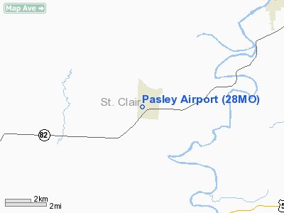
Location & QuickFacts
| FAA Information Effective: | 2008-09-25 |
| Airport Identifier: | 28MO |
| Airport Status: | Operational |
| Longitude/Latitude: | 093-49-07.7650W/37-58-26.1140N
-93.818824/37.973921 (Estimated) |
| Elevation: | 790 ft / 240.79 m (Estimated) |
| Land: | 0 acres |
| From nearest city: | 0 nautical miles SW of Roscoe, MO |
| Location: | St Clair County, MO |
| Magnetic Variation: | 04E (1985) |
Owner & Manager
| Ownership: | Privately owned |
| Owner: | M. R. Pasley |
| Address: | 4752 Belinder
Shawnee Mission, KS 66205 |
| Phone number: | 913-831-2369 |
| Manager: | M.r. Pasley |
| Address: | 4752 Belinder
Shawnee Mission, KS 66205 |
| Phone number: | 913-831-2369 |
Airport Operations and Facilities
| Airport Use: | Private |
| Wind indicator: | Yes |
| Segmented Circle: | No |
| Control Tower: | No |
| Landing fee charge: | No |
| Sectional chart: | Kansas City |
| Region: | ACE - Central |
| Boundary ARTCC: | ZKC - Kansas City |
| Tie-in FSS: | COU - Columbia |
| FSS on Airport: | No |
| FSS Toll Free: | 1-800-WX-BRIEF |
Airport Services
| Airframe Repair: | NONE |
| Power Plant Repair: | NONE |
Runway Information
Runway 10/28
| Dimension: | 3250 x 100 ft / 990.6 x 30.5 m |
| Surface: | TURF, |
| |
Runway 10 |
Runway 28 |
| Traffic Pattern: | Left | Left |
| Obstruction: | | 35 ft pline, 250.0 ft from runway |
|
Radio Navigation Aids
| ID |
Type |
Name |
Ch |
Freq |
Var |
Dist |
| EAD | NDB | Nevada | | 209.00 | 06E | 24.0 nm |
| GLY | NDB | Golden Valley | | 388.00 | 04E | 24.0 nm |
| LLU | NDB | Spring River | | 356.00 | 05E | 37.4 nm |
| HCK | NDB | Hawks | | 296.00 | 04E | 41.0 nm |
| ILJ | NDB | Willard | | 254.00 | 03E | 44.4 nm |
| FSK | NDB | Fort Scott | | 379.00 | 05E | 46.2 nm |
| SZL | TACAN | Whiteman | 035X | | 04E | 47.5 nm |
| BUM | VORTAC | Butler | 106X | 115.90 | 07E | 36.4 nm |
| SGF | VORTAC | Springfield | 116X | 116.90 | 04E | 43.7 nm |
Remarks
- PROVIDED THAT THE APCH TO EACH RWY IS MAINTAINED FOR A MINIMUM 20:1 GLIDE SLOPE AND THE TRANSITIONAL SURFACE BE MAINTAINED FOR A 7:1 SLOPE.
Images and information placed above are from
http://www.airport-data.com/airport/28MO/
We thank them for the data!
| General Info
|
| Country |
United States
|
| State |
MISSOURI
|
| FAA ID |
28MO
|
| Latitude |
37-58-26.114N
|
| Longitude |
093-49-07.765W
|
| Elevation |
790 feet
|
| Near City |
ROSCOE
|
We don't guarantee the information is fresh and accurate. The data may
be wrong or outdated.
For more up-to-date information please refer to other sources.
|
|


