 |
|
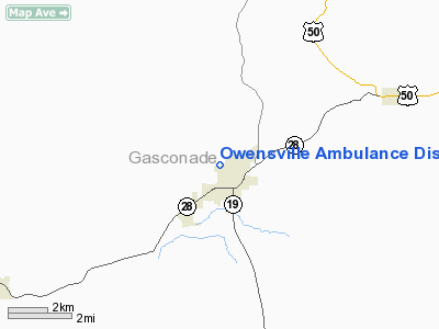
Owensville Ambulance District Heliport |
Location & QuickFacts
| FAA Information Effective: | 2008-09-25 |
| Airport Identifier: | 9MO8 |
| Airport Status: | Operational |
| Longitude/Latitude: | 091-30-08.5750W/38-21-20.1680N
-91.502382/38.355602 (Estimated) |
| Elevation: | 900 ft / 274.32 m (Estimated) |
| Land: | 0 acres |
| From nearest city: | 0 nautical miles N of Owensville, MO |
| Location: | Gasconade County, MO |
| Magnetic Variation: | 03E (1985) |
Owner & Manager
| Ownership: | Privately owned |
| Owner: | Owensville Area Ambulance Dis |
| Address: | P O Box 139
Owensville, MO 65066 |
| Phone number: | 314-437-4353 |
| Manager: | Karen Hubenthal |
| Address: | P O Box 139
Owensville, MO 65066 |
| Phone number: | 314-437-4353 |
Airport Operations and Facilities
| Airport Use: | Private
MEDICAL USE. |
| Wind indicator: | Yes |
| Segmented Circle: | No |
| Control Tower: | No |
| Lighting Schedule: | PHONE REQ
FOR PERIMETER LGTS CALL 314-437-4353. |
| Sectional chart: | Kansas City |
| Region: | ACE - Central |
| Boundary ARTCC: | ZKC - Kansas City |
| Tie-in FSS: | COU - Columbia |
| FSS Toll Free: | 1-800-WX-BRIEF |
Runway Information
Helipad H1
| Dimension: | 50 x 50 ft / 15.2 x 15.2 m |
| Surface: | CONC, |
| |
Runway H1 |
Runway |
| Traffic Pattern: | Left | Left |
|
Radio Navigation Aids
| ID |
Type |
Name |
Ch |
Freq |
Var |
Dist |
| UUV | NDB | Sullivan | | 356.00 | 02E | 17.5 nm |
| UBX | NDB | Cuba | | 380.00 | 01E | 17.8 nm |
| JE | NDB | Algoa | | 397.00 | 03E | 29.2 nm |
| FTT | NDB | Guthrie | | 317.00 | 03E | 37.6 nm |
| ONH | NDB | Noah | | 515.00 | 03E | 38.8 nm |
| BHN | NDB | Buckhorn | | 391.00 | 03E | 48.7 nm |
| TBN | VOR | Forney | | 110.00 | 03E | 47.6 nm |
| VIH | VOR/DME | Vichy | 124X | 117.70 | 06E | 15.5 nm |
| COU | VOR/DME | Columbia | 039X | 110.20 | 03E | 43.4 nm |
| FTZ | VORTAC | Foristell | 045X | 110.80 | 05E | 32.2 nm |
| MAP | VORTAC | Maples | 081X | 113.40 | 06E | 47.9 nm |
| JEF | VOT | Jefferson City | | 112.00 | | 33.5 nm |
| SUS | VOT | Spirit Of St Louis | | 112.20 | | 44.1 nm |
Remarks
- OWNER DESIRES ARPT NOT BE CHARTED.
- PRVDD POLE AND WIND INDICATOR ARE RELOCATED TO NORTHEAST; LIGHT AND MARK PLINES ALONG RR TRACKS UPON COMPLETION OF TWO PREVIOUS CONDITIONS THE INGRESS OF ACCEPTABLE AT 360-260 DEGREE APCH/DEP CLEARANCE MAINTAIN A 8:1 GLIDE SLOPE; A CLEARANCE TRANSITONAL SURFACE IS MAINTAIN FOR A 2:1 SLOPE.
Images and information placed above are from
http://www.airport-data.com/airport/9MO8/
We thank them for the data!
| General Info
|
| Country |
United States
|
| State |
MISSOURI
|
| FAA ID |
9MO8
|
| Latitude |
38-21-20.168N
|
| Longitude |
091-30-08.575W
|
| Elevation |
900 feet
|
| Near City |
OWENSVILLE
|
We don't guarantee the information is fresh and accurate. The data may
be wrong or outdated.
For more up-to-date information please refer to other sources.
|
|


