 |
|
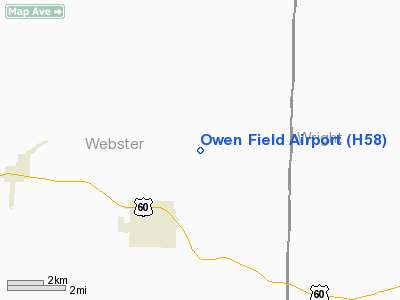
Location & QuickFacts
| FAA Information Effective: | 2008-09-25 |
| Airport Identifier: | H58 |
| Airport Status: | Operational |
| Longitude/Latitude: | 092-44-15.5136W/37-11-04.9570N
-92.737643/37.184710 (Estimated) |
| Elevation: | 1600 ft / 487.68 m (Estimated) |
| Land: | 75 acres |
| From nearest city: | 3 nautical miles NE of Seymour, MO |
| Location: | Webster County, MO |
| Magnetic Variation: | 04E (1985) |
Owner & Manager
| Ownership: | Privately owned |
| Owner: | Harold Owen |
| Address: | Box 223 1 Owen Drive
Seymour, MO 65746 |
| Phone number: | 417-935-2232 |
| Manager: | Harold Owen |
| Address: | Box 223 1 Owen Drive
Seymour, MO 65746 |
| Phone number: | 417-935-2232
ALTERNATE PHONE NBRS 417-848-0075 OR 417-935-2728. |
Airport Operations and Facilities
| Airport Use: | Open to public |
| Segmented Circle: | No |
| Control Tower: | No |
| Landing fee charge: | No |
| Sectional chart: | Kansas City |
| Region: | ACE - Central |
| Boundary ARTCC: | ZKC - Kansas City |
| Tie-in FSS: | COU - Columbia |
| FSS on Airport: | No |
| FSS Toll Free: | 1-800-WX-BRIEF |
| NOTAMs Facility: | COU (NOTAM-d service avaliable) |
Airport Communications
Airport Services
Runway Information
Runway 01/19
| Dimension: | 2800 x 45 ft / 853.4 x 13.7 m |
| Surface: | TURF, Poor Condition
FIRST 1000 FT OF RY 19 HAS A VERY STEEP SLOPE; RY SFC ROUGH; ROLLING, UNEVEN & NARROW WITH TALL OBSTNS AT RY END.
RY SFC ROUGH; ROLLING, UNEVEN & NARROW WITH TALL OBSTNS AT RY END. |
| |
Runway 01 |
Runway 19 |
| Traffic Pattern: | Left | Left |
| Obstruction: | 17 ft trees, 245.0 ft from runway, 65 ft right of centerline, 14:1 slope to clear | 51 ft trees, 150.0 ft from runway, 2:1 slope to clear |
|
Runway 15/33
| Dimension: | 1725 x 25 ft / 525.8 x 7.6 m |
| Surface: | TURF, Poor Condition
FIRST 1000 FT OF RY 19 HAS A VERY STEEP SLOPE; RY SFC ROUGH; ROLLING, UNEVEN & NARROW WITH TALL OBSTNS AT RY END.
RY SFC ROUGH; ROLLING, UNEVEN & NARROW WITH TALL OBSTNS AT RY END. |
| |
Runway 15 |
Runway 33 |
| Traffic Pattern: | Left | Left |
| Obstruction: | 52 ft trees, 100.0 ft from runway, 55 ft right of centerline, 1:1 slope to clear | 24 ft trees, 225.0 ft from runway, 70 ft left of centerline, 9:1 slope to clear |
|
Radio Navigation Aids
| ID |
Type |
Name |
Ch |
Freq |
Var |
Dist |
| AOV | NDB | Bilmart | | 341.00 | 02E | 13.2 nm |
| IEB | NDB | Lebanon | | 414.00 | 03E | 23.6 nm |
| ILJ | NDB | Willard | | 254.00 | 03E | 34.3 nm |
| PLK | NDB | Point Lookout/dcmsnd | | 204.00 | 03E | 41.0 nm |
| BHN | NDB | Buckhorn | | 391.00 | 03E | 43.2 nm |
| UNO | NDB | Pomona | | 335.00 | 02E | 44.2 nm |
| TBN | VOR | Forney | | 110.00 | 03E | 44.0 nm |
| HUW | VOR/DME | Hutton | 053X | 111.60 | 02E | 44.4 nm |
| DGD | VORTAC | Dogwood | 031X | 109.40 | 06E | 11.8 nm |
| SGF | VORTAC | Springfield | 116X | 116.90 | 04E | 30.3 nm |
Remarks
- WILDLIFE ON & INVOF ARPT.
- AFTER HEAVY RAINS CALL 417-935-2232 FOR RY CONDS.
- LINE OF SIGHT FM RY ENDS OBSTRUCTED BY CHANGESS IN RY GRADE.
- CATTLE & LIVESTOCK MAY BE ON RYS AT ANY TIME.
- NTSD RY SAFETY AREAS BEYOND EACH RY END; INCORRECT TERRAIN GRADIENTS, FENCES, TREES, BRUSH, DITCHES, CROPS & BLDGS.
- HAZARDOUS OPERATING CONDITIONS EXIST AT THIS AIRPORT. EXERCISE CAUTION WHEN USING THIS FACILITY.
- CONSTRUCTED PRIOR TO 5/15/59.
Images and information placed above are from
http://www.airport-data.com/airport/H58/
We thank them for the data!
| General Info
|
| Country |
United States
|
| State |
MISSOURI
|
| FAA ID |
H58
|
| Latitude |
37-11-00.181N
|
| Longitude |
092-44-00.613W
|
| Elevation |
1600 feet
|
| Near City |
SEYMOUR
|
We don't guarantee the information is fresh and accurate. The data may
be wrong or outdated.
For more up-to-date information please refer to other sources.
|
|


