 |
|
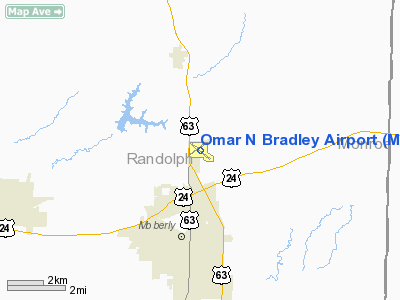
Location & QuickFacts
| FAA Information Effective: | 2008-09-25 |
| Airport Identifier: | MBY |
| Airport Status: | Operational |
| Longitude/Latitude: | 092-25-37.3610W/39-27-49.8850N
-92.427045/39.463857 (Estimated) |
| Elevation: | 867 ft / 264.26 m (Surveyed) |
| Land: | 285 acres |
| From nearest city: | 3 nautical miles N of Moberly, MO |
| Location: | Randolph County, MO |
| Magnetic Variation: | 05E (1980) |
Owner & Manager
| Ownership: | Publicly owned |
| Owner: | City Of Moberly |
| Address: | City Hall 101 W. Reed
Moberly, MO 65270 |
| Phone number: | 660-263-4420 |
| Manager: | Tom Sanders |
| Address: | City Hall 101 W. Reed
Moberly, MO 65270 |
| Phone number: | 660-269-8705 |
Airport Operations and Facilities
| Airport Use: | Open to public |
| Wind indicator: | Yes
NSTD LGTD WIND TEE ; WHITE LGTS. |
| Segmented Circle: | Yes |
| Control Tower: | No |
| Lighting Schedule: | DUSK-DAWN
MIRL RYS 05/23 AND 13/31 PRESET ON LOW INTST; TO INCR INTST AND ACTVT REIL RYS 13 & 31 - CTAF. |
| Beacon Color: | Clear-Green (lighted land airport) |
| Landing fee charge: | No |
| Sectional chart: | Kansas City |
| Region: | ACE - Central |
| Boundary ARTCC: | ZKC - Kansas City |
| Tie-in FSS: | COU - Columbia |
| FSS on Airport: | No |
| FSS Toll Free: | 1-800-WX-BRIEF |
| NOTAMs Facility: | COU (NOTAM-d service avaliable) |
| Federal Agreements: | NGY |
Airport Communications
| CTAF: | 122.700 |
| Unicom: | 122.700 |
Airport Services
| Fuel available: | 100LLA |
| Bottled Oxygen: | NONE |
| Bulk Oxygen: | NONE |
Runway Information
Runway 05/23
| Dimension: | 3350 x 60 ft / 1021.1 x 18.3 m
RWY 5/23 SHORTENED 377 FT AT RWY 5 THLD.
RWY 13/31 SHORTENED 411 FT AT RWY 13 THLD. |
| Surface: | ASPH, Fair Condition |
| Weight Limit: | Single wheel: 4000 lbs. |
| Edge Lights: | Medium |
| |
Runway 05 |
Runway 23 |
| Longitude: | 092-25-57.1000W | 092-25-22.9620W |
| Latitude: | 39-27-43.1350N | 39-28-03.0340N |
| Elevation: | 867.00 ft | 860.00 ft |
| Alignment: | 53 | 127 |
| Traffic Pattern: | Left | Left |
| Markings: | Basic, Good Condition | Basic, Fair Condition |
| Obstruction: | 30 ft pole, 900.0 ft from runway, 23:1 slope to clear | 10 ft road, 520.0 ft from runway, 160 ft left of centerline, 32:1 slope to clear |
|
Runway 13/31
| Dimension: | 4270 x 100 ft / 1301.5 x 30.5 m
RWY 5/23 SHORTENED 377 FT AT RWY 5 THLD.
RWY 13/31 SHORTENED 411 FT AT RWY 13 THLD. |
| Surface: | ASPH, Good Condition |
| Weight Limit: | Single wheel: 30000 lbs.
Dual wheel: 38000 lbs. |
| Edge Lights: | Medium |
| |
Runway 13 |
Runway 31 |
| Longitude: | 092-25-56.2040W | 092-25-14.3300W |
| Latitude: | 39-28-00.8580N | 39-27-33.8920N |
| Elevation: | 862.00 ft | 864.00 ft |
| Alignment: | 127 | 127 |
| Traffic Pattern: | Left | Left |
| Markings: | Non-precision instrument, Good Condition | Non-precision instrument, Good Condition |
| Crossing Height: | 44.00 ft | 39.00 ft |
| VASI: | 4-light PAPI on left side | 4-light PAPI on left side |
| Visual Glide Angle: | 3.00° | 3.00° |
| Runway End Identifier: | Yes | Yes |
| Obstruction: | 31 ft tree, 497.0 ft from runway, 232 ft left of centerline, 9:1 slope to clear | , 50:1 slope to clear |
|
Radio Navigation Aids
| ID |
Type |
Name |
Ch |
Freq |
Var |
Dist |
| VER | NDB | Viertel | | 347.00 | 02E | 33.2 nm |
| BZK | NDB | Brookfield | | 383.00 | 03E | 36.4 nm |
| FTT | NDB | Guthrie | | 317.00 | 03E | 42.2 nm |
| PUR | NDB | Marshall | | 371.00 | 03E | 43.9 nm |
| HAE | NDB | Hannibal | | 411.00 | 03E | 48.0 nm |
| MCM | VOR/DME | Macon | 076X | 112.90 | 06E | 11.7 nm |
| COU | VOR/DME | Columbia | 039X | 110.20 | 03E | 40.4 nm |
| HLV | VORTAC | Hallsville | 089X | 114.20 | 06E | 25.2 nm |
| IRK | VORTAC | Kirksville | 093X | 114.60 | 06E | 41.1 nm |
Remarks
- SPRAYER & ULTRALIGHT ACFT ON & INVOF ARPT.
Images and information placed above are from
http://www.airport-data.com/airport/MBY/
We thank them for the data!
| General Info
|
| Country |
United States
|
| State |
MISSOURI
|
| FAA ID |
MBY
|
| Latitude |
39-27-50.133N
|
| Longitude |
092-25-39.352W
|
| Elevation |
867 feet
|
| Near City |
MOBERLY
|
We don't guarantee the information is fresh and accurate. The data may
be wrong or outdated.
For more up-to-date information please refer to other sources.
|
|


