 |
|
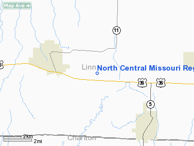
North Central Missouri Regional Airport |
|
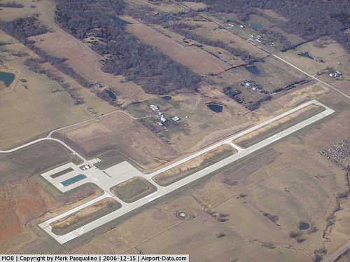 |
(Click on the photo to enlarge) |
Location & QuickFacts
| FAA Information Effective: | 2008-09-25 |
| Airport Identifier: | MO8 |
| Airport Status: | Operational |
| Longitude/Latitude: | 093-00-45.8700W/39-46-12.0500N
-93.012742/39.770014 (Estimated) |
| Elevation: | 843 ft / 256.95 m (Estimated) |
| Land: | 158 acres |
| From nearest city: | 2 nautical miles E of Brookfield, MO |
| Location: | Linn County, MO |
| Magnetic Variation: | 02E (2000) |
Owner & Manager
| Ownership: | Publicly owned |
| Owner: | Cities Of Brookfield & Marceline |
| Address: | 116 West Brooks
Brookfield, MO 64628 |
| Phone number: | 660-258-3377 |
| Manager: | Ted & Randy Stockwell |
| Address: | 28540 Jet Way Drive, Po Box 283
Brookfield, MO 64628 |
| Phone number: | 660-258-7317
ALTERNATE PHONE NBRS 660-258-5700, 660-734-2505; 660-258-3969; 660-375-3616. |
Airport Operations and Facilities
| Airport Use: | Open to public |
| Wind indicator: | Yes |
| Segmented Circle: | Yes |
| Control Tower: | No |
| Lighting Schedule: | DUSK-DAWN
ACTVT MIRL RY 18/36; PAPI RYS 18 & 36; REIL RYS 18 & 36 - CTAF. |
| Beacon Color: | Clear-Green (lighted land airport) |
| Region: | ACE - Central |
| Boundary ARTCC: | ZKC - Kansas City |
| Tie-in FSS: | COU - Columbia |
| FSS Toll Free: | 1-800-WX-BRIEF |
| NOTAMs Facility: | COU (NOTAM-d service avaliable) |
Airport Communications
Airport Services
| Fuel available: | 100LLA
SELF-SERVICE FUEL AVAILABLE 24 HRS. |
Runway Information
Runway 18/36
| Dimension: | 4000 x 75 ft / 1219.2 x 22.9 m |
| Surface: | CONC, Good Condition |
| Weight Limit: | Single wheel: 12500 lbs. |
| Edge Lights: | Medium |
| |
Runway 18 |
Runway 36 |
| Longitude: | 093-00-45.2800W | 093-00-46.4600W |
| Latitude: | 39-46-31.8100N | 39-45-52.2900N |
| Elevation: | 843.00 ft | 826.00 ft |
| Alignment: | 127 | 2 |
| Traffic Pattern: | Left | Left |
| Markings: | Non-precision instrument, Good Condition | Non-precision instrument, Good Condition |
| Crossing Height: | 47.00 ft | 37.00 ft |
| VASI: | 4-light PAPI on left side | 4-light PAPI on left side |
| Visual Glide Angle: | 3.50° | 3.00° |
| Runway End Identifier: | Yes | Yes |
| Obstruction: | 50 ft tree, 1500.0 ft from runway, 26:1 slope to clear | 21 ft trees, 618.0 ft from runway, 195 ft right of centerline, 19:1 slope to clear |
|
Radio Navigation Aids
| ID |
Type |
Name |
Ch |
Freq |
Var |
Dist |
| BZK | NDB | Brookfield | | 383.00 | 03E | 4.5 nm |
| CHT | NDB | Chillicothe | | 375.00 | 03E | 22.2 nm |
| TRX | NDB | Trenton | | 400.00 | 03E | 32.6 nm |
| PUR | NDB | Marshall | | 371.00 | 03E | 44.6 nm |
| MCM | VOR/DME | Macon | 076X | 112.90 | 06E | 25.5 nm |
| BQS | VOR/DME | Braymer | 049X | 111.20 | 03E | 40.8 nm |
| IRK | VORTAC | Kirksville | 093X | 114.60 | 06E | 29.3 nm |
Remarks
- TOWER 319 FT AGL, 3500 FT NORTH, 1925 FT EAST OF RY 18 END.
- FOR SERVICE AFTER HRS, CALL PHONE NUMBERS POSTED ON AIRPORT MGMT OFFICE DOOR.
- NUMEROUS WATERFOWL & DEER ON & INVOF ARPT.
Images and information placed above are from
http://www.airport-data.com/airport/MO8/
We thank them for the data!
| General Info
|
| Country |
United States
|
| State |
MISSOURI
|
| FAA ID |
MO8
|
| Latitude |
39-46-13.360N
|
| Longitude |
093-00-57.740W
|
| Elevation |
837 feet
|
| Near City |
BROOKFIELD
|
We don't guarantee the information is fresh and accurate. The data may
be wrong or outdated.
For more up-to-date information please refer to other sources.
|
|


