 |
|
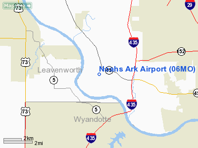
Location & QuickFacts
| FAA Information Effective: | 2008-09-25 |
| Airport Identifier: | 06MO |
| Airport Status: | Operational |
| Longitude/Latitude: | 094-48-15.8610W/39-13-50.0070N
-94.804406/39.230558 (Estimated) |
| Elevation: | 755 ft / 230.12 m (Estimated) |
| Land: | 160 acres |
| From nearest city: | 1 nautical miles NW of Waldron, MO |
| Location: | Platte County, MO |
| Magnetic Variation: | 05E (1985) |
Owner & Manager
| Ownership: | Privately owned |
| Owner: | W N Dunagan |
| Address: | Box 11
Waldron, MO 64092 |
| Phone number: | 816-891-0623 |
| Manager: | W N Dunagan |
| Address: | Box 11
Waldron, MO 64092 |
| Phone number: | 816-891-0623 |
Airport Operations and Facilities
| Airport Use: | Private |
| Wind indicator: | Yes |
| Segmented Circle: | No |
| Control Tower: | No |
| Lighting Schedule: | PHONE REQ
FOR RWY LGTS CALL 891-0623. |
| Sectional chart: | Kansas City |
| Region: | ACE - Central |
| Boundary ARTCC: | ZKC - Kansas City |
| Tie-in FSS: | COU - Columbia |
| FSS on Airport: | No |
| FSS Toll Free: | 1-800-WX-BRIEF |
Airport Services
| Fuel available: | 100LL |
| Airframe Repair: | MINOR |
| Power Plant Repair: | MINOR |
Runway Information
Runway 15/33
| Dimension: | 3000 x 30 ft / 914.4 x 9.1 m |
| Surface: | ASPH, |
| Edge Lights: | Low |
| |
Runway 15 |
Runway 33 |
| Traffic Pattern: | Right | Left |
|
Radio Navigation Aids
| ID |
Type |
Name |
Ch |
Freq |
Var |
Dist |
| DO | NDB | Dotte | | 359.00 | 05E | 2.6 nm |
| GQ | NDB | Norge | | 517.00 | 05E | 12.3 nm |
| GKB | NDB | Norge | | 517.00 | 05E | 12.3 nm |
| GPH | NDB | Mosby | | 284.00 | 03E | 24.1 nm |
| LXT | NDB | Lesumit | | 263.00 | 04E | 25.9 nm |
| EZZ | NDB | Cameron | | 394.00 | 03E | 38.8 nm |
| AZN | NDB | Amazon | | 233.00 | 06E | 39.6 nm |
| TO | NDB | Biloy | | 521.00 | 05E | 41.7 nm |
| FOE | TACAN | Forbes | 053X | | 05E | 43.4 nm |
| RIS | VOR/DME | Riverside | 051X | 111.40 | 05E | 11.7 nm |
| OJC | VOR/DME | Johnson County | 077X | 113.00 | 06E | 23.6 nm |
| RBA | VOR/DME | Robinson | 019X | 108.20 | 04E | 47.0 nm |
| BQS | VOR/DME | Braymer | 049X | 111.20 | 03E | 49.4 nm |
| MCI | VORTAC | Kansas City | 079Y | 113.25 | 05E | 4.5 nm |
| ANX | VORTAC | Napoleon | 087X | 114.00 | 07E | 32.5 nm |
| TOP | VORTAC | Topeka | 125X | 117.80 | 05E | 35.1 nm |
| STJ | VORTAC | St Joseph | 102X | 115.50 | 08E | 44.2 nm |
| MKC | VOT | Kansas City Downtown | | 108.60 | | 11.6 nm |
| FOE | VOT | Forbes | | 111.00 | | 43.6 nm |
Remarks
Images and information placed above are from
http://www.airport-data.com/airport/06MO/
We thank them for the data!
| General Info
|
| Country |
United States
|
| State |
MISSOURI
|
| FAA ID |
06MO
|
| Latitude |
39-13-50.007N
|
| Longitude |
094-48-15.861W
|
| Elevation |
755 feet
|
| Near City |
WALDRON
|
We don't guarantee the information is fresh and accurate. The data may
be wrong or outdated.
For more up-to-date information please refer to other sources.
|
|


