 |
|
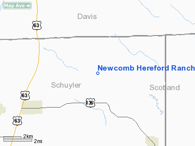
Newcomb Hereford Ranch Airport |
Location & QuickFacts
| FAA Information Effective: | 2008-09-25 |
| Airport Identifier: | 4MO2 |
| Airport Status: | Operational |
| Longitude/Latitude: | 092-26-30.6710W/40-33-30.1040N
-92.441853/40.558362 (Estimated) |
| Elevation: | 850 ft / 259.08 m (Estimated) |
| Land: | 0 acres |
| From nearest city: | 4 nautical miles NE of Lancaster, MO |
| Location: | Schuyler County, MO |
| Magnetic Variation: | 03E (1985) |
Owner & Manager
| Ownership: | Privately owned |
| Owner: | Donald L. Newcomb |
| Address: | Rt 1, Box 131
Lancaster, MO 63548 |
| Phone number: | 816-457-3620 |
| Manager: | Donald L. Newcomb |
| Address: | Rt 1, Box 131
Lancaster, MO 63548 |
| Phone number: | 816-457-3620 |
Airport Operations and Facilities
| Airport Use: | Private |
| Wind indicator: | Yes |
| Segmented Circle: | No |
| Control Tower: | No |
| Landing fee charge: | No |
| Sectional chart: | Chicago |
| Region: | ACE - Central |
| Boundary ARTCC: | ZKC - Kansas City |
| Tie-in FSS: | COU - Columbia |
| FSS on Airport: | No |
| FSS Toll Free: | 1-800-WX-BRIEF |
Airport Services
| Airframe Repair: | NONE |
| Power Plant Repair: | NONE |
Runway Information
Runway 15/33
| Dimension: | 2000 x 60 ft / 609.6 x 18.3 m |
| Surface: | TURF, |
| |
Runway 15 |
Runway 33 |
| Traffic Pattern: | Left | Left |
|
Radio Navigation Aids
| ID |
Type |
Name |
Ch |
Freq |
Var |
Dist |
| BEX | NDB | Bloomfield | | 269.00 | 02E | 11.2 nm |
| TVK | NDB | Centerville | | 290.00 | 04E | 22.3 nm |
| FFL | NDB | Fairfield | | 332.00 | 03E | 34.2 nm |
| OOA | NDB | Oskaloosa | | 414.00 | 03E | 40.2 nm |
| EOK | NDB | Keokuk | | 366.00 | 02E | 46.4 nm |
| MPZ | NDB | Mount Pleasant | | 212.00 | 02E | 48.3 nm |
| OTM | VOR/DME | Ottumwa | 053X | 111.60 | 06E | 28.8 nm |
| IRK | VORTAC | Kirksville | 093X | 114.60 | 06E | 26.4 nm |
Images and information placed above are from
http://www.airport-data.com/airport/4MO2/
We thank them for the data!
| General Info
|
| Country |
United States
|
| State |
MISSOURI
|
| FAA ID |
4MO2
|
| Latitude |
40-33-30.104N
|
| Longitude |
092-26-30.671W
|
| Elevation |
850 feet
|
| Near City |
LANCASTER
|
We don't guarantee the information is fresh and accurate. The data may
be wrong or outdated.
For more up-to-date information please refer to other sources.
|
|


