|
|
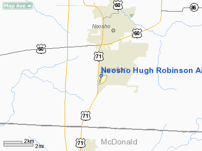
Neosho Hugh Robinson Airport |
| Neosho Hugh Robinson Airport |
| IATA: EOS – ICAO: KEOS – FAA LID: EOS |
| Summary |
| Airport type |
Public |
| Owner |
City of Neosho |
| Serves |
Neosho, Missouri |
| Elevation AMSL |
1,255 ft / 383 m |
| Coordinates |
36°48′39″N 094°23′30″W / 36.81083°N 94.39167°W / 36.81083; -94.39167 |
| Runways |
| Direction |
Length |
Surface |
| ft |
m |
| 1/19 |
5,001 |
1,524 |
Asphalt |
| Statistics (2008) |
| Aircraft operations |
3,110 |
| Based aircraft |
43 |
| Source: Federal Aviation Administration |
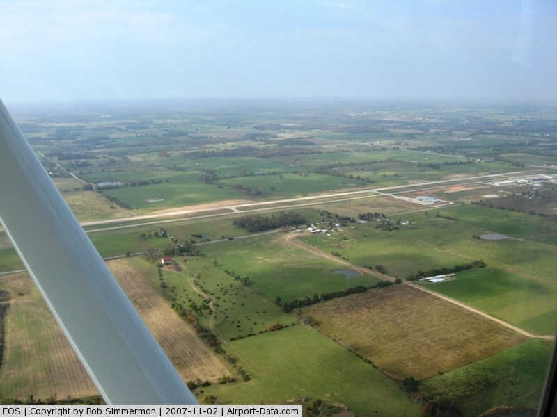
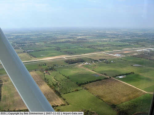
Neosho Hugh Robinson Airport (IATA: EOS, ICAO: KEOS, FAA LID: EOS) is a city-owned public-use airport located three nautical miles (6 km) south of the central business district of Neosho, a city in Newton County, Missouri, United States.
Facilities and aircraft
Neosho Hugh Robinson Airport covers an area of 687 acres (278 ha) at an elevation of 1,255 feet (383 m) above mean sea level. It has one asphalt paved runway designated 1/19 which measures 5,001 by 100 feet (1,524 x 30 m).
For the 12-month period ending February 27, 2008, the airport had 3,110 aircraft operations, an average of 259 per month: 93% general aviation, 6% air taxi and 1% military. At that time there were 43 aircraft based at this airport: 79% single-engine, 9% multi-engine and 12% helicopter.
The above content comes from Wikipedia and is published under free licenses – click here to read more.
|
 |
(Click on the photo to enlarge) |
Location & QuickFacts
| FAA Information Effective: | 2008-09-25 |
| Airport Identifier: | EOS |
| Airport Status: | Operational |
| Longitude/Latitude: | 094-23-30.1000W/36-48-38.9000N
-94.391694/36.810806 (Estimated) |
| Elevation: | 1255 ft / 382.52 m (Surveyed) |
| Land: | 687 acres |
| From nearest city: | 3 nautical miles S of Neosho, MO |
| Location: | Newton County, MO |
| Magnetic Variation: | 07E (1970) |
Owner & Manager
| Ownership: | Publicly owned |
| Owner: | City Of Neosho |
| Address: | 203 E Main St
Neosho, MO 64850 |
| Phone number: | 417-451-8050 |
| Manager: | Billy Sallee |
| Address: | 1400 Terry Johnson Dr.
Neosho, MO 64850 |
| Phone number: | 417-451-8098 |
Airport Operations and Facilities
| Airport Use: | Open to public |
| Wind indicator: | Yes |
| Segmented Circle: | Yes |
| Control Tower: | No |
| Lighting Schedule: | DUSK-DAWN
ACTVT MIRL RY 01/19 & REIL RYS 01 & 19 - CTAF. PAPI RYS 01 & 19 OPERATE 24 HRS. |
| Beacon Color: | Clear-Green (lighted land airport) |
| Landing fee charge: | No |
| Sectional chart: | Kansas City |
| Region: | ACE - Central |
| Boundary ARTCC: | ZKC - Kansas City |
| Tie-in FSS: | COU - Columbia |
| FSS on Airport: | No |
| FSS Toll Free: | 1-800-WX-BRIEF |
| NOTAMs Facility: | COU (NOTAM-d service avaliable) |
| Federal Agreements: | NGPY |
Airport Communications
| CTAF: | 122.800 |
| Unicom: | 122.800 |
Airport Services
| Fuel available: | 100LLA1+
24 HR SELF SERVICE 100LL FUEL PUMP. |
| Airframe Repair: | MINOR |
| Power Plant Repair: | MAJOR |
| Bulk Oxygen: | NONE |
Runway Information
Runway 01/19
| Dimension: | 5001 x 100 ft / 1524.3 x 30.5 m |
| Surface: | ASPH, Good Condition |
| Surface Treatment: | Aggregate Friction Seal Coat |
| Weight Limit: | Single wheel: 30000 lbs.
Dual wheel: 43000 lbs. |
| Edge Lights: | Medium |
| |
Runway 01 |
Runway 19 |
| Longitude: | 094-23-36.5397W | 094-23-23.7334W |
| Latitude: | 36-48-14.6885N | 36-49-03.0518N |
| Elevation: | 1255.00 ft | 1219.00 ft |
| Alignment: | 12 | 127 |
| Traffic Pattern: | Left | Left |
| Markings: | Non-precision instrument, Good Condition | Non-precision instrument, Good Condition |
| Crossing Height: | 31.00 ft | 40.00 ft |
| VASI: | 4-light PAPI on left side | 4-light PAPI on left side |
| Visual Glide Angle: | 3.00° | 3.00° |
| Runway End Identifier: | Yes | Yes |
| Obstruction: | , 50:1 slope to clear | 55 ft trees, 1435.0 ft from runway, 280 ft left of centerline, 22:1 slope to clear |
|
Radio Navigation Aids
| ID |
Type |
Name |
Ch |
Freq |
Var |
Dist |
| SLG | NDB | Siloam Springs | | 284.00 | 04E | 37.7 nm |
| LLU | NDB | Spring River | | 356.00 | 05E | 40.8 nm |
| PTS | NDB | Pittsburg | | 365.00 | 05E | 41.2 nm |
| EOS | VOR/DME | Neosho | 120X | 117.30 | 07E | 2.8 nm |
| DAK | VOR/DME | Drake | 025X | 108.80 | 07E | 47.1 nm |
| RZC | VORTAC | Razorback | 111X | 116.40 | 04E | 36.3 nm |
| OSW | VORTAC | Oswego | 123X | 117.60 | 08E | 44.2 nm |
Remarks
- WILDLIFE ON & INVOF ARPT.
- GND HAZ CAMP CROWDER FIRING RANGE ACTV - STAY ABV PAT ALT TIL BASE LEG WKDAYS & WKENDS INDEFLY.
- RY 01/19 LINE OF SIGHT OBSTRUCTED BY GRADE CHANGE ON NORTH END.
Images and information placed above are from
http://www.airport-data.com/airport/EOS/
We thank them for the data!
| General Info
|
| Country |
United States
|
| State |
MISSOURI
|
| FAA ID |
EOS
|
| Latitude |
36-48-38.900N
|
| Longitude |
094-23-30.100W
|
| Elevation |
1255 feet
|
| Near City |
NEOSHO
|
We don't guarantee the information is fresh and accurate. The data may
be wrong or outdated.
For more up-to-date information please refer to other sources.
|
|