 |
|
| Municipal Airport |
| IATA: none – ICAO: none – FAA LID: K43 |
| Summary |
| Airport type |
Public |
| Owner |
City of Unionville |
| Serves |
Unionville, Missouri |
| Elevation AMSL |
1,046 ft / 319 m |
| Coordinates |
40°32′25″N 093°01′32″W / 40.54028°N 93.02556°W / 40.54028; -93.02556 |
| Runways |
| Direction |
Length |
Surface |
| ft |
m |
| 17/35 |
2,805 |
855 |
Asphalt |
| Statistics (2006) |
| Aircraft operations |
1,800 |
| Source: Federal Aviation Administration |
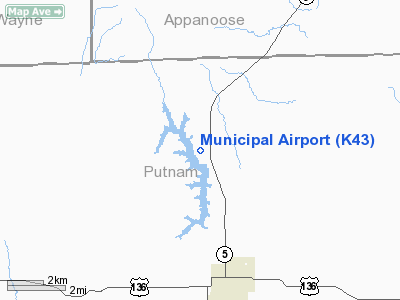
Municipal Airport (FAA LID: K43) is a city-owned, public-use airport located three miles (5 km) north of the central business district of Unionville, a city in Putnam County, Missouri, United States. It is also known as Unionville Airport.
Facilities and aircraft
Municipal Airport covers an area of 62 acres (25 ha) and has one runway designated 17/35 with a 2,805 x 49 ft (855 x 15 m) asphalt surface. For the 12-month period ending October 31, 2006, the airport had 1,800 general aviation aircraft operations, an average of 150 per month.
The above content comes from Wikipedia and is published under free licenses – click here to read more.
Location & QuickFacts
| FAA Information Effective: | 2008-09-25 |
| Airport Identifier: | K43 |
| Airport Status: | Operational |
| Longitude/Latitude: | 093-01-31.9000W/40-32-24.8000N
-93.025528/40.540222 (Estimated) |
| Elevation: | 1046 ft / 318.82 m (Estimated) |
| Land: | 62 acres |
| From nearest city: | 3 nautical miles N of Unionville, MO |
| Location: | Putnam County, MO |
| Magnetic Variation: | 04E (1985) |
Owner & Manager
| Ownership: | Publicly owned |
| Owner: | City Of Unionville |
| Address: | 1611 Grant Po Box 255
Unionville, MO 63565 |
| Phone number: | 660-947-2437 |
| Manager: | Sharon Steele
CITY CLERK |
| Address: | 1611 Grant Po Box 255
Unionville, MO 63565 |
| Phone number: | 660-947-2437 |
Airport Operations and Facilities
| Airport Use: | Open to public |
| Wind indicator: | Yes |
| Segmented Circle: | Yes |
| Control Tower: | No |
| Lighting Schedule: | DUSK-2300
ACTVT LIRL RY 17/35 & ROTG BCN - CTAF; 3 CLICKS ON & 2 CLICKS OFF. |
| Beacon Color: | Clear-Green (lighted land airport) |
| Landing fee charge: | No |
| Sectional chart: | Omaha |
| Region: | ACE - Central |
| Boundary ARTCC: | ZKC - Kansas City |
| Tie-in FSS: | COU - Columbia |
| FSS on Airport: | No |
| FSS Toll Free: | 1-800-WX-BRIEF |
| NOTAMs Facility: | COU (NOTAM-d service avaliable) |
| Federal Agreements: | Y1 |
Airport Communications
Airport Services
| Airframe Repair: | NONE |
| Power Plant Repair: | NONE |
| Bottled Oxygen: | NONE |
| Bulk Oxygen: | NONE |
Runway Information
Runway 17/35
| Dimension: | 2805 x 49 ft / 855.0 x 14.9 m
WIDTH VARIANCE 49-50 FT. |
| Surface: | ASPH, Good Condition |
| Surface Treatment: | Aggregate Friction Seal Coat |
| Edge Lights: | Low |
| |
Runway 17 |
Runway 35 |
| Longitude: | 093-01-34.0800W | 093-01-29.6500W |
| Latitude: | 40-32-38.5100N | 40-32-10.9900N |
| Traffic Pattern: | Left | Right |
| Markings: | Basic, Fair Condition | Basic, Fair Condition |
| Obstruction: | 4 ft gnd, 200.0 ft from runway
+1-2 FT & GND; 0-200 FT FM RY END L&R. | 15 ft trees, 600.0 ft from runway, 26:1 slope to clear
RWY 35 +1-15 FT & BRUSH; 140 FT FM RY END, 100 FT R. |
|
Radio Navigation Aids
| ID |
Type |
Name |
Ch |
Freq |
Var |
Dist |
| TVK | NDB | Centerville | | 290.00 | 04E | 10.5 nm |
| BEX | NDB | Bloomfield | | 269.00 | 02E | 29.8 nm |
| CNC | NDB | Chariton | | 335.00 | 05E | 32.5 nm |
| TRX | NDB | Trenton | | 400.00 | 03E | 38.0 nm |
| OXV | NDB | Knoxville | | 284.00 | 03E | 45.6 nm |
| BZK | NDB | Brookfield | | 383.00 | 03E | 46.8 nm |
| OOA | NDB | Oskaloosa | | 414.00 | 03E | 47.9 nm |
| OTM | VOR/DME | Ottumwa | 053X | 111.60 | 06E | 43.3 nm |
| IRK | VORTAC | Kirksville | 093X | 114.60 | 06E | 31.4 nm |
| LMN | VORTAC | Lamoni | 114X | 116.70 | 07E | 43.1 nm |
Images and information placed above are from
http://www.airport-data.com/airport/K43/
We thank them for the data!
| General Info
|
| Country |
United States
|
| State |
MISSOURI
|
| FAA ID |
K43
|
| Latitude |
40-32-24.753N
|
| Longitude |
093-01-31.864W
|
| Elevation |
1046 feet
|
| Near City |
UNIONVILLE
|
We don't guarantee the information is fresh and accurate. The data may
be wrong or outdated.
For more up-to-date information please refer to other sources.
|
|


