 |
|
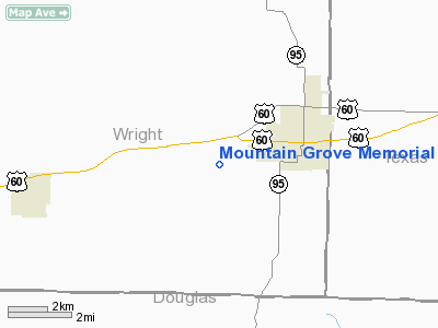
Mountain Grove Memorial Airport |
Location & QuickFacts
| FAA Information Effective: | 2008-09-25 |
| Airport Identifier: | 1MO |
| Airport Status: | Operational |
| Longitude/Latitude: | 092-18-40.4820W/37-07-14.5880N
-92.311245/37.120719 (Estimated) |
| Elevation: | 1476 ft / 449.88 m (Surveyed) |
| Land: | 99 acres |
| From nearest city: | 3 nautical miles SW of Mountain Grove, MO |
| Location: | Wright County, MO |
| Magnetic Variation: | 04E (1985) |
Owner & Manager
| Ownership: | Publicly owned |
| Owner: | City Of Mountain Grove |
| Address: | 100 E. State
Mountain Grove, MO 65711 |
| Phone number: | 417-926-4162 |
| Manager: | Lloyd Darter |
| Address: | 8699 Canary Lane
Mountain Grove, MO 65711 |
| Phone number: | 417-926-4246 |
Airport Operations and Facilities
| Airport Use: | Open to public |
| Wind indicator: | Yes |
| Segmented Circle: | Yes |
| Control Tower: | No |
| Lighting Schedule: | DUSK-DAWN |
| Beacon Color: | Clear-Green (lighted land airport)
ROTG BCN ON WATER TOWER EAST OF ARPT. |
| Landing fee charge: | No |
| Sectional chart: | Kansas City |
| Region: | ACE - Central |
| Boundary ARTCC: | ZKC - Kansas City |
| Tie-in FSS: | COU - Columbia |
| FSS on Airport: | No |
| FSS Toll Free: | 1-800-WX-BRIEF |
| NOTAMs Facility: | COU (NOTAM-d service avaliable) |
| Federal Agreements: | N |
Airport Communications
Airport Services
| Fuel available: | 100LLA1+ MOGAS |
| Airframe Repair: | MINOR |
| Power Plant Repair: | MAJOR |
Runway Information
Runway 08/26
| Dimension: | 3590 x 50 ft / 1094.2 x 15.2 m |
| Surface: | ASPH, Poor Condition
NUMEROUS CRACKS WITH GRASS & WEEDS GROWING IN THEM. |
| Surface Treatment: | Rubberized Friction Seal Coat |
| Edge Lights: | Non-standard lighting system
RWY 08/26 NSTD LIRL; 6 THLD LGTS AT RY 26 THLD. RWY LIGHTING SYSTEM IN POOR CONDITION. |
| |
Runway 08 |
Runway 26 |
| Longitude: | 092-19-02.3560W | 092-18-18.5620W |
| Latitude: | 37-07-11.9000N | 37-07-17.3250N |
| Elevation: | 1458.00 ft | 1476.00 ft |
| Alignment: | 81 | 127 |
| Traffic Pattern: | Left | Left |
| Markings: | Non-precision instrument, Poor Condition
RWY 08 MARKINGS FADED. | Non-precision instrument, Poor Condition
RWY 26 MARKINGS FADED. |
| Obstruction: | 32 ft trees, 234.0 ft from runway, 85 ft right of centerline, 1:1 slope to clear
RWY 08 1-40 FT BRUSH, TREES & GND 0-200 FT FM THLD, L & R. | 8 ft trees, 243.0 ft from runway, 5:1 slope to clear
RWY 26 1-17 FT BRUSH; TREES & GND 0-200 FT FM RY END L & R. |
|
Radio Navigation Aids
| ID |
Type |
Name |
Ch |
Freq |
Var |
Dist |
| AOV | NDB | Bilmart | | 341.00 | 02E | 19.8 nm |
| UNO | NDB | Pomona | | 335.00 | 02E | 24.5 nm |
| MNF | NDB | Mountain View | | 365.00 | 03E | 29.7 nm |
| IEB | NDB | Lebanon | | 414.00 | 03E | 31.8 nm |
| BHN | NDB | Buckhorn | | 391.00 | 03E | 36.1 nm |
| TBN | VOR | Forney | | 110.00 | 03E | 38.3 nm |
| HUW | VOR/DME | Hutton | 053X | 111.60 | 02E | 24.8 nm |
| FLP | VOR/DME | Flippin | 075X | 112.80 | 03E | 49.9 nm |
| DGD | VORTAC | Dogwood | 031X | 109.40 | 06E | 27.8 nm |
| MAP | VORTAC | Maples | 081X | 113.40 | 06E | 37.7 nm |
Remarks
- CROP DUSTING ACFT ON & INVOF ARPT.
- NTSD RWY SAFETY AREAS AROUND ENTIRE RWY; INCORRECT GRADES, INSUF LENGTH BYND RWY ENDS AND SIDES OF RWY, NUMEROUS TREES & OBSTRUCTIONS NEAR PAVEMENT EDGES. EXERCISE CAUTION WHEN USING THIS FACILITY.
- NUMEROUS PART 77 OBSTRUCTIONS IN PRIMARY, APPROACH, & TRANSTIONAL SURFACES AROUND ENTIRE RWY.
Images and information placed above are from
http://www.airport-data.com/airport/1MO/
We thank them for the data!
| General Info
|
| Country |
United States
|
| State |
MISSOURI
|
| FAA ID |
1MO
|
| Latitude |
37-07-14.588N
|
| Longitude |
092-18-40.482W
|
| Elevation |
1476 feet
|
| Near City |
MOUNTAIN GROVE
|
We don't guarantee the information is fresh and accurate. The data may
be wrong or outdated.
For more up-to-date information please refer to other sources.
|
|


