|
|
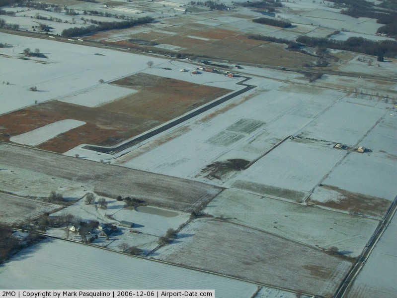
Mount Vernon Municipal Airport |
|
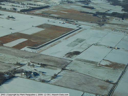 |
(Click on the photo to enlarge) |
Location & QuickFacts
| FAA Information Effective: | 2008-09-25 |
| Airport Identifier: | 2MO |
| Airport Status: | Operational |
| Longitude/Latitude: | 093-53-05.7490W/37-04-06.2050N
-93.884930/37.068390 (Estimated) |
| Elevation: | 1244 ft / 379.17 m (Estimated) |
| Land: | 51 acres |
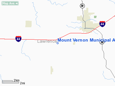
| From nearest city: | 3 nautical miles SW of Mount Vernon, MO |
| Location: | Lawrence County, MO |
| Magnetic Variation: | 05E (1985) |
Owner & Manager
| Ownership: | Publicly owned |
| Owner: | University Of Missouri
SUBLEASED TO THE CITY OF MOUNT VERNON. |
| Address: | Route 3
Mount Vernon, MO 65712 |
| Phone number: | 417-466-2212 |
| Manager: | Gene Stanton
CITY PUBLIC WORKS DIRECTOR. |
| Address: | 319 E. Dallas, P.o. Box 70
Mount Vernon, MO 65712 |
| Phone number: | 417-466-2168 |
Airport Operations and Facilities
| Airport Use: | Open to public |
| Wind indicator: | Yes |
| Segmented Circle: | No |
| Control Tower: | No |
| Lighting Schedule: | RDO-CTL
ACTVT MIRL RY 18/36 - CTAF. |
| Landing fee charge: | No |
| Sectional chart: | Kansas City |
| Region: | ACE - Central |
| Boundary ARTCC: | ZKC - Kansas City |
| Tie-in FSS: | COU - Columbia |
| FSS on Airport: | No |
| FSS Toll Free: | 1-800-WX-BRIEF |
| NOTAMs Facility: | COU (NOTAM-d service avaliable) |
Airport Communications
Airport Services
| Airframe Repair: | NONE |
| Power Plant Repair: | NONE |
| Bottled Oxygen: | NONE |
| Bulk Oxygen: | NONE |
Runway Information
Runway 18/36
| Dimension: | 3195 x 60 ft / 973.8 x 18.3 m |
| Surface: | ASPH, Good Condition |
| Edge Lights: | Medium |
| |
Runway 18 |
Runway 36 |
| Longitude: | 093-53-02.6900W | 093-53-03.4798W |
| Latitude: | 37-04-19.5900N | 37-03-47.9560N |
| Elevation: | 1226.00 ft | 1246.00 ft |
| Alignment: | 127 | 1 |
| Traffic Pattern: | Left | Left |
| Markings: | Basic, Good Condition | Basic, Good Condition |
| Obstruction: | 13 ft road, 550.0 ft from runway, 26:1 slope to clear | 25 ft brush, 200.0 ft from runway
RWY 36 1-25 FT FENCE & BRUSH 195-200 FT FROM RY END L & R. |
|
Radio Navigation Aids
| ID |
Type |
Name |
Ch |
Freq |
Var |
Dist |
| ILJ | NDB | Willard | | 254.00 | 03E | 25.4 nm |
| LLU | NDB | Spring River | | 356.00 | 05E | 32.4 nm |
| PLK | NDB | Point Lookout/dcmsnd | | 204.00 | 03E | 41.2 nm |
| PTS | NDB | Pittsburg | | 365.00 | 05E | 46.1 nm |
| EOS | VOR/DME | Neosho | 120X | 117.30 | 07E | 29.7 nm |
| SGF | VORTAC | Springfield | 116X | 116.90 | 04E | 31.5 nm |
| DGD | VORTAC | Dogwood | 031X | 109.40 | 06E | 48.4 nm |
Remarks
- PAJA ON & INVOF ARPT.
- INSUF RWY SAFETY AREA LENGTH BYND RWY 36 END.
Images and information placed above are from
http://www.airport-data.com/airport/2MO/
We thank them for the data!
| General Info
| |
| Country |
United States
|
| State |
MISSOURI
|
| FAA ID |
2MO
|
| Latitude |
37-04-06.205N
|
| Longitude |
093-53-05.749W
|
| Elevation |
1244 feet
|
| Near City |
MOUNT VERNON
|
We don't guarantee the information is fresh and accurate. The data may
be wrong or outdated.
For more up-to-date information please refer to other sources.
|
|