|
|
|
 |
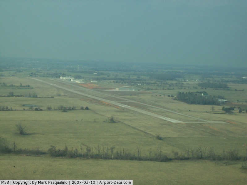
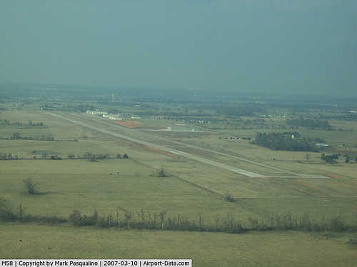
(Click on the photo to enlarge) |
|
 |
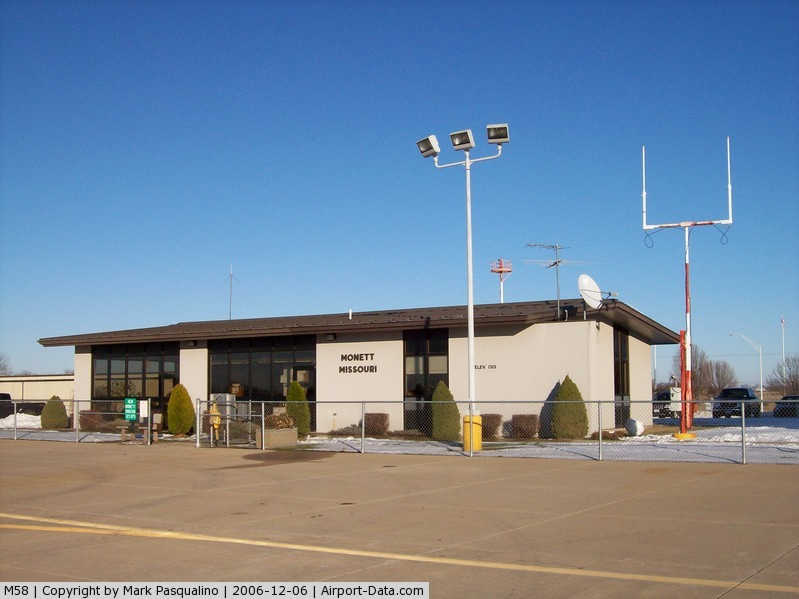
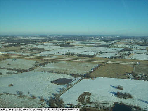
(Click on the photo to enlarge) |
|
 |
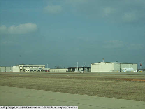
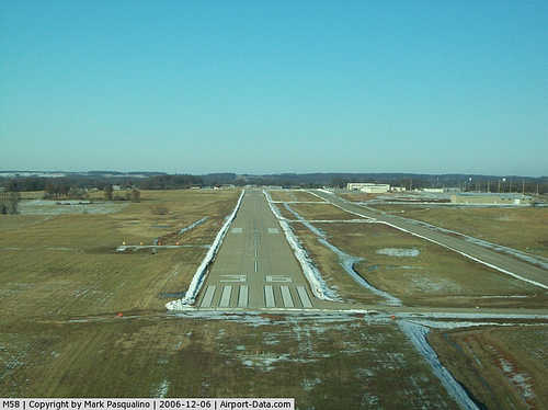
(Click on the photo to enlarge) |
|
 |
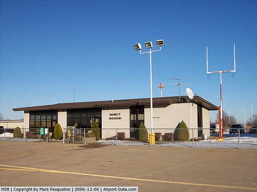
(Click on the photo to enlarge) |
|
 |
(Click on the photo to enlarge) |
Location & QuickFacts
| FAA Information Effective: | 2008-09-25 |
| Airport Identifier: | M58 |
| Airport Status: | Operational |
| Longitude/Latitude: | 094-00-45.9300W/36-54-22.3750N
-94.012758/36.906215 (Estimated) |
| Elevation: | 1314 ft / 400.51 m (Surveyed) |
| Land: | 168 acres |
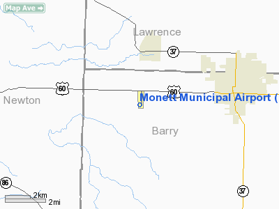
| From nearest city: | 5 nautical miles W of Monett, MO |
| Location: | Barry County, MO |
| Magnetic Variation: | 03E (2000) |
Owner & Manager
| Ownership: | Publicly owned |
| Owner: | City Of Monett |
| Address: | 217 5th - Po Box 110
Monett, MO 65708 |
| Phone number: | 417-235-3763 |
| Manager: | Howard Frazier
ARPT SUPERINTENDENT. |
| Address: | Jct 60 & 97
Pierce City, MO 65723 |
| Phone number: | 417-476-5112 |
Airport Operations and Facilities
| Airport Use: | Open to public |
| Wind indicator: | Yes |
| Segmented Circle: | No |
| Control Tower: | No |
| Lighting Schedule: | DUSK-DAWN
ACTVT MIRL RY 18/36, REIL RY 18/36; MALSF RY 36 - CTAF. PAPI RWY 18 & 36 ON 24 HRS. |
| Beacon Color: | Clear-Green (lighted land airport) |
| Sectional chart: | Kansas City |
| Region: | ACE - Central |
| Boundary ARTCC: | ZKC - Kansas City |
| Tie-in FSS: | COU - Columbia |
| FSS Toll Free: | 1-800-WX-BRIEF |
| NOTAMs Facility: | COU (NOTAM-d service avaliable) |
| Federal Agreements: | NPY |
Airport Communications
| CTAF: | 123.075 |
| Unicom: | 123.075
UNICOM UNMONITORED APRXLY 50% DURG DAYLGT HRS. |
Airport Services
Runway Information
Runway 18/36
| Dimension: | 5000 x 75 ft / 1524.0 x 22.9 m
RY 18/36 - 60 FT X 475 FT ASPH SAFETY AREA NORTH OF RY 18 THLD. |
| Surface: | CONC, Good Condition |
| Weight Limit: | Single wheel: 30000 lbs.
ASPH TWY SECTIONS NOT FULL STRENGTH. |
| Edge Lights: | Medium |
| |
Runway 18 |
Runway 36 |
| Longitude: | 094-00-45.0400W | 094-00-46.8200W |
| Latitude: | 36-54-47.0800N | 36-53-57.6700N |
| Elevation: | 1313.00 ft | 1298.00 ft |
| Alignment: | 127 | 2 |
| Traffic Pattern: | Left | Left |
| Markings: | Non-precision instrument, Good Condition | Non-precision instrument, Good Condition |
| Crossing Height: | 40.00 ft | 39.00 ft |
| VASI: | 4-light PAPI on left side | 4-light PAPI on left side |
| Visual Glide Angle: | 3.00° | 3.00° |
| Approach lights: | | MALSF |
| Runway End Identifier: | Yes | Yes
RY 36 REIL OTS INDEFLY. |
| Obstruction: | 1 ft gnd, 200.0 ft from runway
+1 FT HIGH GND; 200 FT FM RY END L&R. | 43 ft trees, 1030.0 ft from runway, 116 ft right of centerline, 19:1 slope to clear |
|
Radio Navigation Aids
| ID |
Type |
Name |
Ch |
Freq |
Var |
Dist |
| ILJ | NDB | Willard | | 254.00 | 03E | 36.2 nm |
| LLU | NDB | Spring River | | 356.00 | 05E | 37.7 nm |
| PLK | NDB | Point Lookout/dcmsnd | | 204.00 | 03E | 41.2 nm |
| PTS | NDB | Pittsburg | | 365.00 | 05E | 47.0 nm |
| SLG | NDB | Siloam Springs | | 284.00 | 04E | 48.8 nm |
| EOS | VOR/DME | Neosho | 120X | 117.30 | 07E | 20.7 nm |
| RZC | VORTAC | Razorback | 111X | 116.40 | 04E | 40.0 nm |
| SGF | VORTAC | Springfield | 116X | 116.90 | 04E | 42.3 nm |
Remarks
- WILDLIFE & ULTRALIGHTS ON & INVOF ARPT.
- PRVDD APCHS ARE MAINT FOR A 20:1 GLIDE SLOPE AND TRSNL SFCS FOR A 7:1 SLOPE.
Images and information placed above are from
http://www.airport-data.com/airport/M58/
We thank them for the data!
| General Info
|
| Country |
United States
|
| State |
MISSOURI
|
| FAA ID |
M58
|
| Latitude |
36-54-22.375N
|
| Longitude |
094-00-45.930W
|
| Elevation |
1315 feet
|
| Near City |
MONETT
|
We don't guarantee the information is fresh and accurate. The data may
be wrong or outdated.
For more up-to-date information please refer to other sources.
|
|