 |
|
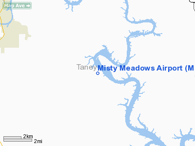
Location & QuickFacts
| FAA Information Effective: | 2008-09-25 |
| Airport Identifier: | MO65 |
| Airport Status: | Operational |
| Longitude/Latitude: | 093-06-10.6410W/36-35-00.2280N
-93.102956/36.583397 (Estimated) |
| Elevation: | 940 ft / 286.51 m (Estimated) |
| Land: | 3 acres |
| From nearest city: | 3 nautical miles SE of Kirbyville, MO |
| Location: | Taney County, MO |
| Magnetic Variation: | 04E (1985) |
Owner & Manager
| Ownership: | Privately owned |
| Owner: | Misty Meadows Farms |
| Address: | Rt 2 Box 1006
Kirbyville, MO 65679 |
| Phone number: | 417-334-4803 |
| Manager: | William L Johnson |
| Address: | Rt 2 Box 1006
Kirbyville, MO 65679 |
| Phone number: | 417-334-5081 |
Airport Operations and Facilities
| Airport Use: | Private |
| Wind indicator: | No |
| Segmented Circle: | No |
| Control Tower: | No |
| Lighting Schedule: | PHONE REQ
FOR RWY LGTS CALL 417-334-5081/4803. |
| Landing fee charge: | No |
| Sectional chart: | Kansas City |
| Region: | ACE - Central |
| Boundary ARTCC: | ZME - Memphis |
| Tie-in FSS: | COU - Columbia |
| FSS on Airport: | No |
| FSS Toll Free: | 1-800-WX-BRIEF |
Airport Services
| Airframe Repair: | NONE |
| Power Plant Repair: | NONE |
Runway Information
Runway 05/23
| Dimension: | 1300 x 65 ft / 396.2 x 19.8 m |
| Surface: | TURF, |
| Edge Lights: | Low |
| |
Runway 05 |
Runway 23 |
| Traffic Pattern: | Left | Left |
| Obstruction: | 50 ft trees, 1000.0 ft from runway | 50 ft trees, 50.0 ft from runway |
|
Radio Navigation Aids
| ID |
Type |
Name |
Ch |
Freq |
Var |
Dist |
| PLK | NDB | Point Lookout/dcmsnd | | 204.00 | 03E | 6.7 nm |
| AOV | NDB | Bilmart | | 341.00 | 02E | 31.0 nm |
| ILJ | NDB | Willard | | 254.00 | 03E | 46.0 nm |
| HRO | VOR/DME | Harrison | 072X | 112.50 | 04E | 16.8 nm |
| FLP | VOR/DME | Flippin | 075X | 112.80 | 03E | 35.5 nm |
| DGD | VORTAC | Dogwood | 031X | 109.40 | 06E | 28.6 nm |
| SGF | VORTAC | Springfield | 116X | 116.90 | 04E | 47.7 nm |
Images and information placed above are from
http://www.airport-data.com/airport/MO65/
We thank them for the data!
| General Info
|
| Country |
United States
|
| State |
MISSOURI
|
| FAA ID |
MO65
|
| Latitude |
36-35-00.228N
|
| Longitude |
093-06-10.641W
|
| Elevation |
940 feet
|
| Near City |
KIRBYVILLE
|
We don't guarantee the information is fresh and accurate. The data may
be wrong or outdated.
For more up-to-date information please refer to other sources.
|
|


