 |
|
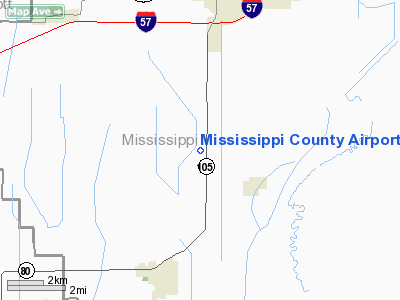
Mississippi County Airport |
Location & QuickFacts
| FAA Information Effective: | 2008-09-25 |
| Airport Identifier: | CHQ |
| Airport Status: | Operational |
| Longitude/Latitude: | 089-21-34.7680W/36-50-31.6940N
-89.359658/36.842137 (Estimated) |
| Elevation: | 313 ft / 95.40 m (Surveyed) |
| Land: | 100 acres |
| From nearest city: | 4 nautical miles S of Charleston, MO |
| Location: | Mississippi County, MO |
| Magnetic Variation: | 01E (1995) |
Owner & Manager
| Ownership: | Publicly owned |
| Owner: | Mississippi County Commission |
| Address: | Po Box 369
Charleston, MO 63834 |
| Phone number: | 573-683-2146 |
| Manager: | Mississippi County Commission |
| Address: | Po Box 369
Charleston, MO 63834 |
| Phone number: | 573-683-2146 |
Airport Operations and Facilities
| Airport Use: | Open to public |
| Wind indicator: | Yes |
| Segmented Circle: | Yes |
| Control Tower: | No |
| Lighting Schedule: | DUSK-DAWN
MIRL RY 18/36 PRESET ON MED INTST; TO INCR INTST - CTAF. |
| Beacon Color: | Clear-Green (lighted land airport) |
| Landing fee charge: | No |
| Sectional chart: | St Louis |
| Region: | ACE - Central |
| Boundary ARTCC: | ZME - Memphis |
| Tie-in FSS: | STL - Saint Louis |
| FSS on Airport: | No |
| FSS Toll Free: | 1-800-WX-BRIEF |
| NOTAMs Facility: | STL (NOTAM-d service avaliable) |
| Federal Agreements: | GY |
Airport Communications
Airport Services
| Fuel available: | 100LL
FOR FUEL CALL NUMBER POSTED ON TERMINAL DOOR. |
| Bottled Oxygen: | NONE |
| Bulk Oxygen: | NONE |
Runway Information
Runway 18/36
| Dimension: | 3196 x 60 ft / 974.1 x 18.3 m |
| Surface: | ASPH, Poor Condition
NUMEROUS CRACKS WITH +1-2 FT TALL WEEDS ON ALL EDGES OF RWY PVMNT. |
| Surface Treatment: | Aggregate Friction Seal Coat |
| Weight Limit: | Single wheel: 12500 lbs. |
| Edge Lights: | Non-standard lighting system
RWY 18/36 NSTD MIRL; 6 THLD LGTS RY 36; THLD LIGHTS LOCATED TOO CLOSE TO RWY ENDS; NO YELLOW EDGE LGTS LAST 1600 FT RY 36. |
| |
Runway 18 |
Runway 36 |
| Longitude: | 089-21-34.6830W | 089-21-34.7930W |
| Latitude: | 36-50-47.5350N | 36-50-15.9350N |
| Elevation: | 313.00 ft | 313.00 ft |
| Alignment: | 127 | 127 |
| Traffic Pattern: | Left | Left |
| Markings: | Nonstandard, Poor Condition
MARKINGS FADING. | Nonstandard, Poor Condition
MARKINGS FADING. |
| Crossing Height: | 25.00 ft | 25.00 ft |
| VASI: | 2-box on left side
VASI OTS INDEFLY. | 2-box on left side
VASI OTS INDEFLY. |
| Visual Glide Angle: | 3.00° | 3.00° |
| Obstruction: | 15 ft road, 510.0 ft from runway, 20:1 slope to clear | 26 ft tree, 1048.0 ft from runway, 346 ft right of centerline, 32:1 slope to clear
RWY 36; +1-3 FT CROPS, 0-200 FT FM RWY END, L & R. |
|
Radio Navigation Aids
| ID |
Type |
Name |
Ch |
Freq |
Var |
Dist |
| CHQ | NDB | Charleston | | 208.00 | 01E | 0.2 nm |
| CIR | NDB | Cairo | | 397.00 | 00E | 14.7 nm |
| DXE | NDB | Dexter | | 423.00 | 00E | 28.2 nm |
| UC | NDB | Obion | | 212.00 | 00E | 37.2 nm |
| BDD | NDB | Bellgrade | | 254.00 | 00E | 37.8 nm |
| GGK | NDB | Mayfield | | 401.00 | 00E | 38.0 nm |
| FD | NDB | Earli | | 278.00 | 03E | 47.8 nm |
| TKX | NDB | Kennett | | 358.00 | 00E | 49.4 nm |
| CGI | VOR/DME | Cape Girardeau | 076X | 112.90 | 01E | 25.3 nm |
| CNG | VORTAC | Cunningham | 078X | 113.10 | 03E | 27.0 nm |
| MAW | VORTAC | Malden | 049X | 111.20 | 03E | 31.7 nm |
| DYR | VORTAC | Dyersburg | 115X | 116.80 | 03E | 49.5 nm |
Remarks
- ULTRALIGHT & CROPDUSTING ACFT ON & INVOF ARPT.
- CROPS WITHIN RY PRIMARY SURFACE & RY SAFETY AREA AT RY 36 END.
Images and information placed above are from
http://www.airport-data.com/airport/CHQ/
We thank them for the data!
| General Info
|
| Country |
United States
|
| State |
MISSOURI
|
| FAA ID |
CHQ
|
| Latitude |
36-50-31.694N
|
| Longitude |
089-21-34.768W
|
| Elevation |
313 feet
|
| Near City |
CHARLESTON
|
We don't guarantee the information is fresh and accurate. The data may
be wrong or outdated.
For more up-to-date information please refer to other sources.
|
|


