 |
|
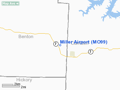
Location & QuickFacts
| FAA Information Effective: | 2008-09-25 |
| Airport Identifier: | MO99 |
| Airport Status: | Operational |
| Longitude/Latitude: | 093-04-37.7020W/38-06-59.1080N
-93.077139/38.116419 (Estimated) |
| Elevation: | 1000 ft / 304.80 m (Estimated) |
| Land: | 0 acres |
| From nearest city: | 2 nautical miles W of Climax Springs, MO |
| Location: | Camden County, MO |
| Magnetic Variation: | 04E (1985) |
Owner & Manager
| Ownership: | Privately owned |
| Owner: | William D. Miller |
| Address: | Box 97
Cleveland, MO 64734 |
| Phone number: | 816-658-3519 |
| Address: |
|
Airport Operations and Facilities
| Airport Use: | Private |
| Wind indicator: | Yes |
| Segmented Circle: | No |
| Control Tower: | No |
| Landing fee charge: | No |
| Sectional chart: | Kansas City |
| Region: | ACE - Central |
| Boundary ARTCC: | ZKC - Kansas City |
| Tie-in FSS: | COU - Columbia |
| FSS on Airport: | No |
| FSS Toll Free: | 1-800-WX-BRIEF |
Airport Services
| Airframe Repair: | NONE |
| Power Plant Repair: | NONE |
Runway Information
Runway 07/25
| Dimension: | 2600 x 100 ft / 792.5 x 30.5 m |
| Surface: | TURF, |
| |
Runway 07 |
Runway 25 |
| Traffic Pattern: | Left | Left |
|
Radio Navigation Aids
| ID |
Type |
Name |
Ch |
Freq |
Var |
Dist |
| AIZ | NDB | Kaiser | | 377.00 | 05E | 24.8 nm |
| GLY | NDB | Golden Valley | | 388.00 | 04E | 32.2 nm |
| DMO | NDB | Sedalia | | 281.00 | 03E | 35.7 nm |
| IEB | NDB | Lebanon | | 414.00 | 03E | 38.3 nm |
| HCK | NDB | Hawks | | 296.00 | 04E | 38.6 nm |
| SZL | TACAN | Whiteman | 035X | | 04E | 43.4 nm |
| TBN | VOR | Forney | | 110.00 | 03E | 49.8 nm |
| SHY | VOR/DME | Sunshine | 021X | 108.40 | 05E | 22.9 nm |
| SGF | VORTAC | Springfield | 116X | 116.90 | 04E | 47.3 nm |
Remarks
- VERY SOFT AND MUDDY DURING RAINY SEASON OR AFTER THAW.
- DEER ON THE RWY.
Images and information placed above are from
http://www.airport-data.com/airport/MO99/
We thank them for the data!
| General Info
|
| Country |
United States
|
| State |
MISSOURI
|
| FAA ID |
MO99
|
| Latitude |
38-06-59.108N
|
| Longitude |
093-04-37.702W
|
| Elevation |
1000 feet
|
| Near City |
CLIMAX SPRINGS
|
We don't guarantee the information is fresh and accurate. The data may
be wrong or outdated.
For more up-to-date information please refer to other sources.
|
|


