 |
|
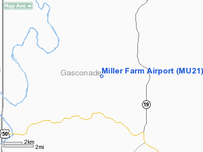
Location & QuickFacts
| FAA Information Effective: | 2008-09-25 |
| Airport Identifier: | MU21 |
| Airport Status: | Operational |
| Longitude/Latitude: | 091-31-03.5860W/38-31-25.1680N
-91.517663/38.523658 (Estimated) |
| Elevation: | 630 ft / 192.02 m (Estimated) |
| Land: | 0 acres |
| From nearest city: | 2 nautical miles NE of Bay, MO |
| Location: | Gasconade County, MO |
| Magnetic Variation: | 03E (1985) |
Owner & Manager
| Ownership: | Privately owned |
| Owner: | Michael W. Miller |
| Address: | 1136 White Lake Dr
St Charles, MO 63301 |
| Phone number: | 314-946-7338 |
| Manager: | Michael W. Miller |
| Address: | 1136 White Lake Dr
St Charles, MO 63301 |
| Phone number: | 573-946-7338 |
Airport Operations and Facilities
| Airport Use: | Private |
| Wind indicator: | Yes |
| Segmented Circle: | No |
| Control Tower: | No |
| Sectional chart: | Kansas City |
| Region: | ACE - Central |
| Boundary ARTCC: | ZKC - Kansas City |
| Tie-in FSS: | STL - Saint Louis |
| FSS on Airport: | No |
| FSS Toll Free: | 1-800-WX-BRIEF |
Runway Information
Runway 11/29
| Dimension: | 1800 x 50 ft / 548.6 x 15.2 m |
| Surface: | TURF, |
| |
Runway 11 |
Runway 29 |
| Traffic Pattern: | Left | Left |
| Obstruction: | 50 ft trees, 50.0 ft from runway | |
|
Radio Navigation Aids
| ID |
Type |
Name |
Ch |
Freq |
Var |
Dist |
| UUV | NDB | Sullivan | | 356.00 | 02E | 24.0 nm |
| JE | NDB | Algoa | | 397.00 | 03E | 26.1 nm |
| UBX | NDB | Cuba | | 380.00 | 01E | 27.9 nm |
| FTT | NDB | Guthrie | | 317.00 | 03E | 29.8 nm |
| ONH | NDB | Noah | | 515.00 | 03E | 34.8 nm |
| VIH | VOR/DME | Vichy | 124X | 117.70 | 06E | 23.9 nm |
| COU | VOR/DME | Columbia | 039X | 110.20 | 03E | 37.1 nm |
| FTZ | VORTAC | Foristell | 045X | 110.80 | 05E | 27.6 nm |
| HLV | VORTAC | Hallsville | 089X | 114.20 | 06E | 45.5 nm |
| JEF | VOT | Jefferson City | | 112.00 | | 29.9 nm |
| SUS | VOT | Spirit Of St Louis | | 112.20 | | 41.5 nm |
Remarks
- PRVDD MAINTAIN A CLEAR 20:1 APCH SFC AND 7:1 TRANSITIONAL SFC.
Images and information placed above are from
http://www.airport-data.com/airport/MU21/
We thank them for the data!
| General Info
|
| Country |
United States
|
| State |
MISSOURI
|
| FAA ID |
MU21
|
| Latitude |
38-31-25.168N
|
| Longitude |
091-31-03.586W
|
| Elevation |
630 feet
|
| Near City |
BAY
|
We don't guarantee the information is fresh and accurate. The data may
be wrong or outdated.
For more up-to-date information please refer to other sources.
|
|


