 |
|
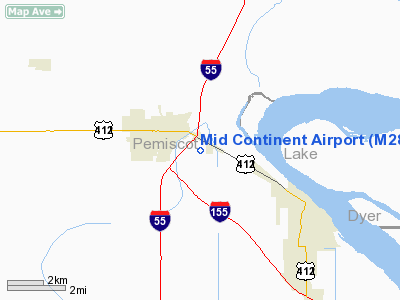
Location & QuickFacts
| FAA Information Effective: | 2008-09-25 |
| Airport Identifier: | M28 |
| Airport Status: | Operational |
| Longitude/Latitude: | 089-43-43.8000W/36-13-27.3000N
-89.728833/36.224250 (Estimated) |
| Elevation: | 268 ft / 81.69 m (Surveyed) |
| Land: | 30 acres |
| From nearest city: | 2 nautical miles E of Hayti, MO |
| Location: | Pemiscot County, MO |
| Magnetic Variation: | 02E (1985) |
Owner & Manager
| Ownership: | Privately owned |
| Owner: | Mid-continent Aircraft Corp. |
| Address: | Drawer L
Hayti, MO 63851 |
| Phone number: | 573-359-0500 |
| Manager: | Richard Reade |
| Address: | 1601 Hwy 84 E, Po Box 540
Hayti, MO 63851 |
| Phone number: | 573-359-0500 |
Airport Operations and Facilities
| Airport Use: | Open to public |
| Wind indicator: | Yes |
| Segmented Circle: | No |
| Control Tower: | No |
| Landing fee charge: | No |
| Sectional chart: | St Louis |
| Region: | ACE - Central |
| Boundary ARTCC: | ZME - Memphis |
| Tie-in FSS: | STL - Saint Louis |
| FSS on Airport: | No |
| FSS Toll Free: | 1-800-WX-BRIEF |
| NOTAMs Facility: | STL (NOTAM-d service avaliable) |
Airport Communications
Airport Services
| Airframe Repair: | MAJOR |
| Power Plant Repair: | MAJOR |
Runway Information
Runway 18/36
| Dimension: | 3420 x 175 ft / 1042.4 x 53.3 m
NORTH 475' OF RY 155' WIDE. |
| Surface: | TURF, Fair Condition
625 FT BY 20 FT ASPH 450 FT SOUTH OF RY 18 THLD 20 FT TO 5 FT EAST OF CNTRLN. |
| |
Runway 18 |
Runway 36 |
| Longitude: | 089-43-44.0200W | 089-43-43.5000W |
| Latitude: | 36-13-44.2000N | 36-13-10.3800N |
| Traffic Pattern: | Left | Left |
| Displaced threshold: | 305.00 ft
18/36 DSPLCD THRS MARKED WITH TIRES/REFLECTORS. | 80.00 ft |
| Obstruction: | 88 ft sign, 770.0 ft from runway, 60 ft right of centerline, 8:1 slope to clear
RWY 18 RATIO 12:1 TO DSPLCD THR +1-6' FENCE, CROPS & EQUIPMENT AT DSPLCD THR, L OF CNTRLN 0:1. | 15 ft road, 0.0 ft from runway
APCH RATIO 5:1 TO DSPLCD THR. |
|
Radio Navigation Aids
| ID |
Type |
Name |
Ch |
Freq |
Var |
Dist |
| TKX | NDB | Kennett | | 358.00 | 00E | 15.0 nm |
| IUI | NDB | Hicks | | 350.00 | 01E | 18.0 nm |
| DNT | NDB | Nally Dunston | | 343.00 | 01W | 20.9 nm |
| MXA | NDB | Manila | | 282.00 | 01E | 28.9 nm |
| BPW | NDB | Osceola | | 239.00 | 02E | 34.8 nm |
| DXE | NDB | Dexter | | 423.00 | 00E | 35.4 nm |
| UC | NDB | Obion | | 212.00 | 00E | 35.8 nm |
| COO | NDB | Covington | | 326.00 | 02E | 38.8 nm |
| PGR | NDB | Paragould | | 383.00 | 01E | 39.2 nm |
| FD | NDB | Earli | | 278.00 | 03E | 39.4 nm |
| CHQ | NDB | Charleston | | 208.00 | 01E | 41.4 nm |
| TGC | NDB | Gibson | | 378.00 | 01E | 46.1 nm |
| GOJ | VOR | Gosnell | | 111.80 | 01E | 19.4 nm |
| JBR | VOR/DME | Jonesboro | 023X | 108.60 | 02E | 46.8 nm |
| MAW | VORTAC | Malden | 049X | 111.20 | 03E | 21.8 nm |
| DYR | VORTAC | Dyersburg | 115X | 116.80 | 03E | 23.5 nm |
Remarks
- A/G TEST FLYING.
- FARM ROAD CROSSES MIDDLE OF RY.
- CROP DUSTING ACFT ON & INVOF ARPT.
- NSTD RWY SAFETY AREA BYND EACH RWY END; INSUFFICENT LENGTH, ROADS, AND CROPS.
Images and information placed above are from
http://www.airport-data.com/airport/M28/
We thank them for the data!
| General Info
|
| Country |
United States
|
| State |
MISSOURI
|
| FAA ID |
M28
|
| Latitude |
36-13-30.245N
|
| Longitude |
089-43-40.295W
|
| Elevation |
268 feet
|
| Near City |
HAYTI
|
We don't guarantee the information is fresh and accurate. The data may
be wrong or outdated.
For more up-to-date information please refer to other sources.
|
|


