 |
|
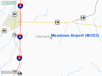
Location & QuickFacts
| FAA Information Effective: | 2008-09-25 |
| Airport Identifier: | MO53 |
| Airport Status: | Operational |
| Longitude/Latitude: | 093-56-00.8210W/40-14-00.0130N
-93.933561/40.233337 (Estimated) |
| Elevation: | 1010 ft / 307.85 m (Estimated) |
| Land: | 0 acres |
| From nearest city: | 5 nautical miles SE of Bethany, MO |
| Location: | Harrison County, MO |
| Magnetic Variation: | 04E (1985) |
Owner & Manager
| Ownership: | Privately owned |
| Owner: | Forest Meadows |
| Address: | 32199 E. St Hwy 146
Bethany, MO 64424 |
| Phone number: | 816-425-6054 |
| Manager: | Forest Meadows |
| Address: | 32199 E. St Hwy 146
Bethany, MO 64424 |
| Phone number: | 816-425-6054 |
Airport Operations and Facilities
| Airport Use: | Private |
| Wind indicator: | No |
| Segmented Circle: | No |
| Control Tower: | No |
| Landing fee charge: | No |
| Sectional chart: | Omaha |
| Region: | ACE - Central |
| Boundary ARTCC: | ZKC - Kansas City |
| Tie-in FSS: | COU - Columbia |
| FSS on Airport: | No |
| FSS Toll Free: | 1-800-WX-BRIEF |
Airport Services
| Airframe Repair: | NONE |
| Power Plant Repair: | NONE |
Runway Information
Runway N/S
| Dimension: | 2400 x 200 ft / 731.5 x 61.0 m |
| Surface: | TURF, |
| |
Runway N |
Runway S |
| Traffic Pattern: | Left | Left |
|
Radio Navigation Aids
| ID |
Type |
Name |
Ch |
Freq |
Var |
Dist |
| TRX | NDB | Trenton | | 400.00 | 03E | 18.1 nm |
| CHT | NDB | Chillicothe | | 375.00 | 03E | 34.1 nm |
| EZZ | NDB | Cameron | | 394.00 | 03E | 34.1 nm |
| EVU | NDB | Emville | | 317.00 | 05E | 45.5 nm |
| BZK | NDB | Brookfield | | 383.00 | 03E | 47.3 nm |
| UNE | NDB | Union County | | 379.00 | 04E | 47.4 nm |
| AZN | NDB | Amazon | | 233.00 | 06E | 49.5 nm |
| BQS | VOR/DME | Braymer | 049X | 111.20 | 03E | 36.3 nm |
| LMN | VORTAC | Lamoni | 114X | 116.70 | 07E | 21.9 nm |
| STJ | VORTAC | St Joseph | 102X | 115.50 | 08E | 48.5 nm |
Remarks
- PROVIDED APPROACH TO EACH RUNWAY IS MAINTAINED FOR A MINIMUM 20:1 GLIDE SLOPE AND THE TRANSITIONAL SURFACE BE MAINTAINED FOR A 7:1 SLOPE.
Images and information placed above are from
http://www.airport-data.com/airport/MO53/
We thank them for the data!
| General Info
|
| Country |
United States
|
| State |
MISSOURI
|
| FAA ID |
MO53
|
| Latitude |
40-14-00.013N
|
| Longitude |
093-56-00.821W
|
| Elevation |
1010 feet
|
| Near City |
BETHANY
|
We don't guarantee the information is fresh and accurate. The data may
be wrong or outdated.
For more up-to-date information please refer to other sources.
|
|


