 |
|
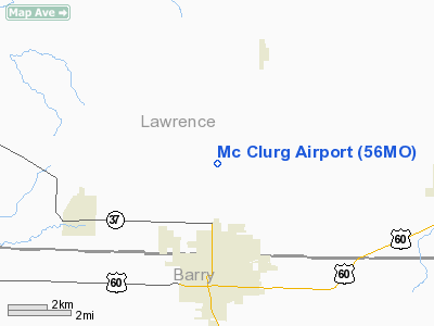
Location & QuickFacts
| FAA Information Effective: | 2008-09-25 |
| Airport Identifier: | 56MO |
| Airport Status: | Operational |
| Longitude/Latitude: | 093-55-26.7480W/36-58-15.2160N
-93.924097/36.970893 (Estimated) |
| Elevation: | 1376 ft / 419.40 m (Estimated) |
| Land: | 0 acres |
| From nearest city: | 2 nautical miles N of Monett, MO |
| Location: | Lawrence County, MO |
| Magnetic Variation: | 05E (1985) |
Owner & Manager
| Ownership: | Privately owned |
| Owner: | Ralph Mc Clurg |
| Address: | Route 1, Box 94
Monett, MO 65708 |
| Phone number: | 417-235-3058 |
| Manager: | Ralph Mc Clurg |
| Address: | Route 1, Box 94
Monett, MO 65708 |
| Phone number: | 417-235-3058 |
Airport Operations and Facilities
| Airport Use: | Private |
| Wind indicator: | No |
| Segmented Circle: | No |
| Control Tower: | No |
| Landing fee charge: | No |
| Sectional chart: | Kansas City |
| Region: | ACE - Central |
| Boundary ARTCC: | ZKC - Kansas City |
| Tie-in FSS: | COU - Columbia |
| FSS on Airport: | No |
| FSS Toll Free: | 1-800-WX-BRIEF |
Runway Information
Runway 08/26
| Dimension: | 1000 x 75 ft / 304.8 x 22.9 m |
| Surface: | TURF, |
| |
Runway 08 |
Runway 26 |
| Traffic Pattern: | Right | Right |
|
Runway 16/34
| Dimension: | 2000 x 75 ft / 609.6 x 22.9 m |
| Surface: | TURF, |
| |
Runway 16 |
Runway 34 |
| Traffic Pattern: | Right | Left |
| Obstruction: | 30 ft pline, 600.0 ft from runway | |
|
Radio Navigation Aids
| ID |
Type |
Name |
Ch |
Freq |
Var |
Dist |
| ILJ | NDB | Willard | | 254.00 | 03E | 30.4 nm |
| LLU | NDB | Spring River | | 356.00 | 05E | 36.1 nm |
| PLK | NDB | Point Lookout/dcmsnd | | 204.00 | 03E | 39.3 nm |
| PTS | NDB | Pittsburg | | 365.00 | 05E | 47.7 nm |
| EOS | VOR/DME | Neosho | 120X | 117.30 | 07E | 25.8 nm |
| SGF | VORTAC | Springfield | 116X | 116.90 | 04E | 36.5 nm |
| RZC | VORTAC | Razorback | 111X | 116.40 | 04E | 44.6 nm |
Remarks
- ULTRALIGHT TRAFFIC WEEKENDS & EVENINGS.
- LIMITED USE BY MILITARY HELICOPTERS FOR TRAINING.
- PROVIDED THAT THE APPROACH TO EACH RWY IS MAINTAINED FOR A MINIMUM 20:1 GLIDE SLOPE AND THAT THE TRANSITIONAL SURFACE BE MAINTAINED FOR A 7:1 SLOPE.
Images and information placed above are from
http://www.airport-data.com/airport/56MO/
We thank them for the data!
| General Info
|
| Country |
United States
|
| State |
MISSOURI
|
| FAA ID |
56MO
|
| Latitude |
36-58-15.216N
|
| Longitude |
093-55-26.748W
|
| Elevation |
1376 feet
|
| Near City |
MONETT
|
We don't guarantee the information is fresh and accurate. The data may
be wrong or outdated.
For more up-to-date information please refer to other sources.
|
|


