 |
|
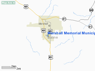
Marshall Memorial Municipal Airport |
Location & QuickFacts
| FAA Information Effective: | 2008-09-25 |
| Airport Identifier: | MHL |
| Airport Status: | Operational |
| Longitude/Latitude: | 093-12-10.1000W/39-05-43.8000N
-93.202806/39.095500 (Estimated) |
| Elevation: | 779 ft / 237.44 m (Surveyed) |
| Land: | 225 acres |
| From nearest city: | 2 nautical miles S of Marshall, MO |
| Location: | Saline County, MO |
| Magnetic Variation: | 03E (2000) |
Owner & Manager
| Ownership: | Publicly owned |
| Owner: | City Of Marshall |
| Address: | 214 N Lafayette
Marshall, MO 65340 |
| Phone number: | 660-886-2225 |
| Manager: | Muni Service Dept |
| Address: | 1277 S. Odell
Marshall, MO 65340 |
| Phone number: | 660-886-9855 |
Airport Operations and Facilities
| Airport Use: | Open to public |
| Wind indicator: | Yes |
| Segmented Circle: | Yes |
| Control Tower: | No |
| Lighting Schedule: | DUSK-DAWN
ACTVT MIRL RY 18/36; PAPI RY 18 - CTAF. |
| Beacon Color: | Clear-Green (lighted land airport) |
| Landing fee charge: | No |
| Sectional chart: | Kansas City |
| Region: | ACE - Central |
| Boundary ARTCC: | ZKC - Kansas City |
| Tie-in FSS: | COU - Columbia |
| FSS on Airport: | No |
| FSS Toll Free: | 1-800-WX-BRIEF |
| NOTAMs Facility: | COU (NOTAM-d service avaliable) |
| Federal Agreements: | NGY |
Airport Communications
| CTAF: | 122.800 |
| Unicom: | 122.800 |
Airport Services
| Fuel available: | 100LL |
| Bottled Oxygen: | NONE |
| Bulk Oxygen: | NONE |
Runway Information
Runway 09/27
| Dimension: | 3320 x 150 ft / 1011.9 x 45.7 m |
| Surface: | TURF, Good Condition |
| |
Runway 09 |
Runway 27 |
| Longitude: | 093-12-43.6000W | 093-12-01.6730W |
| Latitude: | 39-05-47.7000N | 39-05-44.6380N |
| Alignment: | 95 | 127 |
| Traffic Pattern: | Right | Left |
| Obstruction: | 30 ft pline, 393.0 ft from runway, 13:1 slope to clear | , 50:1 slope to clear |
|
Runway 18/36
| Dimension: | 5006 x 75 ft / 1525.8 x 22.9 m |
| Surface: | ASPH, Fair Condition |
| Surface Treatment: | Aggregate Friction Seal Coat |
| Weight Limit: | Single wheel: 12500 lbs.
Dual wheel: 15600 lbs. |
| Edge Lights: | Non-standard lighting system
RWY 18/36 NSTD MIRL-INCOR COLOR OF DSPLCD THR LGTS AT RY 18 END. |
| |
Runway 18 |
Runway 36 |
| Longitude: | 093-12-01.1926W | 093-12-02.2509W |
| Latitude: | 39-06-06.9312N | 39-05-17.4578N |
| Elevation: | 770.00 ft | 778.00 ft |
| Alignment: | 127 | 1 |
| Traffic Pattern: | Left | Left |
| Markings: | Non-precision instrument, Fair Condition | Non-precision instrument, Fair Condition |
| Crossing Height: | 39.00 ft | 36.00 ft |
| Displaced threshold: | 199.00 ft | 294.00 ft |
| VASI: | 4-light PAPI on right side | 4-light PAPI on right side |
| Visual Glide Angle: | 3.05° | 3.04° |
| Obstruction: | 80 ft trees, 1360.0 ft from runway, 20 ft left of centerline, 14:1 slope to clear
RWY 18 APCH SLOPE 17:1 TO DSPLCD THR. | , 50:1 slope to clear |
|
Radio Navigation Aids
| ID |
Type |
Name |
Ch |
Freq |
Var |
Dist |
| PUR | NDB | Marshall | | 371.00 | 03E | 3.2 nm |
| DMO | NDB | Sedalia | | 281.00 | 03E | 23.5 nm |
| VER | NDB | Viertel | | 347.00 | 02E | 25.8 nm |
| HCK | NDB | Hawks | | 296.00 | 04E | 33.0 nm |
| BZK | NDB | Brookfield | | 383.00 | 03E | 40.4 nm |
| CHT | NDB | Chillicothe | | 375.00 | 03E | 43.1 nm |
| GLY | NDB | Golden Valley | | 388.00 | 04E | 49.7 nm |
| SZL | TACAN | Whiteman | 035X | | 04E | 27.1 nm |
| BQS | VOR/DME | Braymer | 049X | 111.20 | 03E | 44.8 nm |
| MCM | VOR/DME | Macon | 076X | 112.90 | 06E | 47.4 nm |
| COU | VOR/DME | Columbia | 039X | 110.20 | 03E | 49.1 nm |
| ANX | VORTAC | Napoleon | 087X | 114.00 | 07E | 43.2 nm |
Remarks
- SPRAYER ACFT ON & INVOF ARPT.
- PROVIDED A CLEAR APCH TO EA RY MAINTAINED FOR A 20:1 GLIDE SLOPE; A CLEAR TRANSITIONAL SFC MAINTAINED FOR A 7:1 SLOPE; A RIGHT TFC PATTERN ESTABLISHED TO RY 09; THE ALP UPDATED & COORDINATION OF NEW RY WITH MHTD.
Images and information placed above are from
http://www.airport-data.com/airport/MHL/
We thank them for the data!
| General Info
|
| Country |
United States
|
| State |
MISSOURI
|
| FAA ID |
MHL
|
| Latitude |
39-05-44.717N
|
| Longitude |
093-12-10.364W
|
| Elevation |
779 feet
|
| Near City |
MARSHALL
|
We don't guarantee the information is fresh and accurate. The data may
be wrong or outdated.
For more up-to-date information please refer to other sources.
|
|


