 |
|
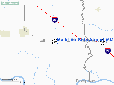
Location & QuickFacts
| FAA Information Effective: | 2008-09-25 |
| Airport Identifier: | 6MO1 |
| Airport Status: | Operational |
| Longitude/Latitude: | 095-04-00.9060W/39-57-59.9830N
-95.066918/39.966662 (Estimated) |
| Elevation: | 1140 ft / 347.47 m (Estimated) |
| Land: | 0 acres |
| From nearest city: | 3 nautical miles SE of Oregon, MO |
| Location: | Holt County, MO |
| Magnetic Variation: | 05E (1985) |
Owner & Manager
| Ownership: | Privately owned |
| Owner: | Ronald Markt |
| Address: | Rte 1 Box 54
Oregon, MO 64473 |
| Phone number: | 816-446-3778 |
| Address: |
|
Airport Operations and Facilities
| Airport Use: | Private |
| Wind indicator: | No |
| Segmented Circle: | No |
| Control Tower: | No |
| Landing fee charge: | No |
| Sectional chart: | Kansas City |
| Region: | ACE - Central |
| Boundary ARTCC: | ZKC - Kansas City |
| Tie-in FSS: | COU - Columbia |
| FSS on Airport: | No |
| FSS Toll Free: | 1-800-WX-BRIEF |
Airport Services
| Airframe Repair: | NONE |
| Power Plant Repair: | NONE |
Runway Information
Runway N/S
| Dimension: | 400 x 30 ft / 121.9 x 9.1 m |
| Surface: | TURF, |
| |
Runway N |
Runway S |
| Traffic Pattern: | Left | Left |
|
Radio Navigation Aids
| ID |
Type |
Name |
Ch |
Freq |
Var |
Dist |
| AZN | NDB | Amazon | | 233.00 | 06E | 8.8 nm |
| EVU | NDB | Emville | | 317.00 | 05E | 24.0 nm |
| FNB | NDB | Brenner | | 404.00 | 05E | 24.8 nm |
| EZZ | NDB | Cameron | | 394.00 | 03E | 39.4 nm |
| AYB | NDB | Auburn | | 430.00 | 05E | 44.1 nm |
| ICL | NDB | Clarinda | | 353.00 | 04E | 45.7 nm |
| DO | NDB | Dotte | | 359.00 | 05E | 47.2 nm |
| SDA | NDB | Shenandoah | | 411.00 | 05E | 49.7 nm |
| RBA | VOR/DME | Robinson | 019X | 108.20 | 04E | 17.8 nm |
| STJ | VORTAC | St Joseph | 102X | 115.50 | 08E | 6.5 nm |
| MCI | VORTAC | Kansas City | 079Y | 113.25 | 05E | 43.7 nm |
Remarks
Images and information placed above are from
http://www.airport-data.com/airport/6MO1/
We thank them for the data!
| General Info
|
| Country |
United States
|
| State |
MISSOURI
|
| FAA ID |
6MO1
|
| Latitude |
39-57-59.983N
|
| Longitude |
095-04-00.906W
|
| Elevation |
1140 feet
|
| Near City |
OREGON
|
We don't guarantee the information is fresh and accurate. The data may
be wrong or outdated.
For more up-to-date information please refer to other sources.
|
|


