 |
|
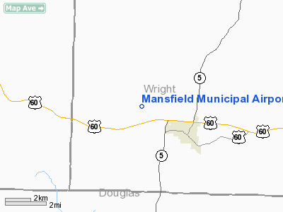
Mansfield Municipal Airport |
Location & QuickFacts
| FAA Information Effective: | 2008-09-25 |
| Airport Identifier: | 03B |
| Airport Status: | Operational |
| Longitude/Latitude: | 092-37-17.8000W/37-07-36.4000N
-92.621611/37.126778 (Estimated) |
| Elevation: | 1500 ft / 457.20 m (Estimated) |
| Land: | 69 acres |
| From nearest city: | 2 nautical miles NW of Mansfield, MO |
| Location: | Wright County, MO |
| Magnetic Variation: | 03E (1995) |
Owner & Manager
| Ownership: | Publicly owned |
| Owner: | City Of Mansfield |
| Address: | 104 Phelps Box 467
Mansfield, MO 65704 |
| Phone number: | 417-924-3719 |
| Manager: | Don Anderson
ARPT BOARD CHAIRMAN. |
| Address: | Po Box 534
Mansfield, MO 65704 |
| Phone number: | 417-924-8894 |
Airport Operations and Facilities
| Airport Use: | Open to public |
| Wind indicator: | Yes |
| Segmented Circle: | Yes |
| Control Tower: | No |
| Lighting Schedule: | DUSK-DAWN |
| Beacon Color: | Clear-Green (lighted land airport) |
| Landing fee charge: | No |
| Sectional chart: | Kansas City |
| Region: | ACE - Central |
| Boundary ARTCC: | ZKC - Kansas City |
| Tie-in FSS: | COU - Columbia |
| FSS on Airport: | No |
| FSS Toll Free: | 1-800-WX-BRIEF |
| NOTAMs Facility: | COU (NOTAM-d service avaliable) |
| Federal Agreements: | GY |
Airport Communications
Airport Services
| Bottled Oxygen: | NONE |
| Bulk Oxygen: | NONE |
Runway Information
Runway 07/25
| Dimension: | 3000 x 50 ft / 914.4 x 15.2 m |
| Surface: | ASPH, Fair Condition |
| Weight Limit: | Single wheel: 12500 lbs. |
| Edge Lights: | Medium
NTSD MIRL; INCORRECT SPACING OF THLD LGTS AT EACH RY END. |
| |
Runway 07 |
Runway 25 |
| Longitude: | 092-37-35.8900W | 092-36-59.6400W |
| Latitude: | 37-07-33.3600N | 37-07-39.5200N |
| Traffic Pattern: | Left | Left |
| Markings: | Basic, Fair Condition | Basic, Fair Condition |
| Crossing Height: | 31.00 ft | 25.00 ft |
| VASI: | 2-box on left side
VASI OTS INDEFLY. | 2-box on left side
VASI OTS INDEFLY. |
| Visual Glide Angle: | 3.00° | 3.00° |
| Obstruction: | 30 ft trees, 650.0 ft from runway, 15:1 slope to clear
RWY 7; +1-3 FT BRUSH, 0-200 FT FM RY END, L & R. | 19 ft trees, 620.0 ft from runway, 120 ft left of centerline, 22:1 slope to clear
+1-5 FT GND 0-200 FT FM THLD L & R. |
|
Radio Navigation Aids
| ID |
Type |
Name |
Ch |
Freq |
Var |
Dist |
| AOV | NDB | Bilmart | | 341.00 | 02E | 9.8 nm |
| IEB | NDB | Lebanon | | 414.00 | 03E | 26.8 nm |
| UNO | NDB | Pomona | | 335.00 | 02E | 37.7 nm |
| ILJ | NDB | Willard | | 254.00 | 03E | 40.6 nm |
| PLK | NDB | Point Lookout/dcmsnd | | 204.00 | 03E | 41.9 nm |
| BHN | NDB | Buckhorn | | 391.00 | 03E | 42.3 nm |
| MNF | NDB | Mountain View | | 365.00 | 03E | 44.3 nm |
| TBN | VOR | Forney | | 110.00 | 03E | 43.6 nm |
| HUW | VOR/DME | Hutton | 053X | 111.60 | 02E | 37.9 nm |
| DGD | VORTAC | Dogwood | 031X | 109.40 | 06E | 13.7 nm |
| SGF | VORTAC | Springfield | 116X | 116.90 | 04E | 36.8 nm |
| MAP | VORTAC | Maples | 081X | 113.40 | 06E | 48.6 nm |
Remarks
- DEER & OTHER WILDLIFE ON & INVOF ARPT.
Images and information placed above are from
http://www.airport-data.com/airport/03B/
We thank them for the data!
| General Info
|
| Country |
United States
|
| State |
MISSOURI
|
| FAA ID |
03B
|
| Latitude |
37-07-40.186N
|
| Longitude |
092-37-15.605W
|
| Elevation |
1500 feet
|
| Near City |
MANSFIELD
|
We don't guarantee the information is fresh and accurate. The data may
be wrong or outdated.
For more up-to-date information please refer to other sources.
|
|


