 |
|
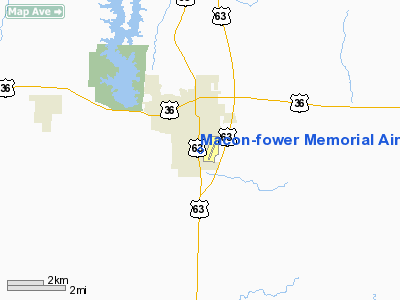
Macon-fower Memorial Airport |
Location & QuickFacts
| FAA Information Effective: | 2008-09-25 |
| Airport Identifier: | K89 |
| Airport Status: | Operational |
| Longitude/Latitude: | 092-27-52.0380W/39-43-43.3450N
-92.464455/39.728707 (Estimated) |
| Elevation: | 874 ft / 266.40 m (Estimated) |
| Land: | 94 acres |
| From nearest city: | 1 nautical miles SE of Macon, MO |
| Location: | Macon County, MO |
| Magnetic Variation: | 02E (2000) |
Owner & Manager
| Ownership: | Publicly owned |
| Owner: | City Of Macon
LEASED TO WAYNE & BILL NOYES. |
| Address: | 121 W Bourke, Box 569
Macon, MO 63552 |
| Phone number: | 660-385-6421 |
| Manager: | Wayne Noyes |
| Address: | 1001 Patton St
Macon, MO 63552 |
| Phone number: | 660-385-6208 |
Airport Operations and Facilities
| Airport Use: | Open to public |
| Wind indicator: | Yes |
| Segmented Circle: | Yes |
| Control Tower: | No |
| Lighting Schedule: | DUSK-DAWN
ACTVT MIRL RY 02/20 - CTAF. |
| Beacon Color: | Clear-Green (lighted land airport) |
| Landing fee charge: | No |
| Sectional chart: | Kansas City |
| Region: | ACE - Central |
| Boundary ARTCC: | ZKC - Kansas City |
| Tie-in FSS: | COU - Columbia |
| FSS on Airport: | No |
| FSS Toll Free: | 1-800-WX-BRIEF |
| NOTAMs Facility: | COU (NOTAM-d service avaliable) |
| Federal Agreements: | NGY |
Airport Communications
| CTAF: | 122.800 |
| Unicom: | 122.800 |
>Airport Services
| Fuel available: | 100LL |
| Airframe Repair: | NONE |
| Power Plant Repair: | NONE |
| Bottled Oxygen: | NONE |
| Bulk Oxygen: | NONE |
Runway Information
Runway 02/20
| Dimension: | 3300 x 60 ft / 1005.8 x 18.3 m |
| Surface: | ASPH, Good Condition |
| Weight Limit: | Single wheel: 12500 lbs. |
| Edge Lights: | Medium |
| |
Runway 02 |
Runway 20 |
| Longitude: | 092-27-33.1675W | 092-27-18.6676W |
| Latitude: | 39-43-28.0226N | 39-43-58.6228N |
| Elevation: | 874.00 ft | 868.00 ft |
| Alignment: | 20 | 127 |
| Traffic Pattern: | Right | Left |
| Markings: | Non-precision instrument, Fair Condition | Non-precision instrument, Fair Condition |
| Obstruction: | 29 ft pline, 473.0 ft from runway, 153 ft right of centerline, 9:1 slope to clear | 43 ft trees, 502.0 ft from runway, 289 ft right of centerline, 7:1 slope to clear |
|
Radio Navigation Aids
| ID |
Type |
Name |
Ch |
Freq |
Var |
Dist |
| BZK | NDB | Brookfield | | 383.00 | 03E | 29.9 nm |
| HAE | NDB | Hannibal | | 411.00 | 03E | 47.0 nm |
| CHT | NDB | Chillicothe | | 375.00 | 03E | 47.7 nm |
| VER | NDB | Viertel | | 347.00 | 02E | 47.9 nm |
| MCM | VOR/DME | Macon | 076X | 112.90 | 06E | 4.6 nm |
| IRK | VORTAC | Kirksville | 093X | 114.60 | 06E | 25.1 nm |
| HLV | VORTAC | Hallsville | 089X | 114.20 | 06E | 40.1 nm |
Remarks
- CROP DUSTING ACFT ON & INVOF ARPT APR-OCT.
- DEER ON RY AT EARLY & LATE HRS.
- FOR SERVICE AFTER HOURS CALL 660-676-2339 OR 660-676-4664.
Images and information placed above are from
http://www.airport-data.com/airport/K89/
We thank them for the data!
| General Info
|
| Country |
United States
|
| State |
MISSOURI
|
| FAA ID |
K89
|
| Latitude |
39-43-43.345N
|
| Longitude |
092-27-52.038W
|
| Elevation |
874 feet
|
| Near City |
MACON
|
We don't guarantee the information is fresh and accurate. The data may
be wrong or outdated.
For more up-to-date information please refer to other sources.
|
|


