 |
|
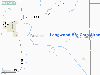
Longwood Mfg Corp Airport |
Location & QuickFacts
| FAA Information Effective: | 2008-09-25 |
| Airport Identifier: | 1MO4 |
| Airport Status: | Operational |
| Longitude/Latitude: | 093-51-50.7910W/39-53-30.0330N
-93.864109/39.891676 (Estimated) |
| Elevation: | 800 ft / 243.84 m (Estimated) |
| Land: | 0 acres |
| From nearest city: | 5 nautical miles E of Gallatin, MO |
| Location: | Daviess County, MO |
| Magnetic Variation: | 04E (1985) |
Owner & Manager
| Ownership: | Privately owned |
| Owner: | Longwood Mfg Corp |
| Address: |
Gallatin, MO 64640 |
| Phone number: | 816-663-2185 |
| Address: |
|
Airport Operations and Facilities
| Airport Use: | Private |
| Wind indicator: | Yes |
| Segmented Circle: | No |
| Control Tower: | No |
| Lighting Schedule: | PHONE REQ
FOR RWY LGTS CALL 663-2185. |
| Landing fee charge: | No |
| Sectional chart: | Kansas City |
| Region: | ACE - Central |
| Boundary ARTCC: | ZKC - Kansas City |
| Tie-in FSS: | COU - Columbia |
| FSS on Airport: | No |
| FSS Toll Free: | 1-800-WX-BRIEF |
Runway Information
Runway N/S
| Dimension: | 2400 x 100 ft / 731.5 x 30.5 m |
| Surface: | TURF-GRVL, |
| Edge Lights: | Low |
| |
Runway N |
Runway S |
| Traffic Pattern: | Left | Left |
| Obstruction: | 5 ft pline, 200.0 ft from runway | 5 ft pline, 200.0 ft from runway |
|
Radio Navigation Aids
| ID |
Type |
Name |
Ch |
Freq |
Var |
Dist |
| TRX | NDB | Trenton | | 400.00 | 03E | 16.9 nm |
| CHT | NDB | Chillicothe | | 375.00 | 03E | 18.4 nm |
| EZZ | NDB | Cameron | | 394.00 | 03E | 21.2 nm |
| BZK | NDB | Brookfield | | 383.00 | 03E | 35.7 nm |
| GPH | NDB | Mosby | | 284.00 | 03E | 38.7 nm |
| AZN | NDB | Amazon | | 233.00 | 06E | 48.2 nm |
| BQS | VOR/DME | Braymer | 049X | 111.20 | 03E | 15.7 nm |
| LMN | VORTAC | Lamoni | 114X | 116.70 | 07E | 42.6 nm |
| STJ | VORTAC | St Joseph | 102X | 115.50 | 08E | 49.1 nm |
| ANX | VORTAC | Napoleon | 087X | 114.00 | 07E | 49.4 nm |
Remarks
- PRVDD TRSNL SFC IS CLEARED FOR A 7:1 GLIDE SLOPE.
Images and information placed above are from
http://www.airport-data.com/airport/1MO4/
We thank them for the data!
| General Info
|
| Country |
United States
|
| State |
MISSOURI
|
| FAA ID |
1MO4
|
| Latitude |
39-53-30.033N
|
| Longitude |
093-51-50.791W
|
| Elevation |
800 feet
|
| Near City |
GALLATIN
|
We don't guarantee the information is fresh and accurate. The data may
be wrong or outdated.
For more up-to-date information please refer to other sources.
|
|


