 |
|
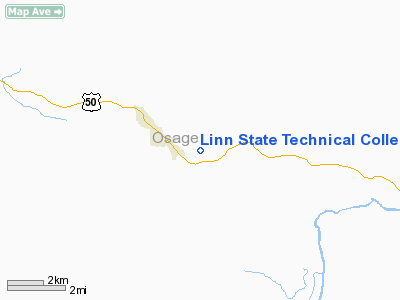
Linn State Technical College Airport |
Location & QuickFacts
| FAA Information Effective: | 2008-09-25 |
| Airport Identifier: | 1H3 |
| Airport Status: | Operational |
| Longitude/Latitude: | 091-49-02.1000W/38-28-17.7000N
-91.817250/38.471583 (Estimated) |
| Elevation: | 952 ft / 290.17 m (Estimated) |
| Land: | 150 acres |
| From nearest city: | 2 nautical miles SE of Linn, MO |
| Location: | Osage County, MO |
| Magnetic Variation: | 02E (1995) |
Owner & Manager
| Ownership: | Publicly owned |
| Owner: | Linn State Technical College |
| Address: | One Technology Dr
Linn, MO 65051 |
| Phone number: | 573-897-3603 |
| Manager: | Robert Holtmeyer |
| Address: | One Technology Dr
Linn, MO 65051 |
| Phone number: | 573-897-5184
EXT. 153 |
Airport Operations and Facilities
| Airport Use: | Open to public |
| Wind indicator: | Yes |
| Segmented Circle: | No |
| Control Tower: | No |
| Lighting Schedule: | DUSK-DAWN
MIRL RY 09/27 PRESET ON MED INTST; TO INCR INTST & ACTVT RYS 09 & 27 REIL, PAPI & WINDSOCK - CTAF. |
| Beacon Color: | Clear-Green (lighted land airport) |
| Sectional chart: | Kansas City |
| Region: | ACE - Central |
| Boundary ARTCC: | ZKC - Kansas City |
| Tie-in FSS: | COU - Columbia |
| FSS on Airport: | No |
| FSS Toll Free: | 1-800-WX-BRIEF |
| NOTAMs Facility: | COU (NOTAM-d service avaliable) |
| Federal Agreements: | N |
Airport Communications
Airport Services
| Airframe Repair: | MINOR
EMERGENCY ONLY. |
| Power Plant Repair: | MINOR
EMERGENCY ONLY. |
Runway Information
Runway 09/27
| Dimension: | 3400 x 60 ft / 1036.3 x 18.3 m |
| Surface: | CONC, Good Condition |
| Weight Limit: | Single wheel: 12500 lbs. |
| Edge Lights: | Medium |
| |
Runway 09 |
Runway 27 |
| Longitude: | 091-49-23.4400W | 091-48-40.6800W |
| Latitude: | 38-28-17.6800N | 38-28-17.7100N |
| Traffic Pattern: | Left | Left |
| Markings: | Non-precision instrument, Fair Condition | Non-precision instrument, Fair Condition |
| Crossing Height: | 45.00 ft | 37.00 ft |
| VASI: | 4-light PAPI on left side | 4-light PAPI on left side |
| Visual Glide Angle: | 3.30° | 3.00° |
| Runway End Identifier: | Yes | Yes |
| Obstruction: | 110 ft tower, 3150.0 ft from runway, 280 ft right of centerline, 26:1 slope to clear | 17 ft trees, 736.0 ft from runway, 80 ft left of centerline, 31:1 slope to clear |
|
Radio Navigation Aids
| ID |
Type |
Name |
Ch |
Freq |
Var |
Dist |
| JE | NDB | Algoa | | 397.00 | 03E | 12.8 nm |
| ONH | NDB | Noah | | 515.00 | 03E | 22.4 nm |
| FTT | NDB | Guthrie | | 317.00 | 03E | 24.0 nm |
| UBX | NDB | Cuba | | 380.00 | 01E | 30.6 nm |
| UUV | NDB | Sullivan | | 356.00 | 02E | 33.9 nm |
| AIZ | NDB | Kaiser | | 377.00 | 05E | 41.4 nm |
| BHN | NDB | Buckhorn | | 391.00 | 03E | 48.5 nm |
| VER | NDB | Viertel | | 347.00 | 02E | 49.8 nm |
| TBN | VOR | Forney | | 110.00 | 03E | 46.4 nm |
| VIH | VOR/DME | Vichy | 124X | 117.70 | 06E | 19.8 nm |
| COU | VOR/DME | Columbia | 039X | 110.20 | 03E | 27.8 nm |
| SHY | VOR/DME | Sunshine | 021X | 108.40 | 05E | 45.2 nm |
| HLV | VORTAC | Hallsville | 089X | 114.20 | 06E | 41.2 nm |
| FTZ | VORTAC | Foristell | 045X | 110.80 | 05E | 41.9 nm |
| JEF | VOT | Jefferson City | | 112.00 | | 17.1 nm |
Remarks
- DEER ON & INVOF ARPT.
- WATERFOWL ON & INVOF ARPT.
- PRVDD A CLEAR APCH EA RY FOR A 20:1 GLIDE SLOPE & A CLEAR TRANSITIONAL SFC FOR A 7:1 SLOPE.
Images and information placed above are from
http://www.airport-data.com/airport/1H3/
We thank them for the data!
| General Info
|
| Country |
United States
|
| State |
MISSOURI
|
| FAA ID |
1H3
|
| Latitude |
38-28-17.380N
|
| Longitude |
091-48-55.140W
|
| Elevation |
952 feet
|
| Near City |
LINN
|
We don't guarantee the information is fresh and accurate. The data may
be wrong or outdated.
For more up-to-date information please refer to other sources.
|
|


