 |
|
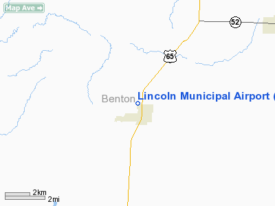
Lincoln Municipal Airport |
Location & QuickFacts
| FAA Information Effective: | 2008-09-25 |
| Airport Identifier: | 0R2 |
| Airport Status: | Operational |
| Longitude/Latitude: | 093-19-56.1000W/38-24-08.4000N
-93.332250/38.402333 (Estimated) |
| Elevation: | 940 ft / 286.51 m (Estimated) |
| Land: | 17 acres |
| From nearest city: | 0 nautical miles N of Lincoln, MO |
| Location: | Benton County, MO |
| Magnetic Variation: | 04E (1985) |
Owner & Manager
| Ownership: | Publicly owned |
| Owner: | City Of Lincoln |
| Address: | 122 E Main Box 17
Lincoln, MO 65338 |
| Phone number: | 660-547-2718 |
| Manager: | Mike Letoureneau
WORK PHONE 660-547-3613. |
| Address: | 122 E Main Box 17
Lincoln, MO 65338 |
| Phone number: | 660-547-2718 |
Airport Operations and Facilities
| Airport Use: | Open to public |
| Wind indicator: | Yes |
| Segmented Circle: | No |
| Control Tower: | No |
| Lighting Schedule: | NONE |
| Landing fee charge: | No |
| Sectional chart: | Kansas City |
| Region: | ACE - Central |
| Boundary ARTCC: | ZKC - Kansas City |
| Tie-in FSS: | COU - Columbia |
| FSS on Airport: | No |
| FSS Toll Free: | 1-800-WX-BRIEF |
| NOTAMs Facility: | COU (NOTAM-d service avaliable) |
Airport Communications
Airport Services
| Airframe Repair: | NONE |
| Power Plant Repair: | NONE |
| Bottled Oxygen: | NONE |
| Bulk Oxygen: | NONE |
Runway Information
Runway 18/36
| Dimension: | 2940 x 125 ft / 896.1 x 38.1 m |
| Surface: | TURF, Good Condition |
| |
Runway 18 |
Runway 36 |
| Longitude: | 093-19-55.3900W | 093-19-56.8600W |
| Latitude: | 38-24-22.9500N | 38-23-53.9000N |
| Traffic Pattern: | Left | Left |
| Displaced threshold: | 340.00 ft
DSPLCD THLD 7 FT HIGHER THAN RY END ELEVATION; RY 36 DSPLCD THLD 4 FT HIGHER THAN RY END ELEVATION. | 240.00 ft |
| Obstruction: | 29 ft trees, 27.0 ft from runway, 108 ft right of centerline, 1:1 slope to clear
RWY 18 14:1 TO DSPLCD THLD; 1-35 FT TREES 0-585 FT 100 FT R; 0:1 BASED ON DSPLCD THLD. | 4 ft fence, 47.0 ft from runway, 11:1 slope to clear
RWY 36 50:1 TO DSPLCD THLD. |
|
Radio Navigation Aids
| ID |
Type |
Name |
Ch |
Freq |
Var |
Dist |
| GLY | NDB | Golden Valley | | 388.00 | 04E | 16.8 nm |
| HCK | NDB | Hawks | | 296.00 | 04E | 17.7 nm |
| DMO | NDB | Sedalia | | 281.00 | 03E | 19.6 nm |
| PUR | NDB | Marshall | | 371.00 | 03E | 39.0 nm |
| AIZ | NDB | Kaiser | | 377.00 | 05E | 41.1 nm |
| VER | NDB | Viertel | | 347.00 | 02E | 44.8 nm |
| SZL | TACAN | Whiteman | 035X | | 04E | 22.5 nm |
| SHY | VOR/DME | Sunshine | 021X | 108.40 | 05E | 40.7 nm |
Remarks
- RWY SOFT AT THLD ENDS AFTER HEAVY RAIN.
- 109 FT GRAIN ELEVATORS 2185-2270 FT FM RY 36 30-60 FT L.
- WILDLIFE ON & INVOF ARPT.
- +50 FT TREELINE 125 FT WEST OF RY CENTERLINE FULL LENGTH.
Images and information placed above are from
http://www.airport-data.com/airport/0R2/
We thank them for the data!
| General Info
|
| Country |
United States
|
| State |
MISSOURI
|
| FAA ID |
0R2
|
| Latitude |
38-24-14.078N
|
| Longitude |
093-19-58.739W
|
| Elevation |
940 feet
|
| Near City |
LINCOLN
|
We don't guarantee the information is fresh and accurate. The data may
be wrong or outdated.
For more up-to-date information please refer to other sources.
|
|


